Florence Roberts Forest

Distance: 1-2 Miles

Difficulty: difficult to Navigate

Sometimes not all trails are good and worth visiting again, which saddens me.  In the words of my husband, "not all trails are good and you have found some pretty great ones." This past weekend I had that experience.  I have driven by Florence Roberts Forest across from Uncle Sam's House on Rt 123 in Mason, NH many times. I have been curious about these trails, but never stopped to explore them.  I have tried to google information on them, but have never found any information about them.  After a group hike this weekend I felt guilty for not taking my dog for a walk so I thought it would be a perfect time to check out the trail.  

IMG_3985.jpg

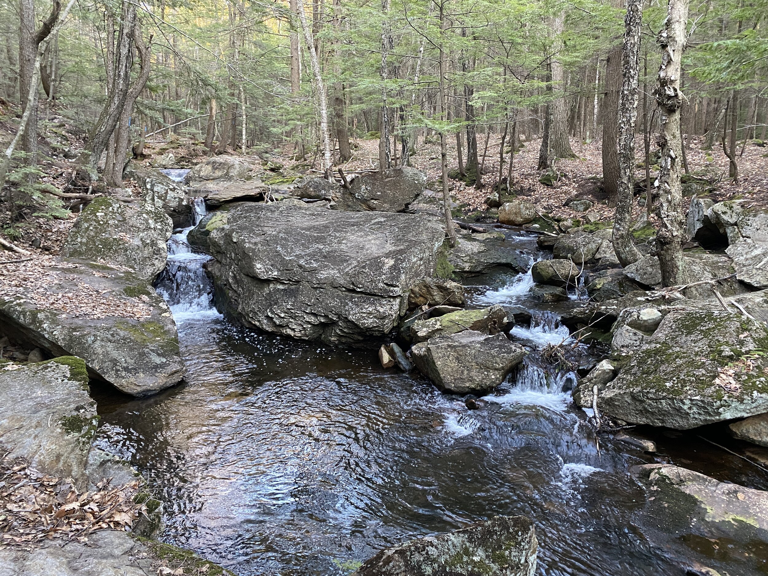
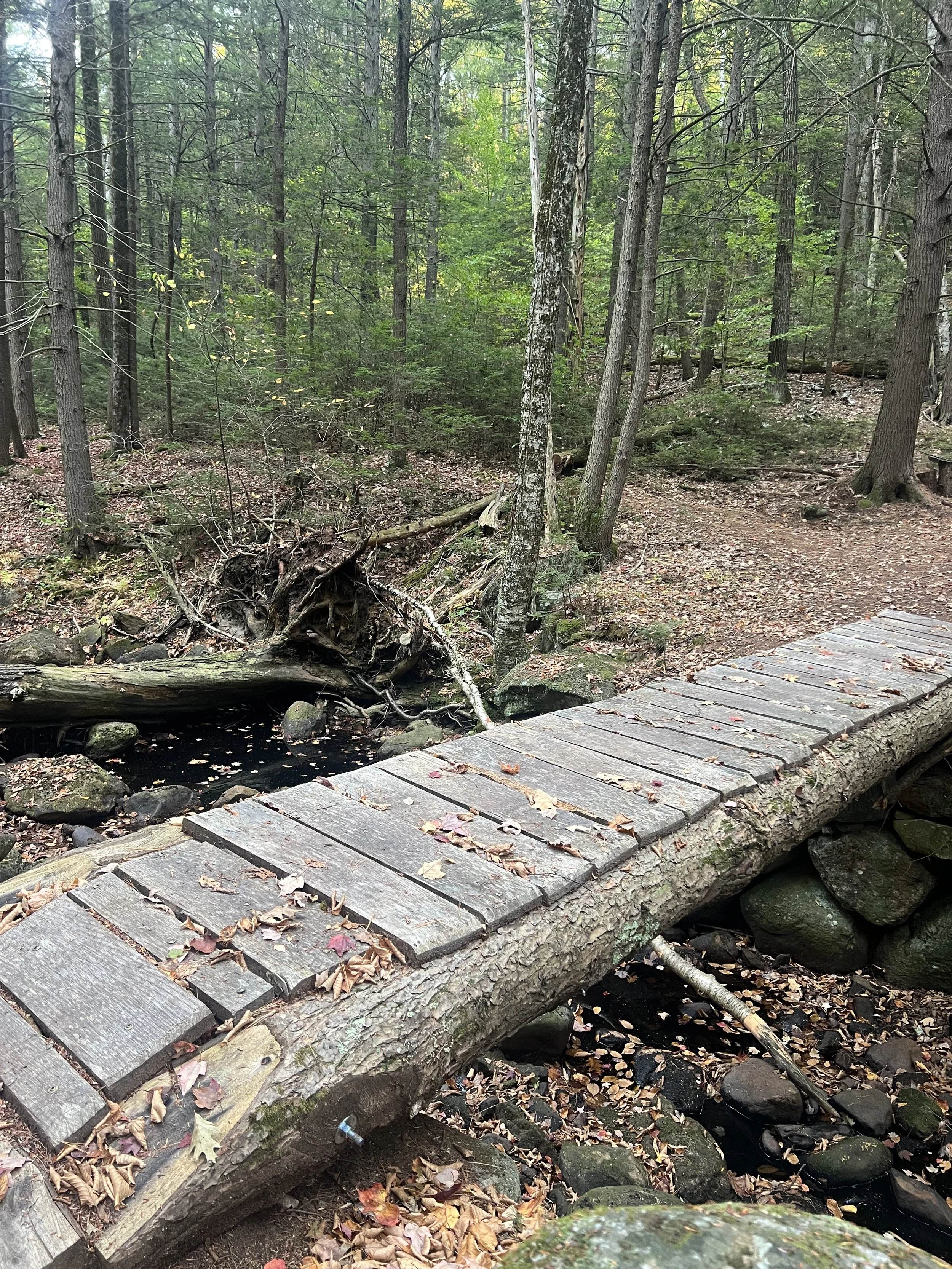
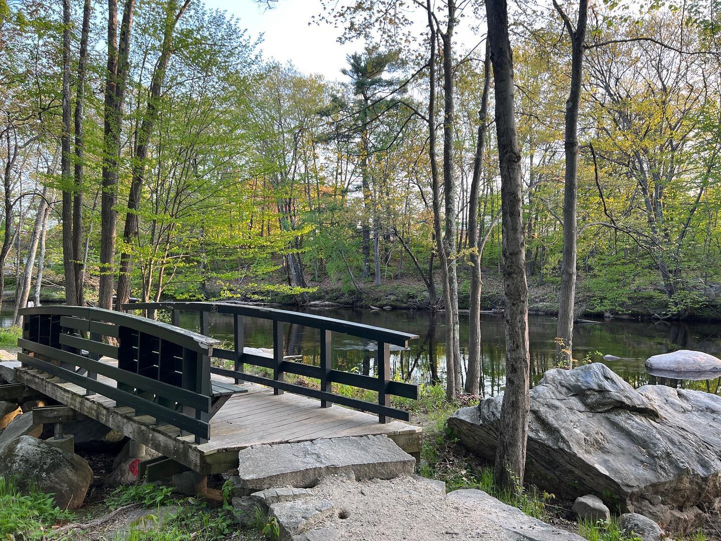
The kiosk at the entrance has limited information.  At one time there were maps, but there were none the day I visited.  There are two trails at the small parking lot, I chose to take the one off to the right.  At first the trail was very easy to follow with trail markers on the trees.  There were also numbers, not in order, my guess for some form of information on the trail.  At the top of a small hill was a bench.  I continued along the path along a ridge line.  There was not much of a view from the top.  As the trail headed back down the ridge there was a beautiful rock wall.  

IMG_3991.jpg

At the bottom of the ridge is where the trail started to get confusing.  There appeared to be a series of blow downs and the trail was marked with flagging. On one side of the trail was a steep rock formation and on the other side some water.  With the blow downs and limited trail markings it was very difficult to navigate the trail and walk, not making for an enjoyable hike.  After about a quarter of a mile I was able to bush wack my way back out to the trail I had started on.  When I got back to my car I walked a few hundred feet along the second trail, but also found that difficult to navigate with very limited trail markers.  

IMG_3992.jpg

Unfortunately,  I would not recommend this trail to others as it not well marked or maintained. If you did not know the area or have difficulty navigating in the woods this trail would not be good for you.   

Cranberry Meadow Pond Trail

Distance: 1 Miles

Difficulty: Easy

Located on Old Street Road in Peterborough, NH, near route 101 is a wonderful hiking trail that is perfect for all abilities or if you just want to get out into the woods for an hour.  The trail starts out by going over several foot bridges.

A0E4DA93-BA8A-445A-B5AC-BB43A403B8F4.jpeg

Then meanders through the woods along a stream. During the summer months the stream can be pretty low, but in the spring there is a nice flow with small cascades.

IMG_3748.jpg

When you get closer to pond there is a small incline and then a decent down to the pond.  

IMG_3761.jpg

On the way back from the pond, when the leaves are off the trees you can get a glimpse of Mt. Monadnock.

D3A77DA7-AC96-4189-A24A-6498943DAD26.jpeg


The hike is about a mile to the pond, but you can continue a little over a mile to East Mountain Road. From there you can connect to a trail that goes up Pack Monadnock.  I have only walked to the pond, therefore I can not comment on the rest of the trail. In the wet season the trail does have some muddy spots. I recommend this hike for all ages and abilities.  


Ponemah Bog Wildlife Sanctuary

Distance: About a mile

Difficulty: Easy

No dogs allowed

Every Thanksgiving we head out for a hike in preparation for all the yummy food ahead.  This year was no different. Since I was cooking  we needed shorter hike.  Ponemah Bog in Amherst, NH is something I’ve heard a lot about and have been wanting to check out.  Usually when I think of a hiking, I'm heading north or west.  I never think to look around Amherst, NH.  With the trail being so close to a main road, I was a little skeptical if I would feel enough in the woods to enjoy myself, but to my surprise, my family and I really like this trail.

IMG_3908.jpg

The trail itself is located on Rhodora Drive off of Stearns Drive in Amherst, NH. There is a sign marking the trail and a decent size parking lot.  There are no dogs allowed so please leave your four legged friends a home.  The trail is a loop.  We started out by walking the boardwalk through the forest and a bog and ending up at a small pond.  

IMG_3896.jpg

Along the pond are bird houses, various lookouts with benches and opportunities for wildlife watching. As you are circling back around the bog to the parking lot there is a raised platform overlooking the bog.  My daughter loved this and felt like she was in a treehouse.  

The one downside to the walk was the boardwalk was very slippery from all the rain from the day before and below freezing temperatures over night.  Over all we loved the walk and would highly recommend this for families or for someone who lives in the area and wants a few minutes outside without having to drive long distances.   

IMG_3912.jpg

Beaver Brook Trails at Maple Hill Farm

Distance: Varies

Difficulty: Easy

Mother Nature played a good April Fool’s joke on us in 2017, dropping about a foot of snow in the Monadnock Region.  Just as we were getting ready to put our snow gear away, winter is back in full force.  Knowing the snow would not last long we ventured out to Beaver Brook Association in Hollis, NH to explore the trails on cross country skis. 

When my husband and I were first dating and lived in Nashua, we frequented these trails as they gave us the opportunity to spend time in nature without driving long distances.  Returning to these trails with our daughter allowed us to share with her some of our earlier memories in our relationship and our love of the outdoors.

 
Beaver Brook is a great place to visit for all ages and abilities. They offer an array of activities such as school activities, a fitness group, a treasure hunt for kids, bird watching, gardens, various presentations, nature identification markers along some of the trails, as well as miles of well marked trails for hiking, mountain biking, snowshoeing and cross country skiing. We also saw deer tracks and could hear various birds chirping. 
The day of our visit we chose to ski a three mile loop.  These trails are multi use so there are no groomed trails, but due to the amount of traffic the trail was packed down enough to get a good glide. 

The second half of the loop was a little more backcountry skiing than we expected, but my husband and I were really proud with how well our daughter did meandering through the trees, up and down hills and over small streams. 

IMG_1211.JPG


Recently, I had seen a Facebook post about a wigwam on one of their trails.  I wanted my daughter to check it out.  This is such a fun little area, there is a small wigwam that fits a few people and allow little ones minds to imagine.  There is also a small stream and a bridge, that I imagine in the spring and summer is great for throwing rocks in.    


If you are in the Nashua area and are looking for a great place to get out into the wood for a few hours, I high recommend that you checking out Beaver Brook Association.

Grafton Outdoors Center

It was the last day of winter of 2017. The winter had had it's up and down in terms of snow fall, limiting how often we were able get out and enjoy winter activities.  With a recent blizzard providing us with well over a foot of snow, I wanted to get out and enjoy what could possible be the last snow of the season.  We have done a lot of repeat activities this winter, skiing the same places and hiking the same trails so I wanted to try a different area in New England.  This is always the difficult part as I never want to spend too much time in the car. After various google searches I decided to take the family cross country skiing to Grafton Outdoors Center In Grafton, Vermont. 

Grafton is located about an hour and a half away from Peterborough, NH.  Grafton is a typical Vermont town, with a local inn, general store, cheese shop and restaurants with fresh local food.  Upon arrival to the outdoors center, you observe a beautiful view as it is nestled among various mountains, a mountain stream and some fields. There is a small lodge where you can rent cross country skis, snowshoes, fat bikes and tubes for sledding. They sell some food and drinks or you can bring your own lunch to enjoy in front of the roaring fireplace.  In the summer, they have other activities such as swimming, disc golf, hiking and mountain biking.  

We spent a couple hours exploring their trails.  They had a great set up for beginners or children just getting into cross country skiing as most of the trails were relatively flat.  The blue trails, which are moderate, we found very manageable for our seven year old.  We explored the forest, some fun hills, a couple fields, a covered bridge, a mountain stream and a cheese factory.  Yes, you can ski to a cheese factory.  Unfortunately, the factory was not open the day we visited, but the general store a couple miles away sold the cheese from the factory.

Skiing

After exploring the trails, my daughter wanted to test out the tubing hill. We rented a tube and headed towards the hill.  This was the only negative of the trip.  You have to walk the tube up the hill and after a couple hours of skiing and walking up the hill our legs got tired quickly.  I know other tubing facilities have some sort of tow or magic carpet, which would have been nice here.  My husband and I took turns going up and down the hill and getting our steps in for the day.  The first run I was a little nervous watching my daughter go down as it was FAST, but she LOVED IT.  She did about 10 runs before leaving. 

Tubing Hill

Overall, we spent about three to four hours at the facility and would go back. If you are looking for some place different to ski, but is not too far away this is a great place to check out for people of all ages and abilities.  

Forest Bells

Distance: .75 Miles

Difficulty: Easy

In Groton, Massachusetts is a magical little place guaranteed to stimulate little minds and get families outside for a little musical fun. Forest Bells is located in Groton Conservation Land.  


 "The Forest Bells were created by local artist and craftsman Paul Matisse in 1995, commissioned by the inaugural Artist’s Valentine project, and installed on land owned by Arthur and Camilla Blackman.  The Blackman's donated the land to the GCT in 2000, and the Trust has been the steward of the land and bells since then." (from Groton Conservation Trust website)

IMG_0461.JPG

Park at the end of Indian Hill Road, but not too close to the house at the end of the road, we parked on the side of the road.  Walk back towards the house at the end of the road and bare left into the woods past the Groton Conservation Trust sign. This appears to be an old tote road. Head down the path under the power lines past a beautiful wetland area. Make sure you stop and enjoy the view.  We were able to see several birds nests high in the trees.

Birds Nest

The water was overflowing onto the trail, causing it to be muddy so make sure you wear appropriate foot wear.  After the wetlands there is a split in the trail, bear left and walk uphill another 5-10 minutes until you reach the bells. It appears there has been some heavy equipment on and around the trail so make sure you pay attention to your surroundings.  The trail is not marked, but you can follow the foot traffic. Once arriving at the bells we spotted six bells located high in the trees to be played for your musical pleasure.  

Bells

There are also two tee pees made from falling trees and some rocks that is fun for little ones to explore.  We spent about 30-45 minutes exploring the tee pees, climbing on rocks and ringing bells.  There is also a pretty view over looking a wetland.

Teepee

As for the first wetland I suspect this could be a good place for animal watching. This is not a long hike, as it's about 1.25 miles round trip, but this is a great opportunity to get families outside as there is a fun reward at the end. The key to getting kids to enjoy the outdoors is to incorporate fun while outside and this is a great place to do it, playing music, hanging out in the tee pees, climbing on the rocks or bringing a picnic to enjoy the great outdoors. Recommended for all abilities.  


Kidder Mountain

Distance: 1.5 Miles

Difficulty: Easy side of moderate

Located on Rt 123/124 across from the old Windblown Ski area is the trailhead to Kidder Mountain located off the Wapack Trail.  In the last couple years they have created a new parking lot, which a Wapack sign.  

From the parking lot follow the triangles to the powers lines. Once at the power line, instead of continuing straight towards Sharon Ledges you take a right and walk up the power line road until you see a small sign on the left for Kidder Mountain.  

Sign

This trail goes over some small rocks, with glimpses of Mt. Monadnock to your left. You will walk by some large flower pots that were supposedly brought up there for a wedding. I have seen flowers in the pots from time to time. From the pots it is a short distance to the top.

My dog loves the trail too

The total distance is a mile and a half. We love this hike because this is the first mountain my daughter hiked on her own, days before her second birthday, it's close to our home and provides a great view.  The views from the top are beautiful you can see Wachusett Ski area, parts of Massachusetts, Mount Monadnock and the mountains of the Wapack Trail. On a clear day you can see the sky line of Boston.

Looking towards Mt. Watatic in MA

This trail is recommended for all abilities as it's a gradual climb to the top.  

Tucker Brook Falls

Distance: 1 Mile loop

Difficulty: Easy

Tucker Brook Falls is a hidden gem located in Milford, New Hampshire. The waterfall is located in Tucker Brook Town Forest. The trailhead is on Savage Road. There is a small parking lot under the power lines.

There are two options for this waterfall. You can walk a mile loop that ends at the waterfall. Or you can walk about a quarter of a mile to the waterfall. There is a trail map as there are other connecting trails.

I enjoy doing the Falls Loop trail. From the parking lot you head up along the power lines and through the woods. They have been doing some forestry work near the trail.

The trail then follows Tucker Brook until you reach Tucker Brook Falls.

Jw9qv5pkThmmWLxWavSsNQ.jpg

From the falls you walk along the brook and bare right up a steep hill back to the parking lot.

For this falls being in Milford, I am quite impressed with Tucker Brook Falls.  If you are looking to enjoy a little peace and quiet in front of a waterfall without having to drive to north, I highly recommend this little waterfall wonder in Milford.


Casalis State Forest

Distance: 2.5-3.5 Loop

Difficulty: Easy

Located on Route 123 in Peterborough is Casalis State Forest.   The trail starts past the gate. After descending from the parking lot you come to a beaver pond.  This is a great opportunity to catch a glimpse of some wildlife, as there are several bird boxes. 

Beaver Pond

After leaving the pond you start up slight incline to a junction the trail.

22B324F4-3544-4E06-8F09-4C7E04B09BDF.jpeg

If you go left this is a loop through the woods. About a half mile along the trail there is another split.  You can go can either way as this is where the loop starts and ends.

If you so straight you come to a stream. You can cross the stream and I believe this trails connects to the Bass Brook Trail, but I have not explored that trail yet. If you take a left the trail follows the stream. There are some beautiful cascades.

8BB94321-C3E9-4FF8-98D4-A6BEBE8D68CE.jpeg

And signs of an old bridge.

82C79C64-1F64-46DA-BF8F-317996F4D89A.jpeg

Right after the bridge you walk up a slight hill and connect to the loop if you would have gone to the left. To continue around the loop take a right. To head directly back to the trail junction take a left. If you continue around the loop there is a side trail to the right that goes to Condy Road in Peterborough. Continue baring left to finish the loop.

The trail is between two and half and three and a half miles long depending on which way you go. This trail is great for all seasons, hiking, snow shoeing and cross country skiing.  The trail is relatively flat with some small inclines. This is also a popular with mountain bikers. All ages and abilities recommended.