Beech Hill

Distance 1 Mile Round Trip

Difficulty: Easy

If you bring dogs because as there was a lot of broken glass at the top.

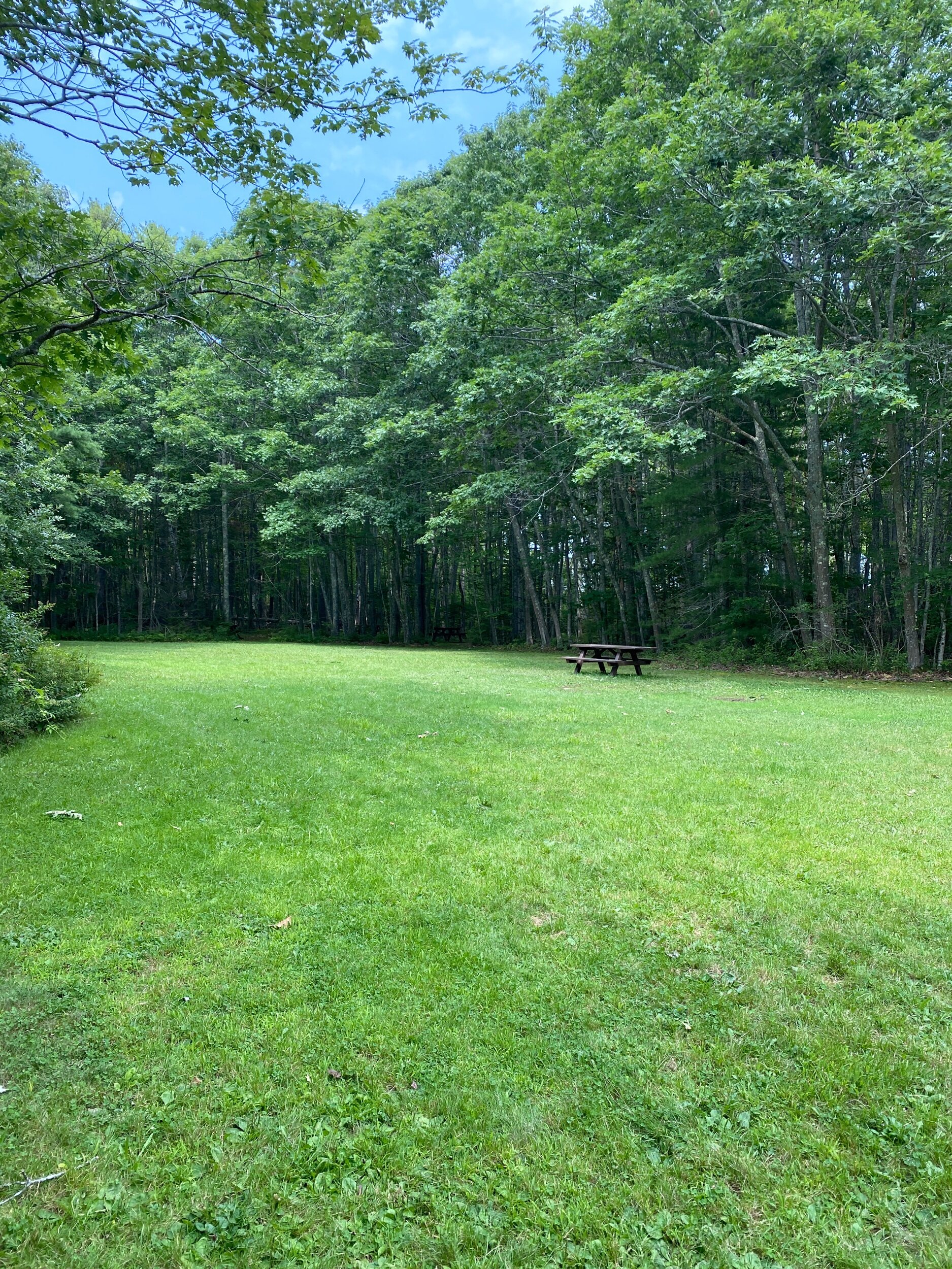
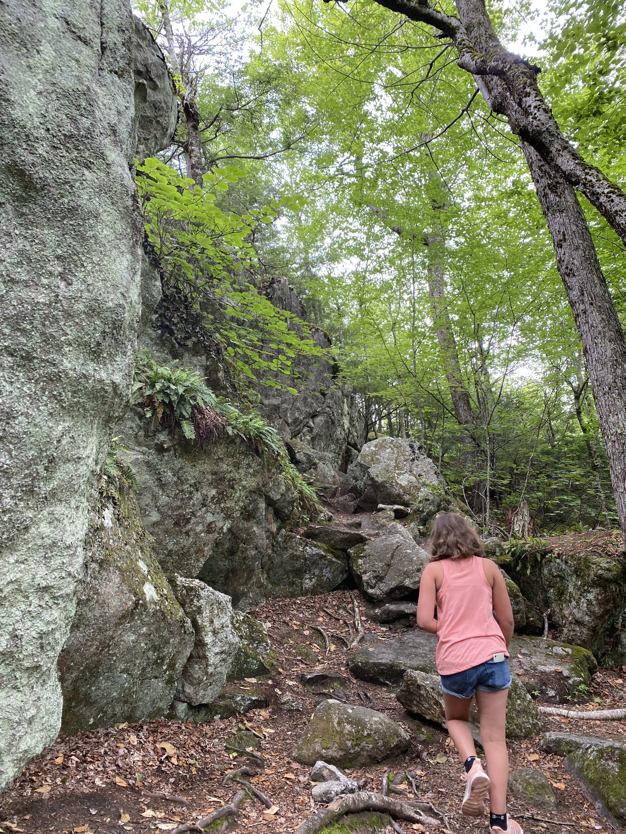
Beech Hill is an easy hike with beautiful views of Keene, New Hampshire. The trailhead is located on Chapman Road in Keene. Access to the trail is on the right hand side and is mark by a gate a couple signs with hours allowed on the trail. Parking is on the side of the road. The trail starts past the gate up a tar road.

IMG_8575.JPG

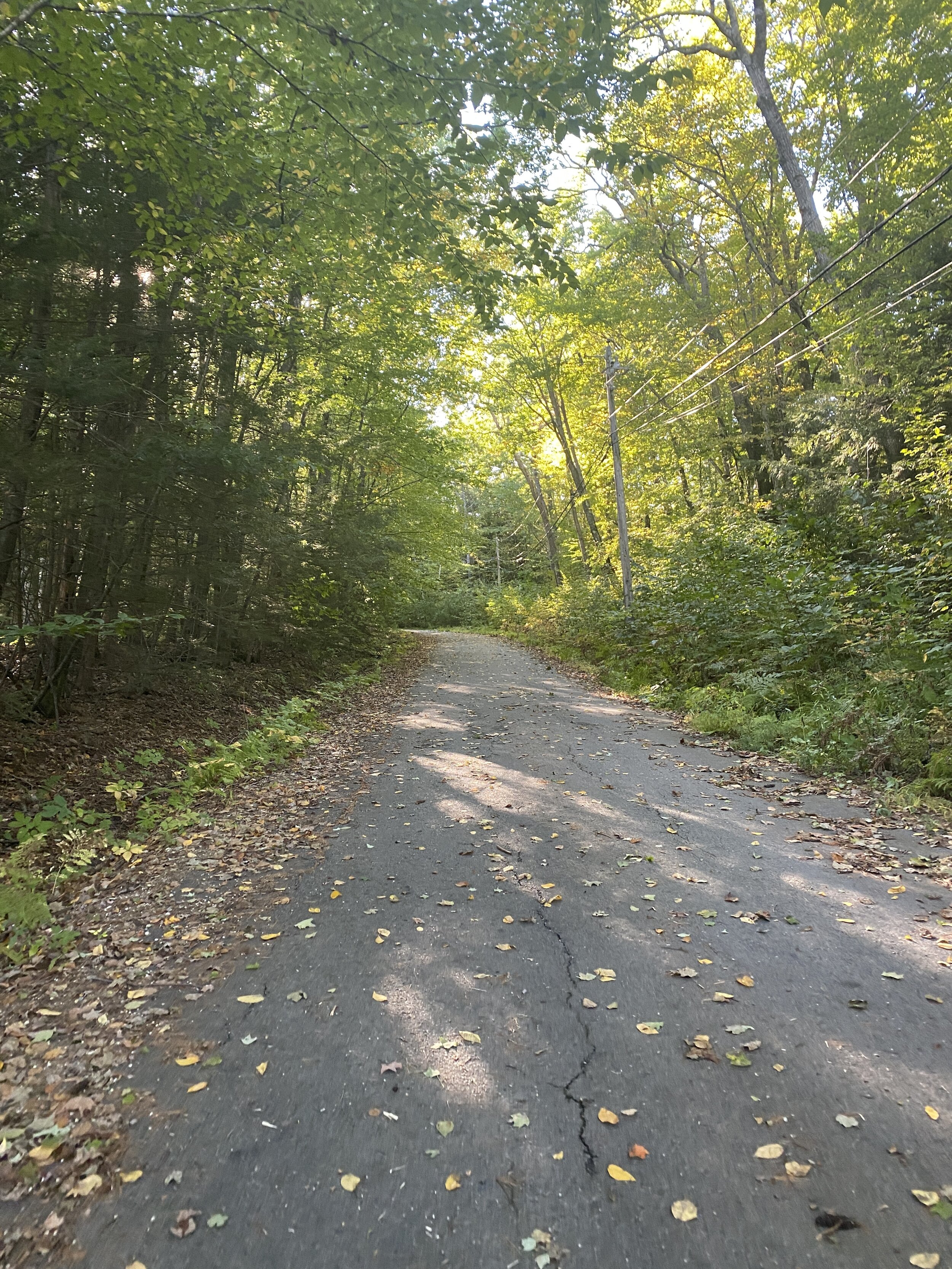
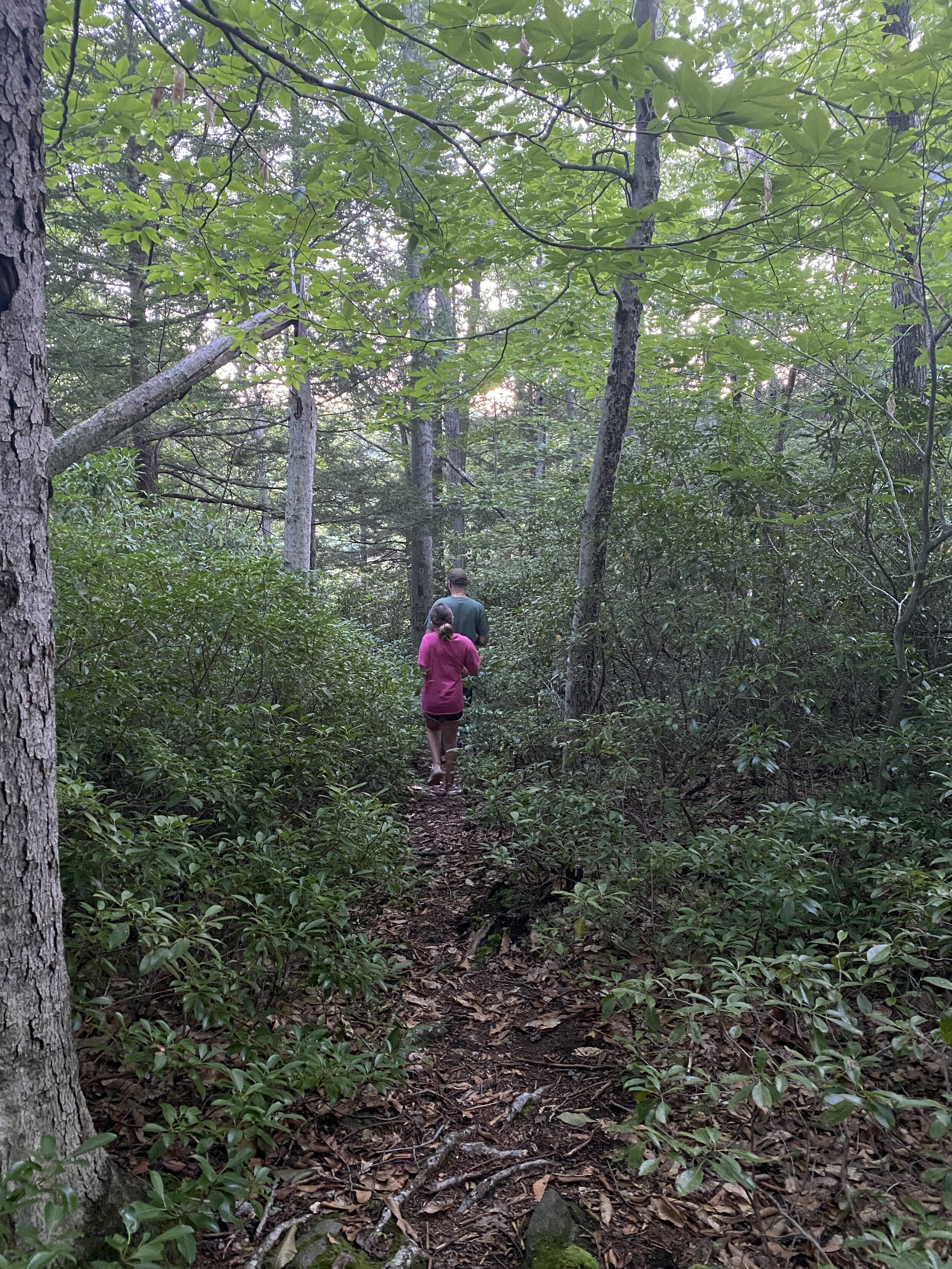
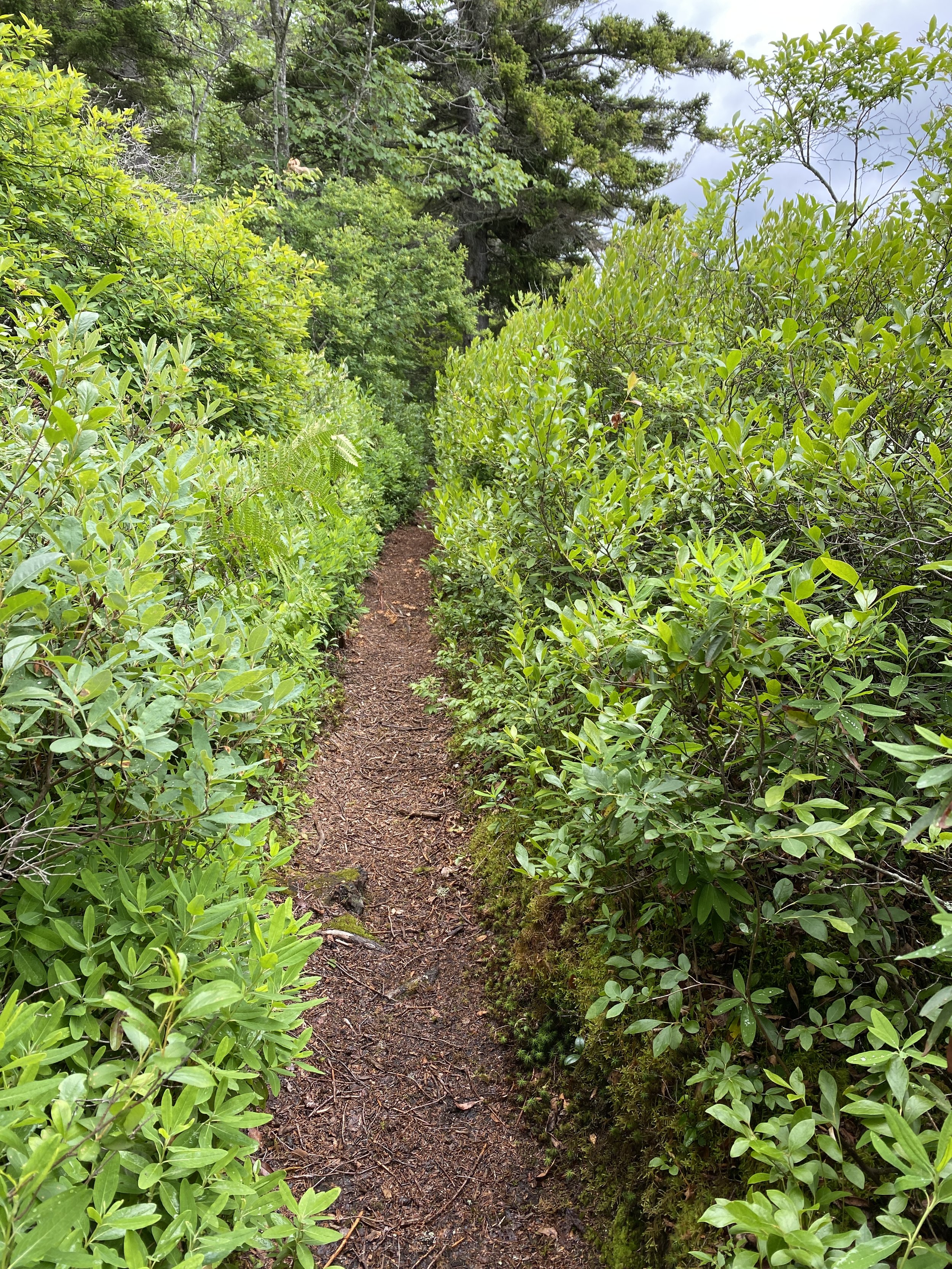
It is a steady up hill walk up for about .2 miles before the road veers right past a water tower and flattens out. After another tenth of a mile you come to split in the road. The tar road continues left up to a cell tower. There is no view from here. We continued straight down a dirt trail.

IMG_8576.JPG

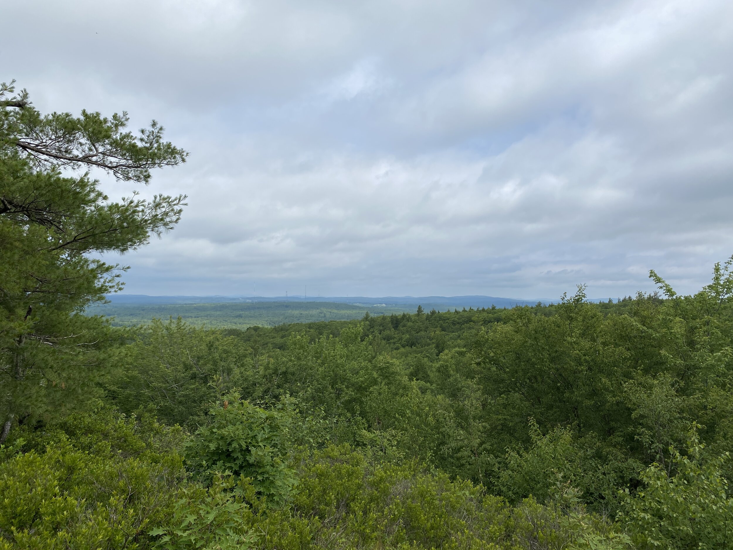
After another quarter mile walk you come to the ledge out cropping. If you bring dogs please be cautions as there was a lot of broken glass here. The view of Keene was beautiful.

6E60F4AB-8DF8-400C-B2CD-4BCB8CA58866.jpeg

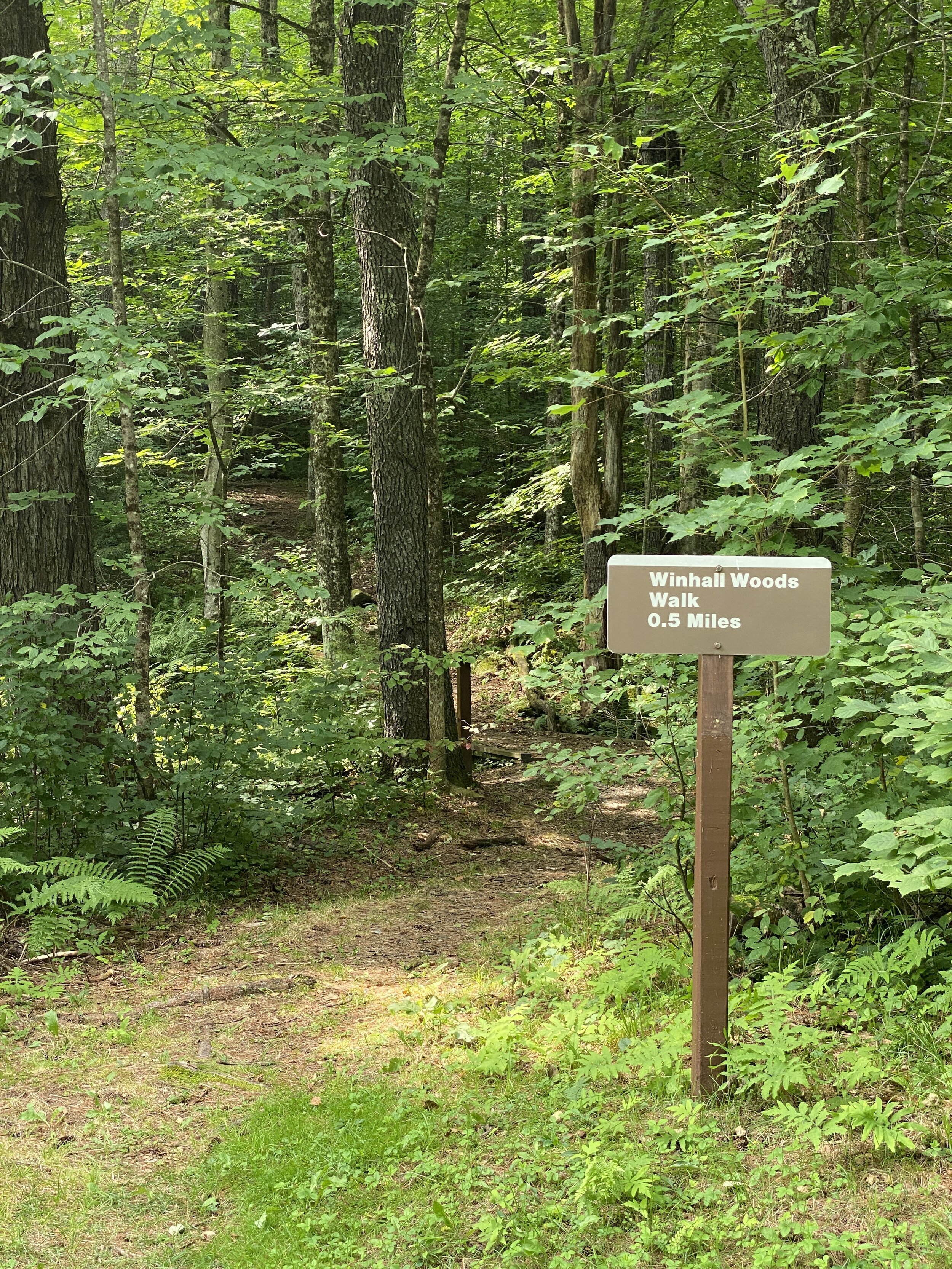
This is a popular place to watch the sunset. It was a short hike, only half mile to the ledges. We did notice some side trails, which some of them provide a short loop, but we did not know them. Beech Hill is a perfect walk in the woods if you want a quick hike with a nice view.

Nussdorfer Nature Area

Distance: .7 Miles Oneway

Difficulty: Easy

Located in New Ipswich, NH is Nussdorfer Nature Area. Located on Turnpike Road is the nature area. If you are heading into New Ipswich, the trail is on the left before you reach Mascenic High School. The dirt road to the trailhead is mark with a sign. There is a small parking lot and a small sign marking the trailhead.

6E0A7799-8A80-4AC0-9C06-AD316777AE55.jpeg

I have hiked Nussdorfer Trail a few times and tried to get additional information, but I always feel like I am missing part of the trail. There are supposedly two trails, one to Hoar Pond and a Nature Trail.

The trail to Hoar Pond is very easy to follow. The trail is marked by yellow blazes.

2BBEF69B-884C-435D-8237-356CB16B0197.jpeg

The trails meanders through the woods and right before you get to the pond the trail goes though some beautiful Mountain Laurel.

4990875D-32EC-4916-BEA9-EC7B58428D5B.jpeg

After a .7 mile hike through the woods you come to Hoar Pond.

I believe from here you can walk the nature trail around the pond, but I am not certain. From the pond it appears there is a trail that you can go left or right. It was getting dark when we visited so I plan to go back another time and explore those trails further.

Overall, it is a beautiful walk to the pond and great for all ages and abilities.

Swimming Hole Dummerston Vermont

Vermont is known for its natural beauty, which includes many swimming holes. Located on Route 30 in Dummerston just south of Newfane is great spot for swimming. The parking area is located on the right as you are driving north out of Dummerston towards Newfane. Before you cross the bridge over Rock River is the entrance to the swimming hole. There is good size parking lot. When we drove by on a Friday afternoon the parking lot was full. There are signs for no parking on certain areas of the road.

There is a short walk down to the river. The swimming whole is located where the Rock and West River meet.

19B6BCCD-B62E-43BE-9EA8-6F6EFDADC2ED.jpeg

There are plenty of places to spread out on the rocks or sandbars.

C8AE0353-268C-46AF-979C-73F3D9685700.jpeg

If you are driving through and need a place to cool off, this is a great spot to stop for dip in a Vermont river.

Update: I have since gone back to explore this area more and discovered another swimming hole across the street, Indian Love Call. This swimming hole is for those who do not mind a hike that is challenging in some area due to ledge crossing along with clothing optional swimming. .

Winhall Brook Campground

Located in Londonderry, Vermont is Windhall Brook Campground. This campground is part of the Army Corps of Engineers. If you are looking for a campground full of amenities and activities this is not the campground for you, but if you are looking for some back to nature time and opportunities to connect with family and friends on a low key camping trip, this is the campground for you.

Winhall Brook Campground is a relaxing place to reconnect with nature. This campground has only a few electric and water sites, most of the sites are off the grid. There is two sections of the campground, a north side and a south side. The majority of the sites are tent or RV sites, but there are a few lean to sites. We stayed on the south side and had a campsite tucked into the woods with plenty of space from our neighbors.

3D83CC40-74A6-4200-BDD7-621A8D578B3E.jpeg

Winhall Brook Campground is perfect for those who love to bike. The roads around the campground are paved, which was perfect for my daughter and her friends to ride their bikes around. There is also The West River Trail where you can bike for several miles if you are looking for a longer option.

9B515793-08AA-4444-B25F-9F205E92AA26.jpeg

The Winhall and West River run through the campground providing plenty of opportunities for water fun. I highly recommended bringing water shoes and a tube for the river. The river is very rocky. There is not enough water to kayak, but there are a couple places that if the water is high enough to can float down some rapids.

56654A01-3389-4175-844C-B3A3D777D782.jpeg

The primary swimming hole is at the end of the campground on the South Side, as this is where the water is the deepest.

7DF42518-FB62-443E-8B31-D082DC75BFC2.jpeg

This is also a popular area for fishing.

There are also a couple different hiking trails at the park.

B652360A-FF1B-4DF4-B2D1-5963A5D6C044.jpeg

We spent the weekend here with friends and really enjoyed our time. Much of the time was in the water, kids riding bikes and just enjoying time with friends. The only time we left the campground was Saturday night to get dinner.

Honeypie is a converted gas station into a burger joint, about four miles from the campground.

57C708AD-D689-4390-8492-84D9A774C604.jpeg

They are only doing takeout or outdoor seating, which is limited. Many people had blankets and were sitting on the lawn area. My husband had a burger, I had a veggie burger and my daughter had a grilled cheese. My husband and I each had a local beer. For dessert we treated ourself to a slice of honey pie which was delish.

585A5E56-331B-4364-912D-72E1A9A1804C.jpeg

Overall, we loved our camping weekend with friends at Winhall Brook Campground. We loved that the majority of the sites you could hear the river flowing at night, the opportunities for several outdoor activities and the cost at $20 a night, for a non electric and water site was amazing. The campground is pretty big and there is only 3 bathrooms so if you do not have a bathroom in your camper or are tenting you may want to look at the site map before picking your campsite. There also is little to no cell phone service in this campground. If you are looking for a back to nature campground where kids and adults are free to bike, hike and play in the water, this campground is for you.

Wolfe’s Neck Woods State Park

Distance: Several Options

Difficulty: Easy

Some trails are good for strollers

Wolfe’s Neck Woods State Park is located minutes from downtown Freeport, Maine. This Maine State Park is a day use park featuring a picnic area, several hiking trails, a rocky beach and a salt marsh for clamming. There is a small fee to enter the park.

The day we visited we met family members for a picnic. There are several picnic tables scattered around the day use area.

We enjoyed some time exploring the coast line, looking for shells and enjoying the beauty of this area. There is no swimming area at this state park.

There is also a few miles of trails. The trails are flat and easy to follow. Make sure you grab a trail map at the gate.

If you are looking to escape the busy shopping area of Freeport, Wolfe’s Neck Woods State Park is the perfect escape for people of all ages and abilities. We saw some families pushing strollers on some of the paths.
We were told on the weekends it can fill to capacity by late morning, so please plan accordingly.

Pillsbury State Park

Pillsbury State Park is a hidden gem of the New Hampshire State Parks. The park features, camping, hiking, kayaking and a day use area. Located off of Rt 31 in Washington, NH is this wonderful state park. When you pull into the park there is a ranger’s station off the right where you stop to pay a small fee to use the park or register for camping. There is a small camp store that had some cool stickers.

We have visited Pillsbury State Parking for camping and for day use. For day use this is a great place to canoe or kayak. The launch point is past the ranger’s station. There is also canoes to rent. You start out by paddling around Butterfield Pond.

96B186E9-EFD4-454A-9B25-3757E6337183.jpeg

Then you can paddle through The Narrows into May pond.

9D7FFB23-BFA2-48AD-BACA-A4DF6B0EDEB5.jpeg

This pond is a little bigger and there are small rock islands around the pond. It’s a very pretty and a fun area to explore. On several occasions we have seen a Loon with her babies.

This is also a great place to have a picnic at their small day use area. There are a few picnic tables, a shelter that can be rented for gatherings, an older slide and swings, outhouses and views of Mill Pond. From here there is also access to several hiking trails.

7FCC6545-D746-44EF-9CB9-2FB7981D66B4.jpeg

We have also spent a couple nights camping at Pillsbury State Park. It is not a big campground, which is nice as you can spread out or be in a group of people. We stayed at site 10 which has beautiful views and access to the water.

There is no electricity at their sites, so you are camping off grid. If you want a little more adventure there are sites you can hike or canoe to. We spent our time kayaking, fishing, hiking a couple of the smaller hiking trails. I really enjoyed walking out the Narrows, which is a 15 minute walk out to where Butterfield and May Pond meet.

This is one of the most relaxing camping trips we have taken. Our daughter loves campgrounds with a lot of amenities and activities, but it was nice to have a couple low key days.

The only downside is there is no swimming here. If you are camping you can swim at Lake Sunapee State Park for free, which is about 20 minutes away. Overall, we love Pillsbury State Park. With it being about an hour from our house it is a perfect place to camp or spend the day to relax and reconnect with nature. .

Parish Pond Town Forest

Distance: 2.1 with option for more or less, loop trail

Difficulty: Easy

Located in Amherst, NH is Parish Pond hiking trail. This is an easy hike, good for the whole family. The trail head is located on Spring Road and is marked with a hiking sign. After looking at the trail map I saw a couple other parking lots as well on Embarkment Road and Parish Pond Road.

From the parking lot you can go straight towards Beaver Dam Lookout or turn left towards the main part of the trail. We started out by going left and walking across a boardwalk.

1149B7E7-C58D-47EB-B85D-2B7256C77940.jpeg

From the boardwalk you get a view of a small stream and the bog.

341B9B89-8366-4568-BD36-1AF39B8E2A55.jpeg

About a quarter of a mile past the boardwalk is split in the trail. You can go either way as this is a loop. We chose to go left.

3814CA3A-020D-447C-AEA3-06C6B75D0A0D.jpeg

The trail is well marked with signs and yellow trail makers. We did see some red trail markers on part of the trail.

We continued on a flat walk through the woods. Part of the trail does border a residential area so please be mindful.

About a 3/4 of a mile through the hike you come to another split in the trail. Left heads towards the parking lot on Bamboosic Lake Road as well as the Josiah Parker Trail, which I am not familiar with. We went right to continue around the loop.

0CFAFE32-12D1-40BF-9912-F1896BCA6394.jpeg

After another quarter of a mile is another split in the trail. You can go straight towards the Parish Pond Road parking lot or continue right around the loop. We continued around the loop. I have to admit this part of the trail I was a little disappointed in. Looking at the map, I thought we were going to be walking along the edge of the bog. We technically were, but there was no view, we continued to walk through the forest.

There is a side trail to an observation deck. it was a little less than a quarter of a mile down to the viewing area, with a viewing platform and a place to sit.

C8A1BC30-9D31-42F9-92FD-8C9C59A0686A.jpeg

From the observation deck you got a pretty view of the bog. I bet in the fall, when the colors are turning this is beautiful.

350AE0B3-421B-4968-B361-1C4B4C151D6B.jpeg

We walked back to the start of the loop, towards the parking lot. At the junction for the parking and the Beaver Dam Lookout it was about 1.65 miles. We chose to take a left and check out the Beaver Dam. It is only three tenths of mile to the lookout. This is a pretty view of the pond and a beaver house. There is also a bench to sit and enjoy the view .

2EA0E6E0-9C9E-40E1-828F-28DC1CC881EF.jpeg

A few feet down the trail you can see evidence of a beaver dam. We had had a lot of rain so the water flowing over the dam.

From here we returned to the parking lot. The whole hike was about 2.1 miles. I read that in the winter people snowshoe and cross country ski here. This was no a favorite trail, but if you are in the area and need to kill some time it is a nice walk through the woods.

Tippin Rock Trail

Distance: 1 Mile oneway

Difficulty: more difficulty side of easy

Located in Swanzey, NH is Tippin Rock hiking trail, which is part of the Monadnock Conservancy. This is a fun hiking trail for the whole family. The trailhead is across the street from Chebaco Kennel’s on Warmac Road. The parking lot is on the edge of a field and there is only enough space for 1-2 cars. Many websites have reported if these two spots are full do not park in front of gate or along the road and recommend you come back at another time.

From the parking lot you walk through the field towards the right corner of the lot.

On the edge of the woods is trail sign and map marking the start of the trail.

From here the trail is a gradual incline for about .6 miles.

The trail flattens out and after another .1 miles you reach Tippin Rock. The story is that if you push on the right spot you can get it to rock. My husband tried, but was not successful.

From here you continue past the rock. Make sure you look off to your right as there is a small cave that is fun to check out.

Roughly another .1 of a mile you come to the first and best lookout of the trail. There is a nice ledge outcropping where you get beautiful untouched views looking west towards Vermont.

There is a second lookout a little further down, but it is not as good as the first.

Overall, we really enjoyed this trail. It was only a mile long and had enough of an incline to give us a little workout. This is a great trail for families as there is enough to keep kids entertained from the rock, cave and if you visit the right time of year, blueberries.

Rhododendron State Park

Distance: .6 mile loop with option for more.

Difficulty: Easy

Trail is good for strollers or wheelchairs

Located in Fitzwilliam, NH is Rhododendron State Park. This park is known for its grove of Rhododendron that blooms in mid July. The park is located on Rhododendron Road, with a sign marking the park. There is a parking area, outhouses and a couple picnic tables.

A trail map guides you around the property. I recommend doing the loop through the Wildflower trail, which marks a variety of wildflowers, then continue through the Rhododendron area. The trail is flat and easy to navigate.

A64C46B8-E514-4873-851D-038CD6E535B6.jpeg

The rhododendron provide a fun tunnel to walk through, making this a perfect hike for young children.

1DDD7328-1BA4-41E8-B811-BD182F07D4E4.jpeg

The best time to visit is when the flowers are in bloom. The state park website provides a bloom report. so you can try to plan your trip accordingly.

8215A686-C915-45E3-8C27-EBB5BA6716CE.jpeg

The loop is a little over a half mile, but if you want a little longer hike, you can connect with the Little Monadnock Trail from here.

Weekend at Huttopia Southern Maine

Glamping has been on my to do list for a while. Huttopia, is a Canadian based company that has locations in Maine, New Hampshire, New York and Canada. We wanted a last minutes weekend get away and decided to give them a try. We tried New Hampshire first, but they were booked. The Maine location had sites available.

Located in Sanford Maine one of the Huttopia glamping resort compiled of tiny homes and canvas tents. When you arrive you check in at the office, which also has a small store and a restaurant. After check-in you park in a large parking lot and carry your items to you tent/tiny home as there is no vehicles allowed in the campground. There are wagons if needed. I would say the furthest you have to walk is about a quarter of a mile.

Our tent was fairly close to the parking lot. It had a nice little porch with a gas camp stove and a couple chairs.

18E43A34-A0B0-47F3-ADCE-79B8847D381C.jpeg

We had two bedrooms with a kitchenette area. Some tents have bathrooms, but ours did not.

C3853941-500F-4B44-84B6-3AE0B3C8A8F2.jpeg

The bathrooms were close to our tent and very clean. The tent was equipped with everything we needed; linens, kitchenware, camp stove, mini fridge, a fire pit, picnic table and two camp chairs. Our only complaint was the fire pit and picnic table where located behind the tent. It would have been nice if they were in front of the porch, most tents had the fire pits and picnic tables in the front.

866E68B5-E9C0-47CD-8C21-341E9E4780EF.jpeg


We walked around the campground to explore the amenities, which are…

  • pool

  • playground

  • various outdoor games

  • hammocks

  • pond and beach area with canoe and paddle board rentals

  • fishing

  • restaurant

We enjoyed dinner at the restaurant, which was pizza and beer.

DD7AE7FB-EA16-4453-90CA-C95522DEB494.jpeg

The outdoor dining area is very relaxing with tables, chairs, lawn chairs and hammocks.

ECA6D9E0-055F-4A8E-96F3-D84C934B126D.jpeg

We brought our own kayak and spent the evening paddling around the pond and swimming.

20FBA558-4F72-40E3-A512-9197EE0540C5.jpeg

We wrapped up the evening with a camp fire and s’mores. My daughter liked that there were no cars in the campground so she could freely ride her bike everywhere.

Saturday morning we got up and had a yummy breakfast of smoothies, croissants and crepes.

780B1B7C-AD8B-40AE-A4D9-FBA77335BD3F.jpeg

After breakfast we took a nice hike around Bauneg Beg Mountain Conservation Area, which is less than five minutes from the resort.

FFEEB3D9-5C9B-4764-BA64-BB7A8B9B2EB4.jpeg

After our hike we decided to head towards the ocean. Wells Beach is only about 25 minutes away from the resort. This is a great beach to spend a few hours.

4A7076E4-DF11-4D02-9642-92F2766DAE7A.jpeg

After the beach we stopped for a late lunch at Food For Thought in Ogunquit. My husband had a beer and I had an adult capri sun, which was so good. Our food was amazing, my husband had a lobster roll, my daughter a salad, I got Nashville Chicken Sandwich and we split an order of street corn. The service was fantastic as well.

6B7A3022-C947-4032-B4C4-B3C328779381.jpeg

Next we stopped for a round of go-carts and mini golf at Wonder Mountain Funpark.

3196952D-EF7F-4A4C-AB0B-02B338A6C138.jpeg

On the way back to the resort we stopped at Shain’s of Maine for some delicious ice cream. We spent the rest of the evening hanging around the tent. My husband said that I should not lie as I feel asleep at 7pm. The resort did have a band playing for a couple hours. We did not mind the music, but if you were looking for peace and quiet during your stay you may not have enjoyed it.

We left early Sunday Morning. Overall, we really enjoyed our stay. It was so nice not to have to pack everything for camping. If you are looking for an outdoor experience without having to buy all the camping gear this is the perfect place for you. We did feel that the price was a little expensive at around $250 a night. We would love to check out the other locations to see what they were like.

Bauneg Beg Mountain Conservation Area

Distance: 1.5 Mile Loop

Difficulty: Easy with a rock scramble

Bauneg Beg Mountain Conservation Area is located at 279 Fox Farm Hill Road in North Berwick, Maine. This is a great family hike in Southern Maine. We were recently staying at Huttopia and wanted a quick morning hike and this was perfect. There is a small parking lot at the trailhead. The trail starts out with some foot bridges, which are always fun to walk on.

6595A1F3-FD83-468B-A816-0D494F4E00FC.jpeg

A little further up the trail you will see a sign off to your right to North Peak. You can go this way for the loop or you can go straight, we chose straight. The trail continues through the woods following white trail blazes, then up a steady incline for a few hundred feet. You will come to another split in the trail. You can go left to Ginny’s Way or go right to Linny’s Way. We chose to go right.

After a short time you come to another split in the trail where you can go left through Devils Den or right towards North Peak. We went through Devils Den which is a fun little rock scramble.

38EE47E6-C05D-489C-BC5E-5BCDFB9A83A0.jpeg

Once you reach the top of the rock scramble you bear left and head towards the view point. On a clean day you can see Mt. Washington, but the day we visited it was cloudy, but still a pretty view.

FFEEB3D9-5C9B-4764-BA64-BB7A8B9B2EB4.jpeg

You can go straight and head towards another parking lot/road on the other side of the lookout or you can go back down Devils Den, which we chose to do. After going back through Devil’s Den we took the trail to North Peak, This is a pretty trail through the woods. When you get to North Peak there is no view, but plenty of blueberry bushes.

8CF6B043-07CB-42E1-A7DD-8266D64637D7.jpeg

The trail loops back to the start of the trail and then it is a short walk back to the parking lot. The loop we did was only about a mile and half, but you could do more if wished. We really enjoyed this hike, it was pretty and allowed you to get a little workout in. This is a good hike for children who like to climb as Devils Den is fun to climb.

Wells beach

Maine has several beautiful ocean beaches. Wells Beach is not exception. After traveling from Downeast Maine we needed to stop and stretch our legs. After some delicious pizza from Seacoast Pizza we decided to walk Well Beach.

We drove to Atlantic Ave in Wells and went to the northern end where there is a metered parking lot for Wells Beach. Since it was Sunday afternoon there was plenty of parking. The charge was $4 an hour. There is a bathroom/changing area and an outdoor shower. From the parking lot there is two options for beach access. There is a small beach right behind the restrooms that is located in an inlet. My guess is at high tide there is not a lot of room.

The water was warmer, shallow and no waves.

To the left of the bathroom/pay meter is a beautiful path to the main beach area. I just loved the roses that lined the path.

The path is about an 1/8 of a mile to the beach. The beach is so beautiful. We walked about a mile down the beach and it looked like it went much further. There was more than enough room to spread out.

We did not swim, but there looked like a lot of fun waves to play in.

There was also a cool jetty that you could walk on.

This beach has made us excited to come back and explore further. There did not appear to be a lot of public parking, so I would plan ahead to ensure you get a parking spot.

6/26/2021 Update: We went back to the beach to swim and it was so much fun. The day we visited it was a little cloudy and windy. I thought for sure the parking lot was going to be full as we arrived around noon, but there was plenty of spells. The water was cold, but waves were a lot of fun to play in. There was plenty of room on the beach to spread out. If you are in the area I highly recommend you checking this beach out.

4A7076E4-DF11-4D02-9642-92F2766DAE7A.jpeg

Ferry Way Trail Loop

Distance: 2 Mile Loop Trail

Difficulty: Easy

Located in the Great Bay National Wildlife Refuge in Newington, NH is a great loop trail overlooking The Great Bay. Located at the end of Merrimac Drive is the parking lot for the Ferry Way Trail Loop and Peverly Pond Trail. At the parking lot there is a kiosk and porta potty’s. From the parking lot you walk across the road to the trailhead.

IMG_6357.JPG

The trail starts out by following a fence.

IMG_6358.JPG

After the fence the trail goes down a small hill and bares to the left. You walk down a very wide trail. There are no trail markers, but it is pretty easy to follow.

IMG_6359.JPG

About a half mile down the trail is the junction of the loop. You can continue straight or you can take a right and go across the bridge. We chose to go right.

IMG_6361.JPG

After walking across the bridge you come into an open field. It was not obvious which way to go. My guess is when the grass has grown some it is easier to tell. You continue to walk straight.

IMG_6362.JPG

After the field you walk down a wooded path.

IMG_6365.JPG

Then you come to an over look of the Great Bay. Across the bay you can see Adams Point, another great hiking path.

IMG_6368.JPG

After this lookout the trail starts to loop back around to the parking lot. There are spots along the trail that provide benches for people to sit and rest of enjoy the great outdoors.

IMG_6371.JPG

This is a two mile flat, easy loop. I wish the trail had more water views. Overall not a bad trail to check out if you are in the area.

Peverly Pond Trail

Distance: .5 Miles Loop Trail

Difficulty Easy

No dogs allowed

Located in the Great Bay National Wildlife Refuge in Newington, NH is a great boardwalk trail. Located at the end of Merrimac Drive is the parking lot for the Ferry Way Trail Loop and Peverly Pond Trail. At the parking lot there is a kiosk and porta potty’s. The trailhead for Peverly Pond is off to the left.

IMG_6346.JPG

This is a loop and whole trail is a boardwalk.

IMG_6350.JPG

There is a lookout point that over looks the pond. This is a popular area to birdwatch.

IMG_6354.JPG

From the pond loop you walk back to the parking lot. Right before the parking lot is a sign for a vernal pool.

IMG_6356.JPG

This trail is only a half mile. This is great for little legs, strollers, wheel chairs etc. If you are looking for a longer hike I recommend walking the Ferry Way Trail Loop across the parking lot.

Goose Pond

Distance: 2.25 mile loop

Difficulty: Easy

Located on East Surry Road in Keene, NH is a pretty trail. Goose Pond has been on my to do list for a while and I am kind of upset I waited so long to hike it. There are two small parking lots for the trail. There was a sign directing people to the second parking area, which has a sign on it.

IMG_6073.JPG

You start up a gradual incline into the woods. You walk about a quarter to a half mile in the woods before you come to Goose Pond. Once you get to the pond you can go right or left as this is where the loop starts and ends. We chose to go left. The trail follows around the edge of the pond.

IMG_6074.JPG

For the most part the trail stays on the edge of the pond. There are a couple sections that goes into the woods and crosses a couple streams.

IMG_6091.JPG

A downside to this trail is it is not well marked There are some faded white blazes in some places along the trail, but a couple times I had to pull out the All Trails app to make sure we were going the right way.

IMG_6094.JPG

There are a couple dams that you walk over as you are looping back around.

IMG_6099.JPG

Another downside to this trail is right after the second dam is a sluiceway that had water flowing over it. Since my husband and I had sneakers on we could not cross it, but if you had waterproof boots on you could. We ended up having to walk down to the first parking lot and walk about 900 feet up the road back to our car, which was not too big of a deal as the road was not that busy.

Overall I loved this hike. The pond was beautiful and the trail was easy to walk. If you are in the Keene area I highly recommend checking out this trail.

Channing Trail at The Harris Center

Distance: 3.5 Miles Loop

Difficulty Easy

The Harris Center on Kings Highway in Hancock, NH is host to an array of hiking trails like North Pond Trail and Skatutakee Mountain. Behind the Harris Center building is another series of trails, called East Side Rails. When you are looking at the Harris Center building I recommend parking on the right hand side as the start of these trails are straight back towards a kiosk at the end of the lawn and edge of the woods. You follow the Dandelelyon Trail into the woods to the Boulder Trail. The Boulder Trail is a Loop, but we chose to take the trail off to the right. You walk through a beautiful boulder field towards Channing Trail.

IMG_5997.JPG

My plan was to walk the Babbitt Trail Loop, but when we got to the intersection of this trail it had not been packed down and we were only wearing our microspike’s so we decided to continue on Channing Trail. The trail continues through the woods. There was a small stream and a bridge, but not much else for water features.

IMG_6008.JPG

You continue through the woods and there is a small bog on your right.

IMG_6010.JPG

This trail does pop out onto Kings Highway, which is a dirt road. You go left and head back towards the Harris Center. It is about a half of a mile walk back to the parking lot. The trail itself is relatively flat and easy to follow. I really enjoyed hiking this trail with friends. If you enjoy a nice walk through the woods, I highly recommend checking out this trail.

This page contains affiliate links for which I may receive a small amount of compensation at no cost to you.

Madison Boulder

Distance: .4 Miles

Difficulty: Easy

Did you know that the largest glacial erratic in North American and possibly the world is located right here in New Hampshire. When I was doing some research for my Explore the Granite State Challenge I learned about Madison Boulder. Located on Boulder Road in Madison is this amazing natural wonder. In the winter you have to park along the road as the parking lot is not plowed. In the non snowy months there is a small parking lot.

IMG_5938.JPG

From the parking lot you walk .4 miles down a flat path to this amazing boulder.

A0337780-D1F4-47B1-A0F1-CB9A4CA428AA.jpeg

From the NH State Park Website, “Boulder is a huge granite rock measuring 83 feet in length, 23 feet in height above the ground, 37 feet in width, and weighs upwards of 5,000 tons.” The boulder was pretty impressive. To get an idea of how big it is, in the picture below is my husband and daughter. My husband is 6ft 2in.

DFDDFC2D-9B86-4AE2-AFAA-D2B4CAB81627.jpeg

We only spent about 30 minutes total here, therefore I would not make this my primary destination, but if you are in the Conway area I highly recommend stopping to check it out.

Exploring Downtown Exeter

Exploring Downtown Exeter

One of the activities in my Explore the Granite State Challenge is to explore a town in New Hampshire you have never been too. This was a little difficult for me as my family and I have been to many places around New Hampshire. When I was looking for the best small towns in New Hampshire, Exeter kept popping up. Even though I have driving through Exeter on Rt 101 we have never stopped. I thought this was a perfect time to explore the downtown area.

Night Away at Wentworth by the Sea

Since COVID, we are missing our regular getaways. We were getting itchy for a change of scenery, but did not want to leave New Hampshire. An impromptu night away at The Wentworth by the Sea was just what we needed. Located in New Castle, outside of Portsmouth is this beautiful historic hotel. With our AAA Card we were able to get a better discount than the trip saver sites.

We left after work on a Friday night and stopped for dinner at Smuttynose Brewery in Hampton. Their restaurant is separate from the brewery. When they weather is warmer they had a nice set up outside with tables, chairs and fire pits. We were able to reserve a table ahead of time through Yelp. We enjoyed the atmosphere, beer and food. I was finally able to try a key lim pie beer, something I have been wanting to try and loved it.

1616C2B1-1F27-41A2-95D7-0AC62938270D.jpeg

Upon arrival to the hotel the check in process was very easy. The staff were friendly and they were taking appropriate COVID precautions to ensure everyone safety.

Our room was a typical two queen bed room. A nice perk was we had a little balcony, which would have been nice if i was warmer out, the view was still enjoyable.

931A8A54-A127-4DA9-BC4A-B7077A0456C9.jpeg

We heading straight to the pool and hot tub area. Some of the amenities were closed due to COVID like the sauna, so if you are looking for a specific amenity make sure you ask ahead of time if it is open. The pool area had a limit of 20 people managed by the staff, we had the place to ourselves most of the evening.

196A2526-5A30-4FFC-BA6E-0A1BAA4C1C59.jpeg

The only downfall was there was no place to get a snack and we did not plan to bring snacks with us. There was a restaurant, but it was pretty expensive just to order an appetizer.

The next morning we enjoyed the pool and hot tub before checking out. If it was nicer there was a walking path down to Great Island Common, which is a park with great views of the ocean I would have loved to walk. With it being near zero degrees out we chose to drive instead.

90C5C1B6-6B5D-4A89-8A96-D43D0C0FC829.jpeg

The final stop for late breakfast was Donut Love in Hampton. If you love donuts this is a must stop if you are in the area.

DF0945A0-1192-43ED-8144-EE19D29DF193.jpeg

Prior to check out there was a note slipped under our door offering us a second night at a substantially lower price, but we did felt one night away was enough. It was nice of them to offer this promotion.

Overall we loved our stay at the Wentworth by the Sea and would recommend this to couples, girls weekends, or those with older children. I would not recommend younger children as I saw a couple signs asking for children to keep noise at an appropriate level. All in all a great and much needed night away.

Fort Foster Park

Distance: Can do up to 3-4 miles

Difficulty: Easy

Located on Pocahontas Rd, in Kittery Point is a beautiful park with walking paths along the ocean. We visited in November and the gate was closed to the park, but you could park along the side of the road and walk in. It was a little under a half mile to the ocean from where we parked. Once at the ocean there is an old fort that you can walk on and a playground.

IMG_4438.JPG

There is also a nice boardwalk to walk out on and get a view of the ocean.

IMG_4444.JPG

There are some beaches to explore as well. My favorite part was the walking paths along the ocean.

IMG_4446.JPG

There were several spots that had picnic tables if you wanted to make a day of out it. There was also shelter with several picnic tables.

IMG_4451.JPG

We spent a little over an hour exploring the park and really enjoyed it. We ended up walking 2-3 miles around the park. This is a perfect place for a family outing as there is enough to do keep children entertained with the playground, beaches and walking paths.