Beaver Brook Old City Trail

Distance: 2/1 Mile Loop

Option for Longer Hike

Difficulty: Easy

Beaver Brook Association in Hollis, New Hampshire has a plethora of hiking trails. My husband and I have hiked many of these trails since we started dating over 20 years ago. I recently learned that on the Old City Trail there is a waterfall. If you know me, I love any type of waterfall. I was surprised that I never knew of this one.

My husband and I set out on a hiking date to find the waterfall. We parked at the Old City Trail Parking Lot on Rocky Pond Road in Hollis.

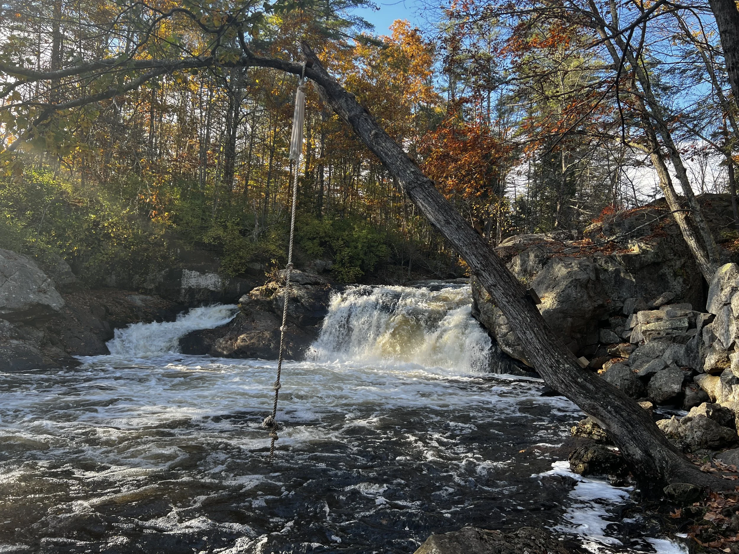
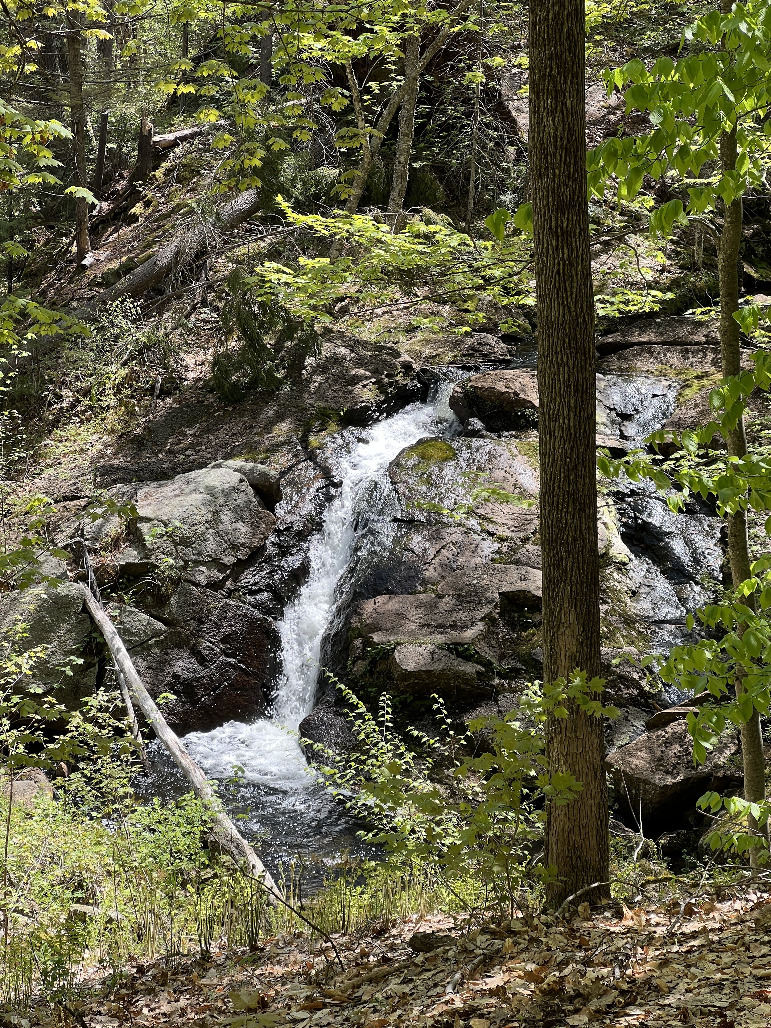
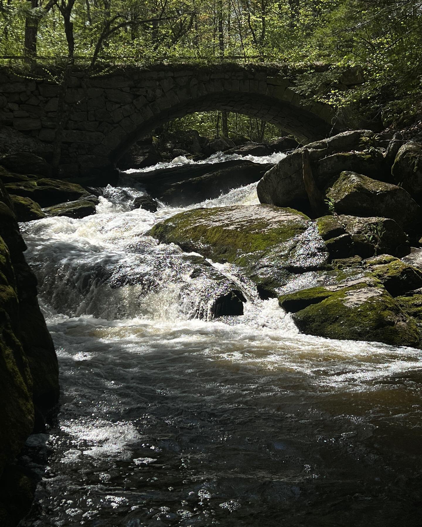
To my surprise, the waterfall was a few hundred feet from the trail head. The waterfall is part of a historic mill site. It is not big by any means, but still pretty.

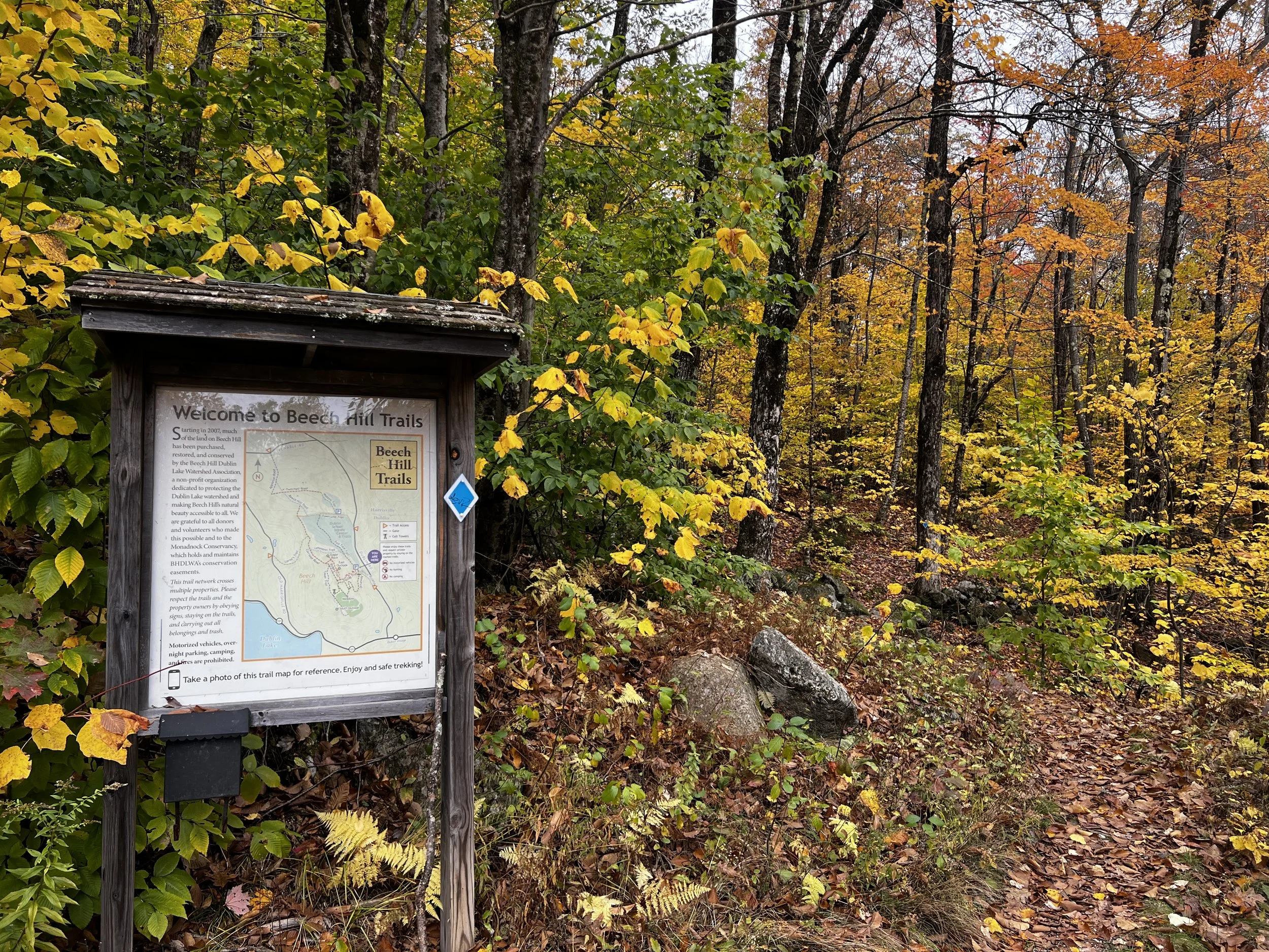
We continued down Old City Trail to get in a hike. The trail was well marked and easy to follow.

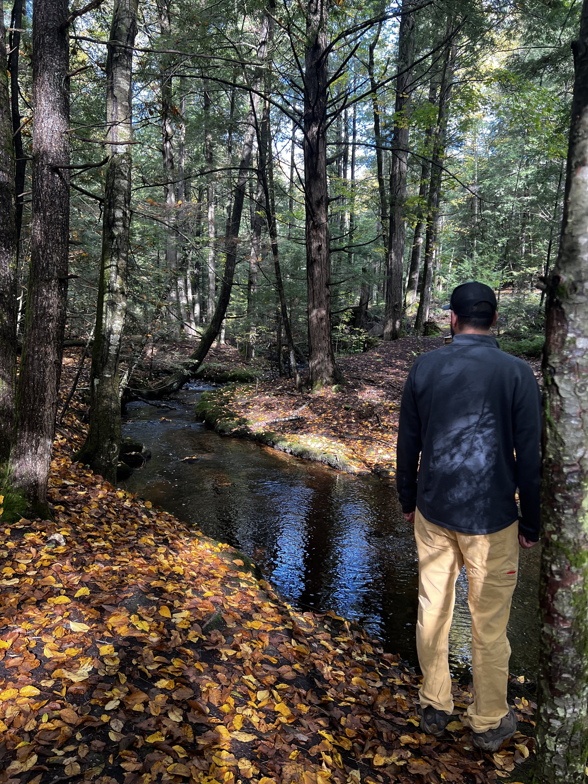
The trail goes along Otter Pond and there are options to take different trails. After looking at the map we learned of another waterfall. Oh course I had to find it.

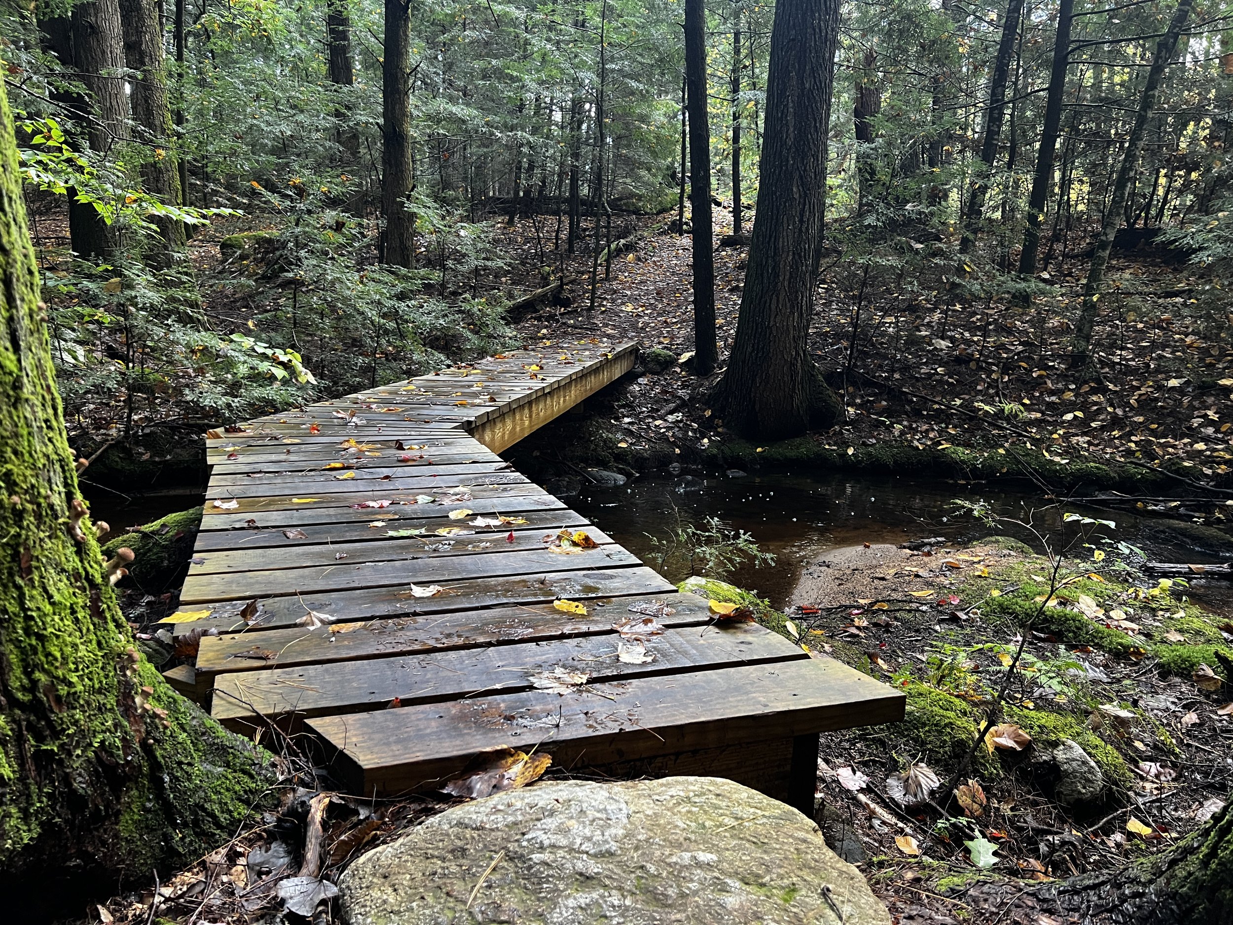
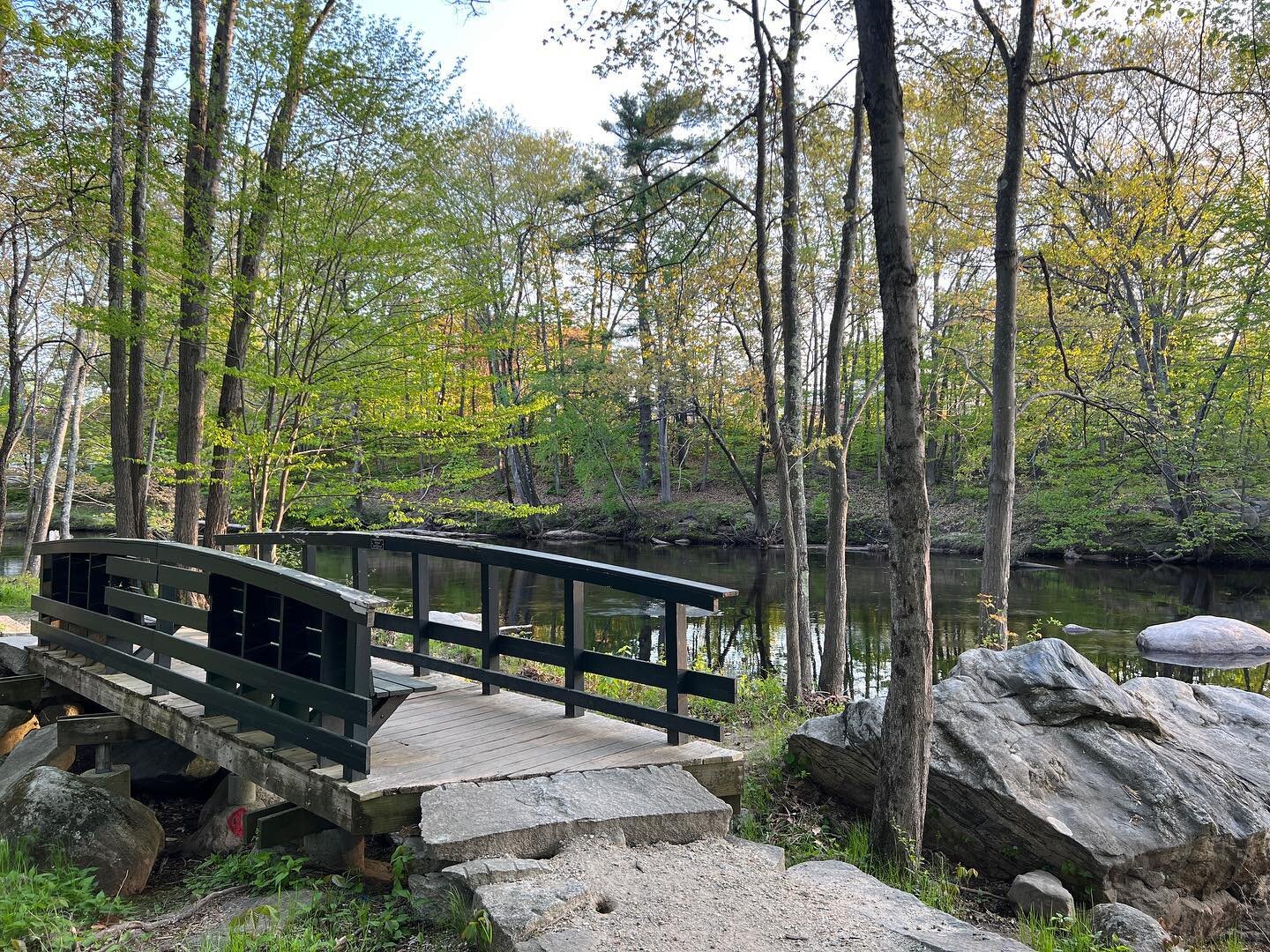
From Old City Trail we took a left onto the Bridge to Hatfield Trail, which came to a pretty little bridge over a stream with some small cascades.

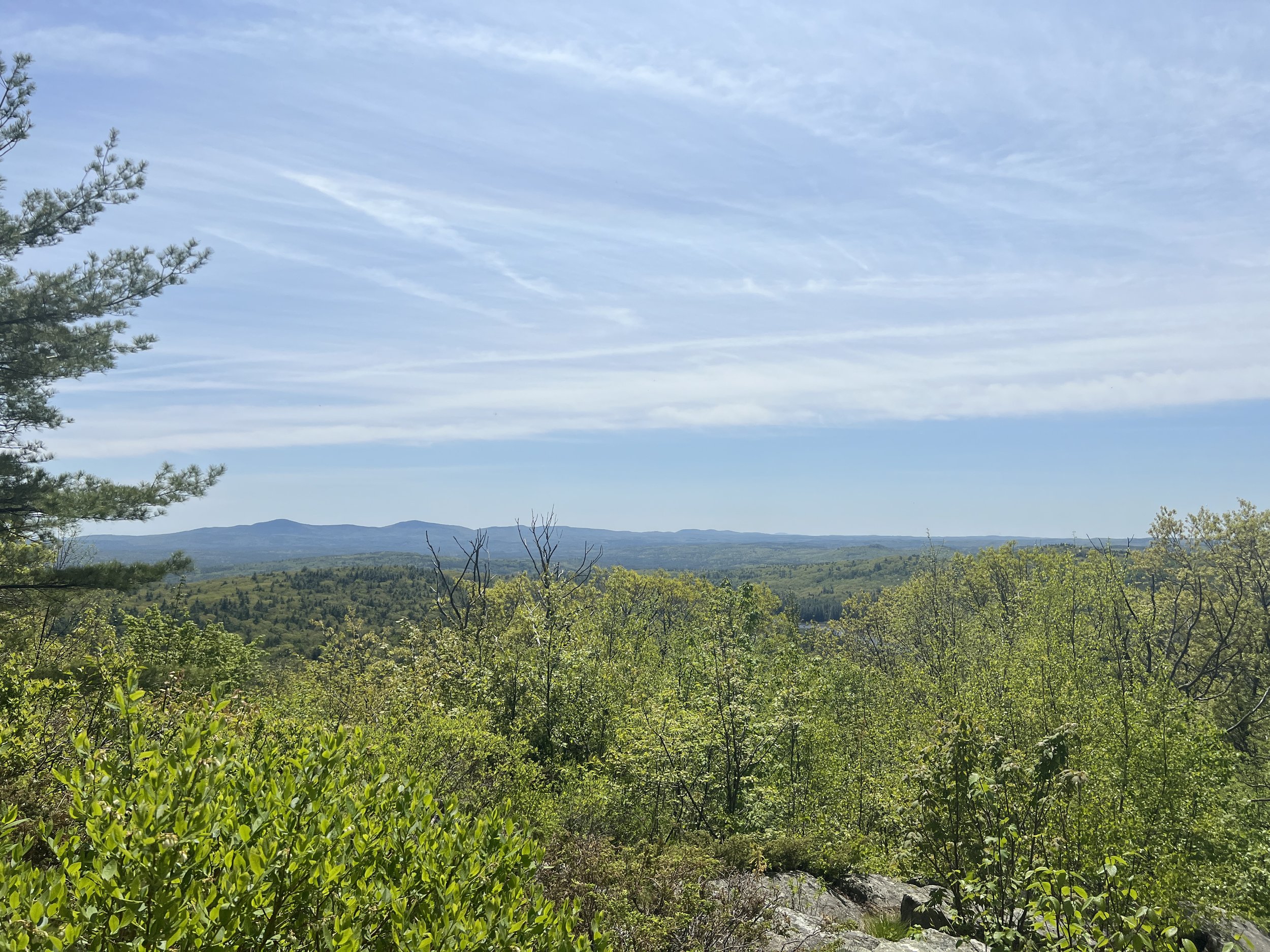
We continued straight up a small hill to an outlook over Otter Pond that we had hiked by.

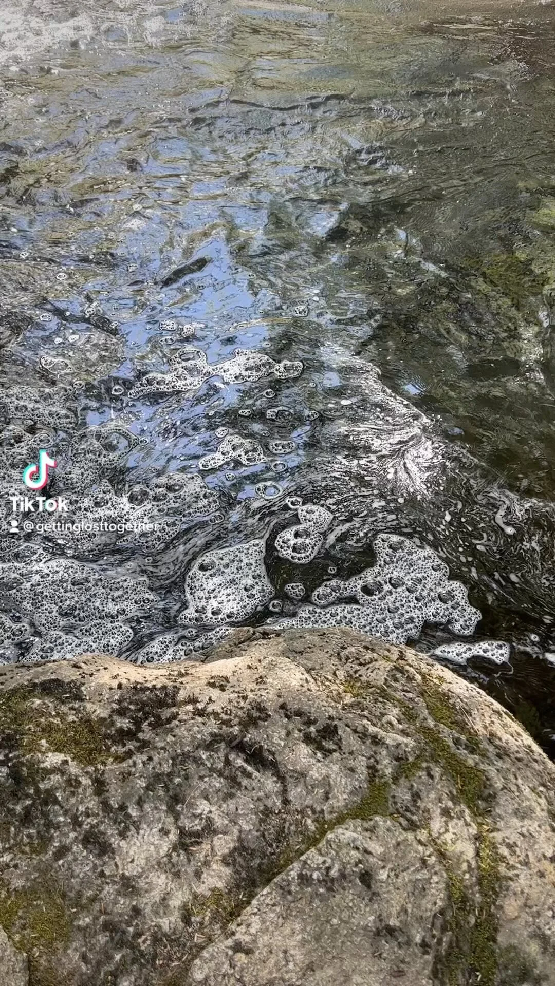
After enjoying the view we backtracked towards the bridge, but took a left before the bridge to check out the falls. The falls was only a few hundred feet down stream. They were small, but pretty.

We continued on the trail and found a trail that cut back across to Old City Trail. The only problem was there was a stream crossing that was a little difficult as there was no bridge and it was a little deep. We were able to make it across with the help of some downed trees.

From here we looped back to the parking lot via the Old City Trail. The loop was 2.1 miles. There are so many trails that you could spend all day hiking these woods. It was an easy hike, mostly flat and easy to navigate. I loved all the different water features on this trail. In the winter months microspikes or snowshoes may be needed for this trail.

This page contains affiliate links for which I may receive a small amount of compensation at no cost to you.

Peterborough Common Pathway and Old Railroad trail

Located in Peterborough, New Hampshire is The Common Pathway a multi use trail good for walking, running, biking, snowshoeing and cross country skiing. The trail starts at Noones Falls on Rt 202 in Peterborough where you walk along the Contoocook River.

The trail leads you through an underpass of Rt 101 and into Downtown Peterborough. If you have time to walk around Downtown Peterborough it is such a great area with lots of shops and restaurants. A couple of our favorite’s are ToadStool Book Store and Sweet Macaron.

The trail continues up Summer Street past the fire station before turning back into the woods. There is another parking area for the trail on Summer Street. This portion of the Peterborough Common Pathway goes between a paved trail and walking on the road as well as pulling away from the river.

The trail comes out at Rt 202 across from Scott Mitchell Road, the Peterborough Recycling Center and another parking area. It is 2.5 miles from the Summer Street Parking area to this one.

This is the end of the Common Pathway which is a total of 6.5 miles

The trail does continue as The Old Railroad Trail.

The trail goes through a tunnel under Rt 202 and continues past the Recycling Center. The Old Railroad Trail brings you back to walking along the Contoocook River. This section of the trail is not paved, but hard packed.

From here the trail can get narrow in places, but is still walk and bike able. The Old Railroad Trail continues up to Forest Road in Hancock for another 2.7 miles.

We have walked sections of this trail so many times since we moved to the area. It is a great place when you want to get in an easy walk without dealing with too much traffic.

New Boston Rail Trail

The New Boston Rail Trail is a four mile long rail trail starting from Hillsborough County Youth Center off of Rt 13 on Hilldale Lane to the Goffstown town line. I have passed this trail many times and loved how it went along the Piscataquog River. Today my family and stopped to check it out. We parked at Lang Station which on Gregg Mill Road, which is off Route 13. After crossing the bridge you will see an old train station building on your left and the parking area is directly after the building.

From the parking lot you can head past the trail sign which goes towards the Hillsborough County Youth Center. This part of the trail had some Christmas ornaments hanging on various trees.

We opted to walk across Gregg Mill Road and over a small foot bridge to continue on the trail that heads towards the Goffstown line.

We walked about a mile up the trail. About half of the walk we were able to follow the river.

The trail is very easy to follow. There are benches along the way if you need to take a rest.

I would love to come back and walk or bike all of the rail trail. My husband and I felt we could have cross country skied and saw evidence of people snowshoeing. Overall this is a great multi use trail that I would absolutely visit again.

While you are in the area drive to the center of Goffstown to Apotheca Flower and Tea to enjoy their cafe and adorable gift shop. Their teas and bagels are delicious.

Sewall Falls Trail

Distance: 2.5 Miles Roundtrip

Difficulty: Easy

Located on Sewall Falls Road in Concord, New Hampshire is an easy hiking trail along the Merrimack River.

I would guess this trail is multipurpose for hiking, walking, snowshoeing, biking and possibly cross country skiing. The day we visited a lot of people were walking their dogs off leash.

There is a large parking lot. We visited in January and it was not plowed very well and was very icy. The trailhead is marked by a small kiosk. Even though the trail itself is not marked, I found it very easy to follow.

The trail follows the Merrimack River most of the way providing a relaxing atmosphere.

We walked to the end of the trail, about 1.25 miles where there was an abandoned hydroplant and views of the river.

As we backtracked to the parking lot there was a side trail down to the river where I believe the falls is located. The water was very high so it was hard to tell if there was actually falls or just the site of an old dam.

The total hike was 2.5 miles of easy walking and terrain. I liked seeing the old dam and hydroplant. It was very peaceful walking along the river. If you are in the Concord area I think this trail is worth the stop.

If you are looking for breakfast, highly recommend Tucker’s on South Street in Concord, their breakfast is outstanding, especially the Maple Bourbon Bacon and breakfast bowls.

Russell Abbott State Forest Loop

Distance: 3.5 Mile Loop, option for further.

Difficulty : Easy side of moderate due to distance and short incline.

Russell Abbott State Forest is located in Mason and Wilton, New Hampshire. There are some trails that go through this forest and connect with the Greenville Mason Railtrail.

Today we explored a loop through the forest. We parked at Pratt Pond on Pratt Pond Road in Mason. We started out by walking up the dirt road towards Starch Mill Road. At the intersection, on the left, there is a small parking area and trail sign for Russell Abbott State Forest.

We walked past the gate down an old skidder road. We walked along a small stream for a short amount of time. The trail is not marked, but it was fairly easy to follow.

We did have to walk through some clear cuts, but were able to navigate through them to where the trail continued.

Once we got to the power line you can go straight or you can take a left. We went left and walked the power line, which was steep in sections, but a little less than a half mile. We came out on the Mason Greenville Rail Trail where we looped back to Pratt Pond.

This loop was 3.5 Miles with the option for longer hike if you wished. The only difficult park was walking up the power line as it was steep and the trail was soft sand. I am not sure what the trail is like if you went past the power line to the next trail that also connects to the rail trail. There was not any great views, but just a nice walk in the woods.

Moore State Park

Distance: Varies, but we did 2 miles

Difficulty: Easy

Moore State Park located in Paxton, Massachusetts is a beautiful state park with hiking, history, picnicking and water features. There are several trails within this park and we explored two miles of them. There is a trail map on the state parks website. The main reason I wanted to visit was to explore the various waterfalls.

From the parking lot we walked down the Saw Mill Road, a tarred road to Enchanta Bridge, Eames Pond and a waterfall.

From the Enchanta Bridge we hiked the Stairway Loop Trail along a series of exposed ledges.

Within the Stairway Loop Trail is Judy’s Secret Garden Loop, giving you more of a view of Eames Pond before looping back to the Enchanta Bridge.

We continued down Sawmill Road to the Azalea Path where we enjoyed views of an old grist mill and waterfalls.

From here we looped back to the parking lot via the Blackhill Road Trail. Our total hike was an easy two miles. I really enjoyed Moore State Park and the various waterfalls and the ledges throughout this trails. There were other trails we did not hike, but we would absolutely return.

Gonic Trails

Distance: 1.5, but option for more

Difficulty: Easy with some incline

Hike to a Waterfall, possible swimming area

Gonic Trails is located on Rochester Neck Road in Rochester, New Hampshire and is owned by the Waste Management company, which was a little surprise to me, but such a great series of trails. From the large parking lot there is a kiosk with trail information. There is the option to go left or right.

We chose to start our hike to the right. The trail was wide and easy to follow with a gentle walk down hill.

I forgot to look at my watch, but after a 10-15 minutes walk we started to hear the rush of water and came to the top of a waterfall. From the top there was not much of a view.

As you walk downstream you can get to the foot of the falls for a beautiful view.

I could have sat on a log all day here. The falls were very relaxing. There was a rope swing that looked like it had been used this past summer, so this may be a swimming hole, but I could not get any clarification on this.

After enjoying the falls we continued along the trail which followed the river. We came to a split and took a left which went straight up a hill to the top of a ridge. Once on top of the ridge it was flat walk back to the parking lot.

We hiked one and half miles and really enjoyed this loop. There are other trails, we just did not explore them. Overall these trails are fairly easy to hike except for that one steep section. The trails were mostly flat. We would absolutely return if we were in the area. If you are looking for a place for lunch or dinner I highly recommend Revolution Taproom. Their falafel wrap is my favorite. They also have a great selection of beer.

Blue Job Mountain and Fire Tower

Distance: 1.5 Miles, but options for longer

Difficulty: Easy side of moderate

Blue Job Mountain is located on First Crown Point Road in Farmington, NH near the Strafford town line. This is a popular short hike that leads to a fire tower and beautiful views. This hike and fire tower is part of the New Hampshire Fire Tower Quest Program.

The day we visited the parking lot was full and we had to park on the side of the road. From the parking lot there is a kiosk with trail information.

There are a few different trails. We went right to go straight to the fire tower. If you go left you can also loop around to the fire tower, it’s just a little longer hike.

The trail starts by walking through the woods and across a private driveway. Then the trail is a steady incline up until you get to the fire tower.

It is only .4 miles to the top, but due to the steady incline it is not an easy .4 miles. Once you reach the fire tower there are not any views from the bottom, as the trees are too tall. After climbing to the top of the tower you get a beautiful 360 degree view.

From here you can hike to Little Blue Job Mountain, but we chose to finish the loop and head back to the car. The second part of the loop down was just as steep as the first part. I would recommend hiking boots, not sneakers. We hiked a total of 1.5 miles. The trail was easy to navigate. Due to the incline of the trail and the short distance I would say difficulty is easy side of moderate.

This page contains affiliate links for which I may receive a small amount of compensation at no cost to you.

Peabody Mills Environmental Center

Distance: 2.5 Mile loop, but option for more or less.

Difficulty: Easy with a few inclined sections.

Story book trail and picnic area

Peabody Mills Environmental Center is located on Brook Road in Amherst and has several hiking trails. My husband and I had a day off and decided to check out these trails as we drive by the sign in Route 101 frequently.

At the parking lot there is a kiosk with trail information. These maps are located at the trail intersections so the area was easy to navigate.

We started up the Hammond Brook Trail following a small stream.

We connected to the Eagle Trail which had more incline to it, but no view points. At times we were close to people’s backyards.

We made a loop around the Eagle Trail to the Timber Trail and then to the Old Brook Trail. Off the Old Brook Trail to the Highland Trail was a bridge over a small stream and what looks like evidence of an old mill. There was also a story book trail on this path. The bridge was my favorite part of the hike.

From here we walked back to the parking lot. We ended up hiking about two and half miles. There were still several trails we did notvisit. I know it has been a wet year, but the trail was muddier than I would have expected and wished I had my hiking boots, not my sneakers. Most of the trails were flat, except for the Eagle Trail there was more of an incline to that trail.

Across from the parking lot is a small pond with picnic tables if you wanted to pack a lunch. We really enjoyed these trails, they provided a peaceful walk through the woods.

This page contains affiliate links for which I may receive a small amount of compensation at no cost to you.

Beech Hill Trails

Distance: Varies

Difficulty: Easy side of Moderate

Located on Beech Hill Road off Dublin Road/Route 137 in Dublin is the trailhead to the Beech Hill Trails. Beech Hill Road is on the left past the Dublin School if you are coming from Route 101. There is a good size parking lot with a kiosk with a trail map.

Follow the trail, which is marked by blue trail blazers and take a left onto the Zig Zag Trail. You can also walk the road up to the cell phone tower, which is what we did. This was a steady uphill walk for about a half mile. I would make sure you have a picture of the map with you, which the Monadnock Conservancy has the one below.

Once at the cell towers there is a large field the left. Follow the road around the field. You will see a trail on your right marked with blue blazes. We walked about a third of a mile on this trail, but had to turn around as there was no lookout and I am unsure where it went. The trail to the South Outlook is past the first trail on your right, which is marked with a sign.

Despite it being a cloudy day we still had a beautiful view of Mt. Monadnock and Dublin Lake.

After enjoying the view we backtracked past the cell phone tower to the Carriage Road Trail. This took us to the next two outlooks. There are three different trails off the Carriage Road Trail, which all lead to the Ridge Trail. We chose the middle trail and then hiked The Ridge Trail to Eagle Rock where we got more beautiful views of Mt. Monadnock to the south and Skatutakee and Thumb Mountain, Mt Kearsarge and Mt Chocorua to the north.

We hiked back the Ridge Trail to the last lookout which was East Lookout. This was my least favorite of the three outlooks as the view was not as good, but still pretty views looking toward Pack and North Pack Monadnock Mountains.

From here we hiked the Ridge Trail back to the Zig Zag Trail, where we hiked a little ways down and then crossed over to the road to finish the hike.

Overall, we really enjoyed this hike. It was on the easy side of moderate due to incline up. We did get turned around a couple times and had to refer to the map. We hiked about 2.5 miles. There is option for more or less. I loved the viewed of the South Outlook and Eagle Rock. This is another great hike in the Monadnock Region. If you want a treat after your hike stop at Dublin General Store for one of their jumbo cookies.

This page contains affiliate links for which I may receive a small amount of compensation at no cost to you.

Caesar’s Brook and Stone Wall Trail Loop

Distance: 1.5 Mile Loop

Difficulty: Easy

Caesar’s Brook and Stone Wall Trail Loop is located on Mt Vernon Road in Amherst. This is a peaceful walk through the woods, over bridges and along a stream. Marking the parking lot and trailhead is a small hiking sign we drove by it first as it’s between two houses. The parking area is small. There is a kiosk with trail information.

The trail descends into the woods and after about a quarter of a mile comes to split. You can go right on the Cedar Brook Trail which is marked with white blazes. Or you can bear left which is the Stone Wall Trail and marked with red blazes. We went left. This trail meanders through the woods and is mostly flat.

There are a few newly constructed bridges at various parts of the loop.

As the trail loops around it connects to the Caesar’s Brook Trail, which was my favorite part of the trail. About half of this trail is along a small stream.

The total loop was 1.5 miles. The trail was well marked with trail blazes and signs at intersections. Overall the trail was flat with some gradual up and downs. Great for beginner hikers, those who do not like a lot of elevation and younger hikers. I really enjoyed this walk in the woods.

Fall Mountain

b

Distance: .35 Miles with option for more

Difficulty Easy, but gradual incline

Located at the end of Mountain View Road in North Walpole, New Hampshire is the trailhead up two maintains, Mt. Kilburn and Fall Mountain. Mt Kilburn is about a mile up and Fall Mountain is about .4 miles. Due to time constraints we hiked up Fall Mountain.

The trailhead is at the end of Mountain View Road in a residential neighborhood. There is only enough parking for a couple cars. The trail is an access road so make sure you do not block it.

Walk the inclined road until you get to a split, there is a small pond in front of you. Bare left. If you go right that goes up Mt Kilburn.

The road continues up a steady incline on a rocky access road until you get to the power lines. You will see straight in front of you a rock outcropping with views of Bellows Falls Vermont. The total hike one way was a little under .4 miles. The views were pretty even for a cloudy day.

While you are in the area make sure you stop at Hungry Diner in Walpole for a milkshake, they are one of the best.

Thunderbolt Mountain Coaster

We love a good mountain coaster and have ridden a few around New England. We recently discovered Thunderbold Mountain Coaster located in Charlemont, Massachusetts. When it first opened it was the longest mountain coaster in the United States, but has since lost that title. The mountain coaster is still impressive and worth the visit.

Located on a ski mountain, Thunderbolt Mountain Coaster provides an exhilarating ride. In the summer the mountain is most known for its mountain biking trails, but please do not overlook the mountain coaster.

Tickets can be purchased online in advance or in the pro shop. We had a little hard time finding where to check in as there was no signs, but there was a check in at the pro/rental shop attached to the lodge.

The day we visited the attendant was very good about giving riders a lot of space between cars as we hate getting stuck behind someone slow on a mountain coaster.

Once on the car it felt like it was a long ride getting to the top, which made me a little nervous.

The ride down was very fast with lots of turns. Usually I can go full speed, but was not able to as it was too fast. The total ride was about 10-15 mins and probably the best mountain coaster we have been on.

We would absolutely visit the mountain coaster again. If you are looking for other things to check out in the area I would recommend The Bridge of Flowers in Shelbourne Falls, The Shelbourne Falls Pot Holes or Zoar Outdoors if you are feeling adventurous.

East Beach at Watch Hill

We have visited several ocean beaches throughout New England and I have always said that my all time favorite beach is Good Harbor. Sorry Good Harbor you have been replaced.

Last November we visited Watch Hill in Rhode Island and fell in love with the small seaside town. If you have a Taylor Swift fan in your life you may know she has a home, Holiday House, in Watch Hill.

During our August vacation and stay at the Mystic KOA we wanted to spend a few hours at a beach. My daughter requested returning to Watch Hill and this is where we found East Beach. Parking can be difficult, but since we went later in the afternoon we were able to park in a lot for about $15 for a couple hours. We had about a five minute walk to the beach. The path from the road to East Beach was beautiful.

East Beach is absolutely stunning. Its white soft sand, light house views, beautiful ocean views and waves galore it was the perfect place to spend the afternoon.

The day we visited the waves were a little higher than normal. We had so much fun playing in them.

We did not see any amenities or restrooms from where we were set up. There was a trailer with bathrooms at the parking lot. The downtown area is about a 10-15 minute walk to shops and restaurants. Overall we loved East Beach and it has now become my new favorite New England Beach.

Gillette Castle State Park

Gillette Castle State Park is located at 67 River Road East Haddam, Connecticut. This state park is home to a medieval fortress owned by actor William Gillette known for his role as Sherlock Holmes. This property has picnic areas, hiking trails, beautiful views and the main focal point being Gillette Castle.

At the Visitor Center you pay a small fee to enter the castle. When we visited it was a timed entry. This gave us enough time to walk the grounds around the castle and enjoy the views. Gillette Castle itself sits on a hill overlooking the Connecticut River.

The castle is beautiful inside and out.

Inside is a self guided tour with staff around the home to provide history and answer questions. The woodwork was absolutely stunning. Mr. Gillettes love of cats was evident around the castle.

I personally fell in love with the conservatory and could have stayed in there all day long.

It took about 30 minutes to walk around the inside of Gillette Castle visiting every room and admiring all the attention to detail in the design.

After exploring the castle we drove to another parking area within the state park to hike into an old railroad tunnel. This part of the state park you can access for free. It was an easy hike to the tunnel, a little over a half mile oneway. The tunnel was pretty cool to check out and worth the walk.

In total we spent about an hour and half exploring the grounds and Gillette Castle. We could have spent more time hiking many of the trails. If you are in the area and love history and castles I highly recommend checking it out.

Wadsworth Big Falls

Wadsworth Big Falls is located in Middlefield, Connecticut within a state park. Located on Cherry Hill Road is a parking lot to access this waterfall. If you are from out of state there is an Iron Ranger to pay a fee.

From the parking lot walk a few hundred feet down a well maintained path. You will hear the waterfall from the parking lot, so it is not a long walk. Being use to waterfalls in New Hampshire, I was pretty impressed with Wadsworth Big Falls. There is no swimming, but we did see people having picnics.

If you are up for a longer walk you can walk about a half mile to Wadsworth Little Falls. We did not do the walk as we were on a time crunch. Wadsworth Waterfall is defiantly worth checking out in if you are the Middlefield, Connecticut area.

Indian Love Call

Indian Love Call on Rock River in Newfane, Vermont is a popular swimming hole for a variety of people. Where Depot Road and Route 30 meet is a fairly large parking area that can fill up quickly on a warm day. If you’re coming from the south it is on the right before the bridge where Rock River and West River meet. Here there is a swimming hole that is poplar with families with younger children. In another blog post I had called this Swimming Hole Dummerston, but now I have more information on this area.

If you are looking for a little adventure cross Rt 30 onto Depot road and bare a right to walk down the road with camps on it. This is private property so please be respectful.

Follow the path until you get to a set of ledges, which can be dangerous to cross so make sure you have sneakers or hiking boots on. I made the mistake of having sandals and ended up walking barefoot. After crossing the ledges the path leveled out for easy walking. The first swimming hole is about a half mile from the parking lot. Due to the high waters there was a creek we had to cross to reach the this swimming area, but was easy to cross.

Yes, you read the sign right, the first swimming area is clothing required due to it being the family swimming area. As you walk up the path further clothing becomes optional.

There are several pool above the family swimming area. I met a guy who informed me this has been a popular nudist swimming hole for several years. Each pool along the river has its own population from couples, gays etc. There is a sign about being respectful, no loud music and it being an inclusive area.

We opted to stay in the family swimming area which was perfect, we had a sandy beach, a couple rocks for jumping and fun rapids to float down. Surprisingly we had the swimming spot to ourselves.

Due to the rocky ledges I would not recommend this swimming hole for young children or those who can not navigate walking on rough ledges. We spent a couple hours swimming and enjoying the beautiful river.

Rainbow Falls

Distance: .6 Miles

Difficulty: Easy

No Swimming

Named one of New Hampshire’s finest waterfalls outside of the White Mountain National Forest, Rainbow Falls is a must visit if you are in the Plymouth, New Hampshire area.

Located on Cummings Hill Road in Plymouth is a small parking lot and the Newton Trailhead. Park in the lot and walk up the road a few feet to the kiosk and start of the Rainbow Falls Trail.

This short flat trail was easy to follow and well maintained. There are signs for any trails merging off it.

After walking .6 miles you arrive at Rainbow Falls. There are a couple benches to sit and enjoy the falls. There is no swimming at the falls.

From here there is a loop back to your car that is 1.5 miles or you can walk back the way you came. We chose to go back the way we came. Overall we enjoyed Rainbow Falls and would visit again.

Mill Pond and Goodhue Hill Trails.

Distance: Half Mile up to 2.5 Miles

Difficulty: Easy to easy side of moderate.

Located on Willard Pond Road in Antrim is Willard Pond. A popular kayaking location. There are also a few different trails to hike, such as Bald Mountain, or the Tutor Trail. Today we checked out the Mill Pond and Goodhue Hill Trails.

From the parking lot walk up the road towards the pond. Watch for trail signs on the right for Mill Pond. This is a flat trail around a small pond.

About halfway around the pond there is a trail up Goodhue Hill.

Goodhue Hill is a gentle incline hike following red trail markers through the woods. The last quarter of mile is flat and through a grassy area where we picked up a lot of ticks.

After hiking a mile you come to a ledge out cropping with views of North Pack and Pack Monadnock, Skatutakee and Thumb Mountain and a glimpse of Mt. Monadnock.

After descending the Goodhue Trail you continue the loop around Mill Pond, crossing a couple small bridges.

If you only walk around the pond it is a half mile. If you hike up Goodhue Hill it’s 2 miles up and back. Both trails are 2.5 miles and are great options for some beautiful views.

Bailey Brook Falls

Waterfalls are my happy place and I am always happy when I can find one in the Monadnock Region. Bailey Brook Falls is located on Old Stoddard Road in Nelson, New Hampshire. As you are driving up the dirt road you will see a yellow bee sign on the right, this is the start of the trailhead.

I learned today that even though it is not marked you cannot park on the side of the road as the Harris Center is working on updating the parking lots. The parking lot is about a half mile from the waterfall, where you can also access the trail to Kulish Ledges.

You can see the waterfall from the road through the trees or you can walk closer from the parking lot.

We did not try to get down to the base of the waterfall so I’m not sure how accessible it is, but still a pretty waterfall. If you are looking for other waterfalls in the area, check out my blog post on Waterfalls in the Monadnock Region.