Guantlet Falls

During my teenage years living in Millnocket, Maine my friends and I spent a lot of time at various swimming holes around the Katahdin area. One of my favorite places to go was a little falls tucked away in the Jo-Mary Lakes Region.   About 15-20 miles southwest on Rt 11 out of Millinocket is the entrance to Jo-Mary Lake Campground.  You have to stop at the Gate House and pay a fee to get in.  Ask the attendant for a map and specific directions to the falls.  It is a dirt road and during the week they are logging, so take caution when driving.  

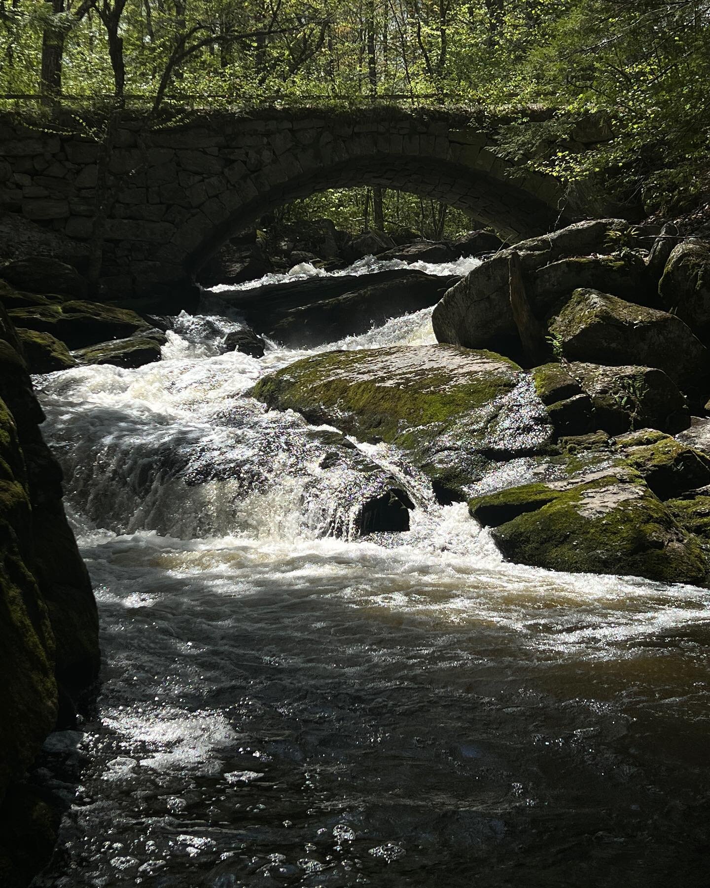
On a recent trip to Millinocket, I was having difficulty deciding where to take my family swimming as there are so many choices.  Since my daughter has become a better swimmer, I decided I wanted to take her to one of my favorite places, Guantlet Falls. I was a little concerned as the last time I was there, over 10 years ago, the road of close to impassible.  We decided to take the chance.  Also I was reading the Untamed Mainer's blog and she talked about a falls lower than Guantlet called Mud Falls, in the many times I went I never knew there was other falls so I wanted to check it out.  

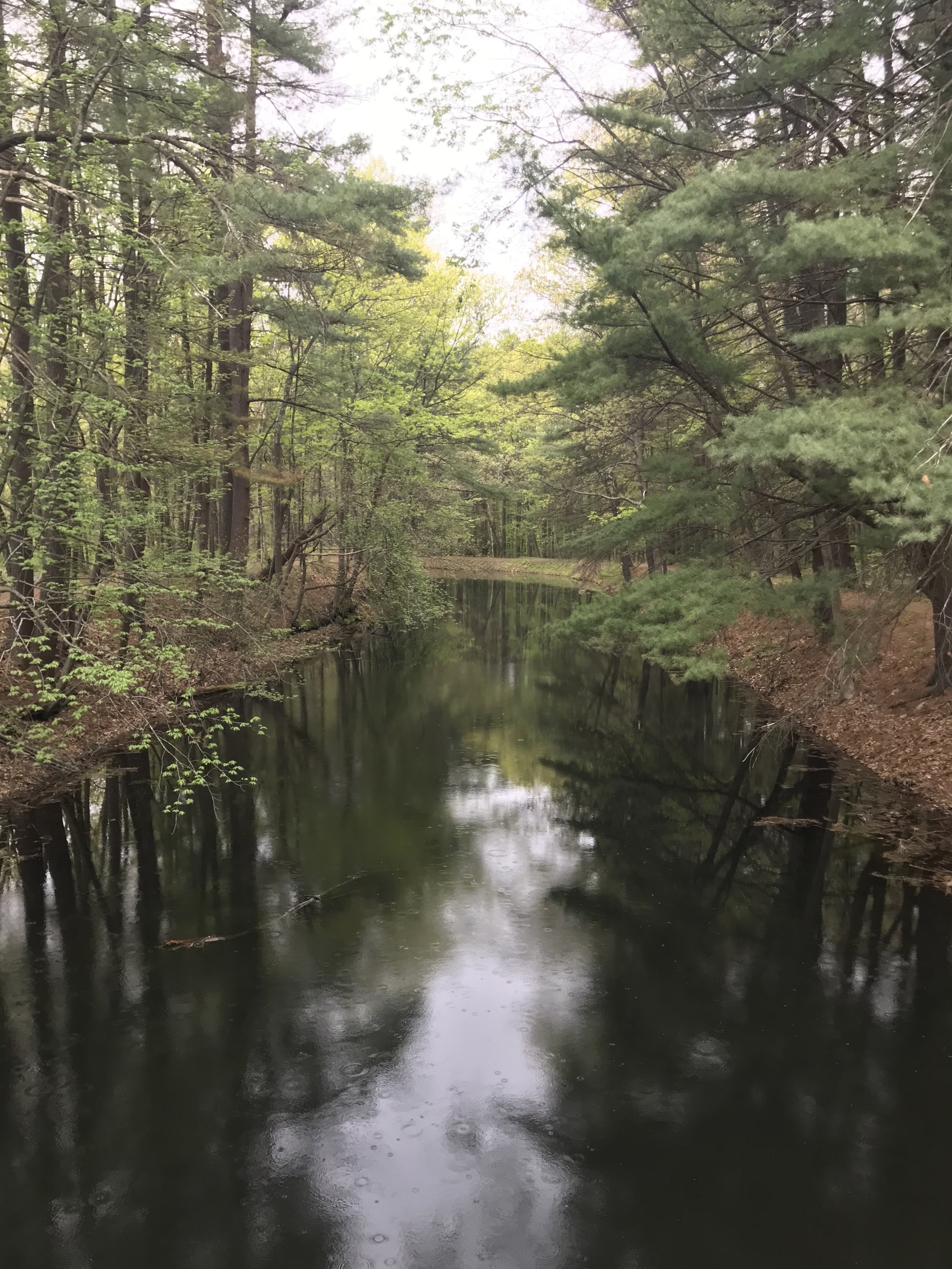
We packed our picnic lunch for the day and my parents joined us for the day trip.  My father asked the gate attendant about Mud Falls and they had never heard of it either. To our surprise the road into the falls has been fixed up and was easy to get through.  We arrived at the falls and it was exactly as I remembered it.  

IMG_7476.JPG

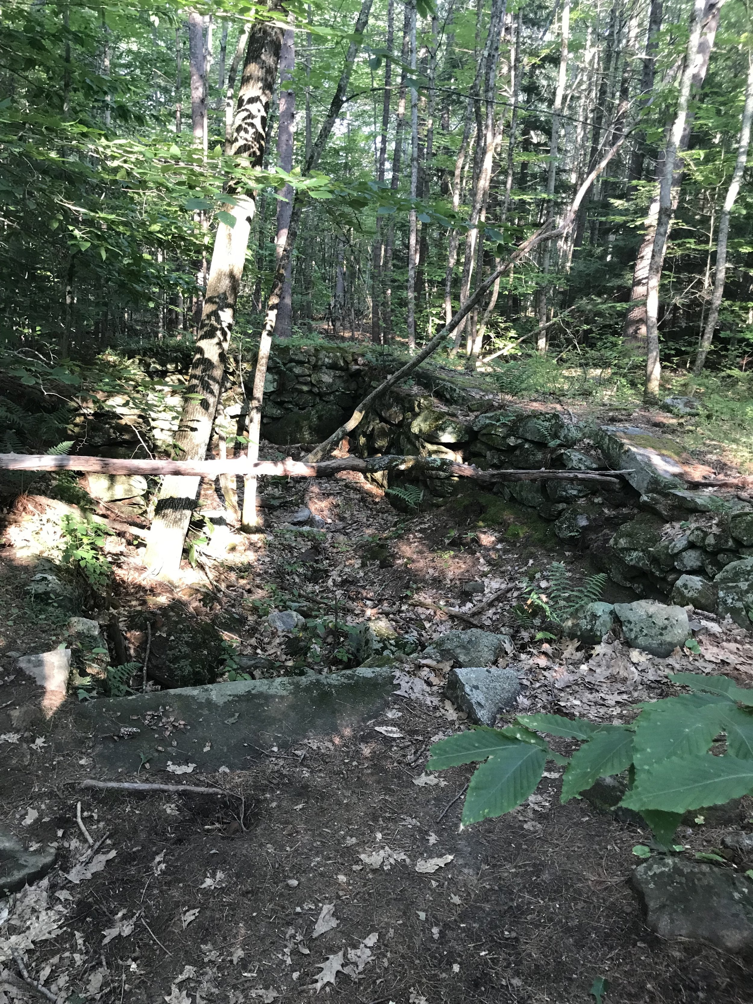
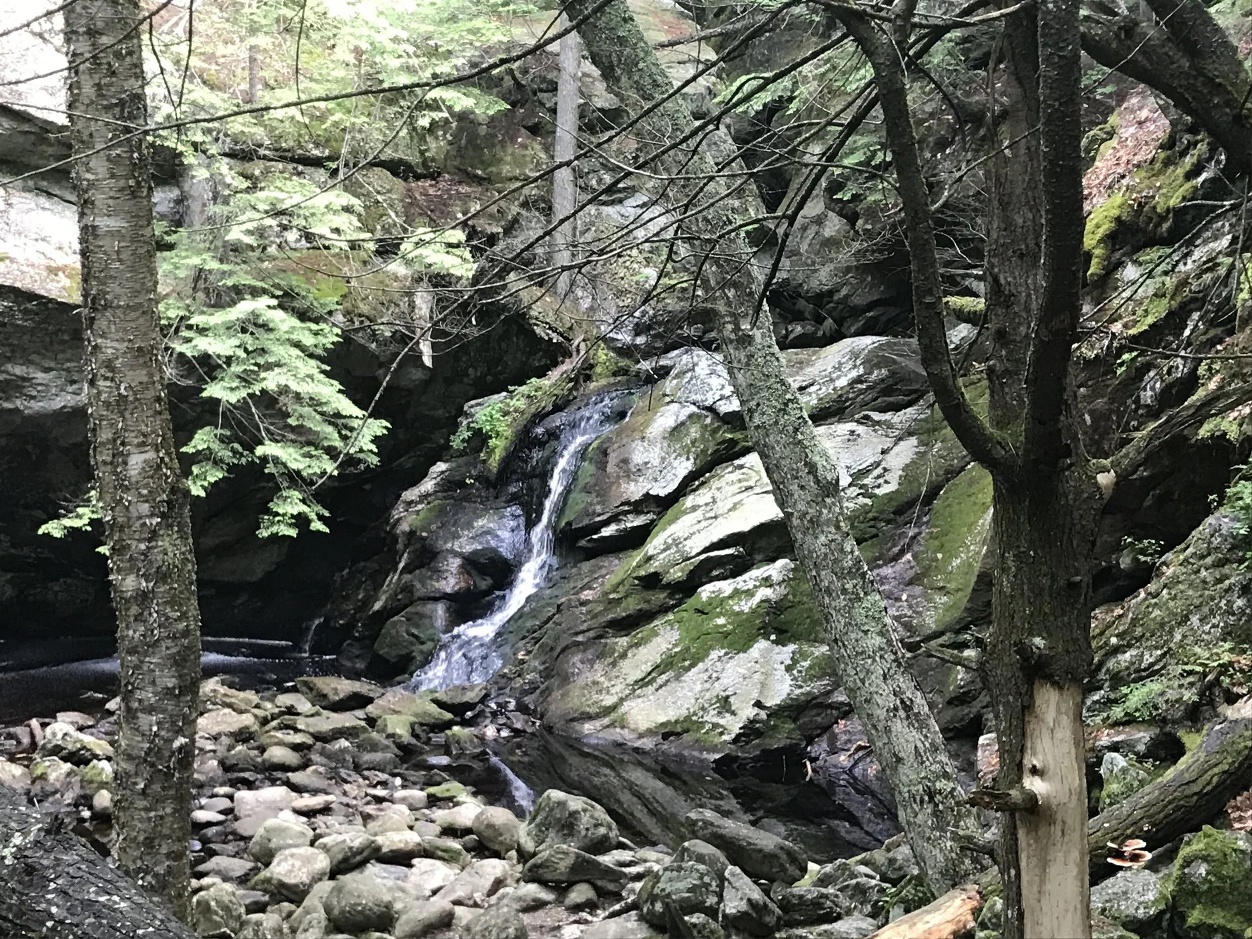
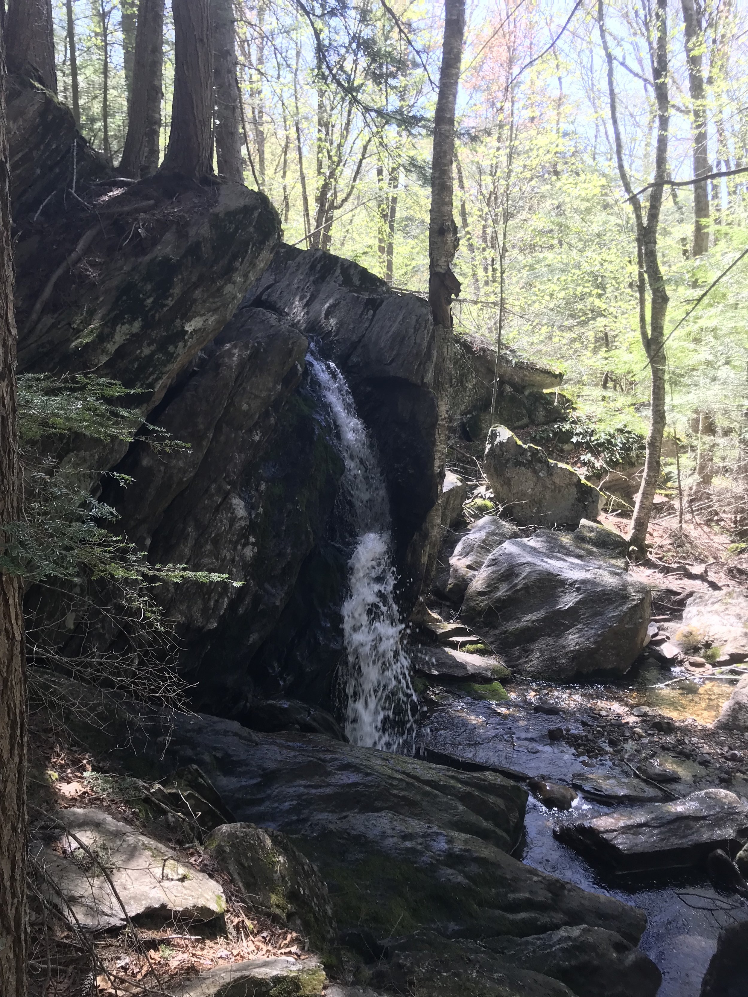
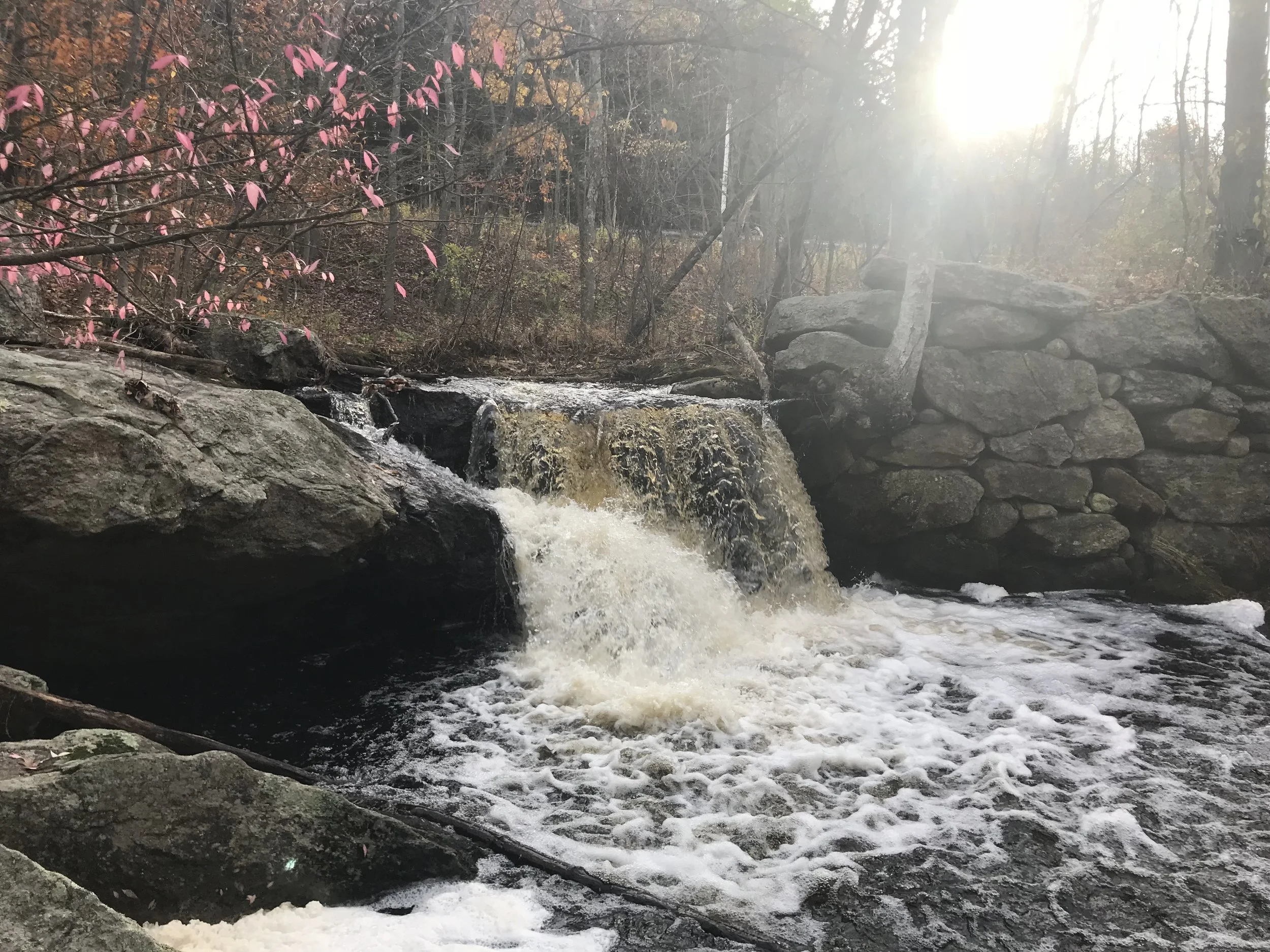
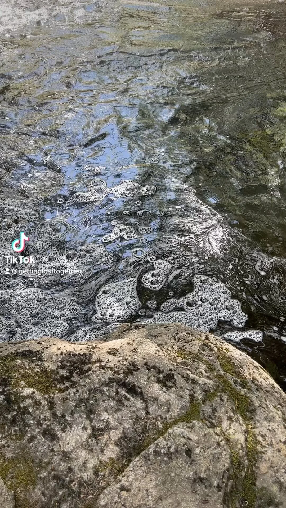
Before jumping into the water I explored around to see if I could find the path to Mud Falls.  When you are standing on the rocks looking downstream there is a trail off to your left that leads down to Mud Falls.  About a quarter to a half mile down the trail to come to two small waterfalls.  My guess is the last one is Mud Falls, this does not look like a great area for swimming, but still pretty to check out.  

IMG_7415.JPG

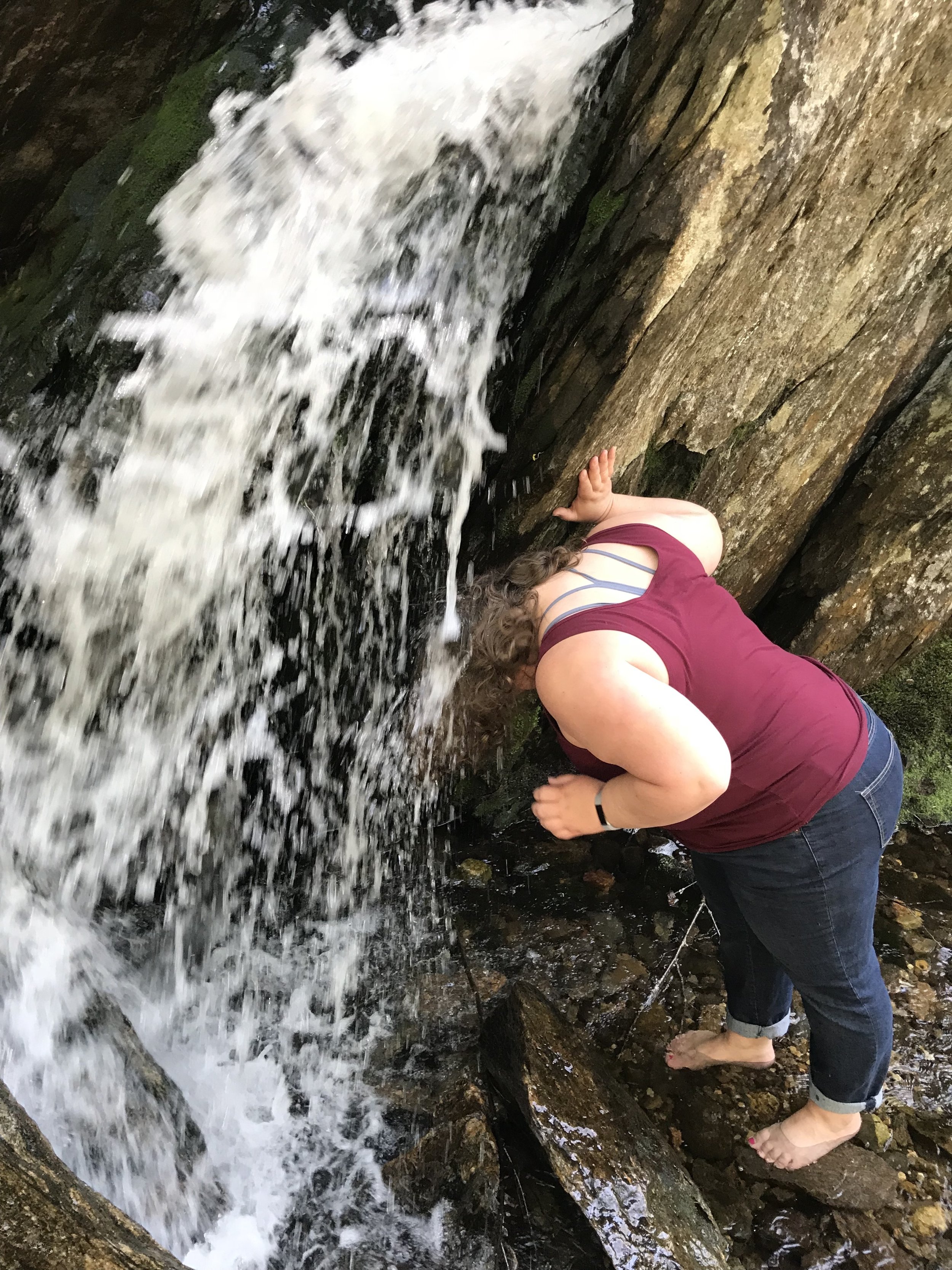
We spend a few hours enjoying the falls jumping from various size cliffs. The water was cold, but we could still get in and enjoy it.  The day we visited the water had a good current to it.  I use to be able to swim up into the falls, but the current was too strong and my husband and I could not get up into the falls. It could also be that I have gotten weaker, but I am blaming it on the current.   

IMG_7457.JPG

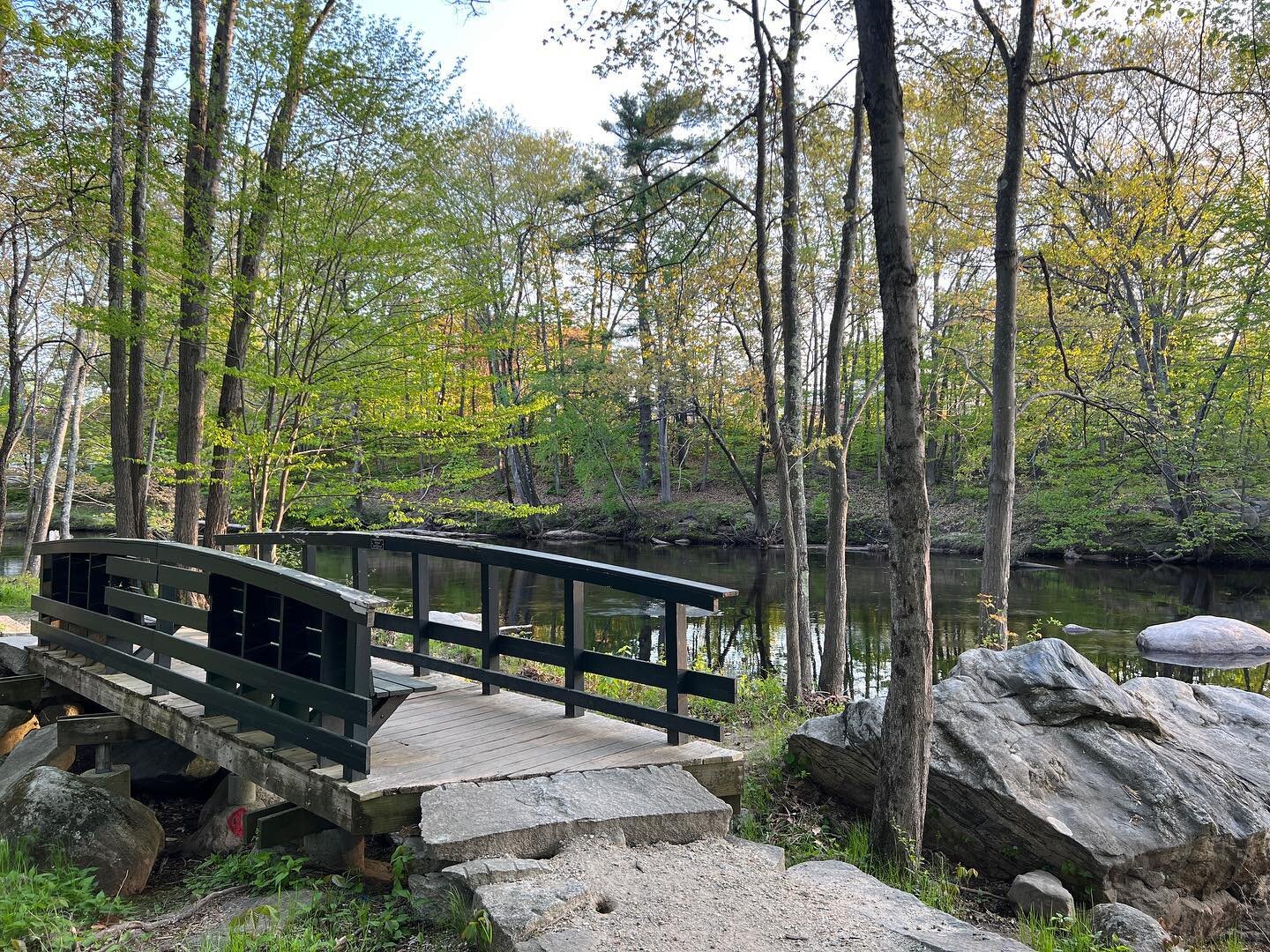
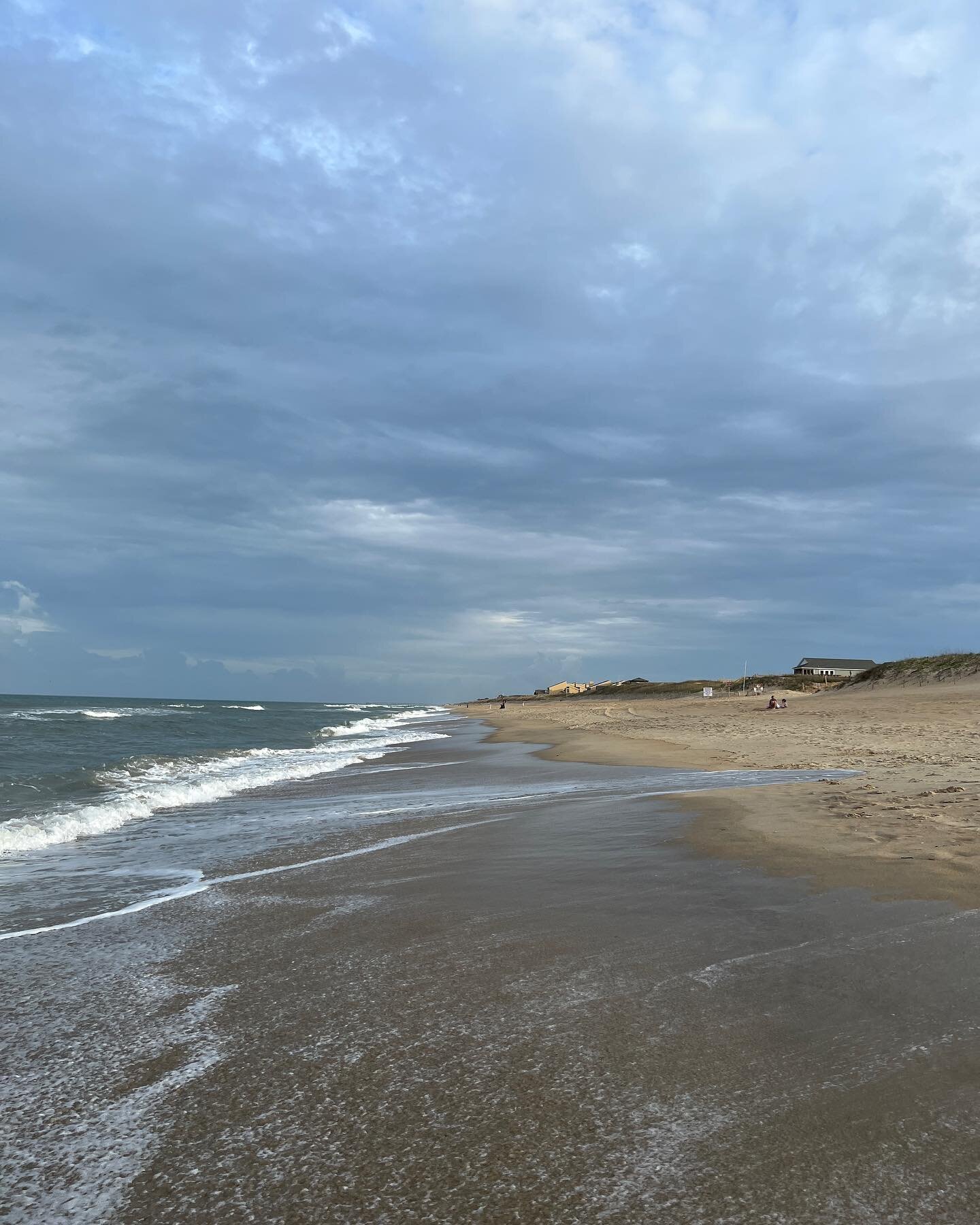
While you are in the area make sure you stop and check out Jo Mary Lake and Campground.  There is a beautiful beach and view of Mt Katahdin.  

IMG_7482.JPG

Garwin Falls

Garwin Falls is currently closed to the public and a fine is issued by the police if you are found visiting the falls.

I love a good waterfall. Especially when it is located in Southern New Hampshire. Located on Issac Frye Highway near Putnam Hill Road in Wilton is a nice little walk to two sets of falls.  There is minimal parking here and the side of the road is posted. If it is a warm day arrive early or go on a weeknight when it is not as busy.  The path is well worn and easy to follow.  About a quarter of a mile down the trail is a path off to your left that goes to Upper Garwin Falls. This is the smaller of the two falls, but still worth checking out. This appears to be a swimming hole, but it looked a little murky and my family and I did not feel we would swim here, but there is evidence that others swim here and it was perfect for our dog.  

IMG_7663.JPG

Once back on the main trail you walk past a dam, there was not a lot of water behind it, but my guess is in the spring the water is pretty flowing. My dog enjoyed the views. 

IMG_7674.JPG

A little further down the trail is evidence of an old home or some form of building with a cool rock foundation.  

IMG_7667.JPG

From the old foundation it is just a short walk down a hill to the Lower Garwin Falls and these are some beautiful falls. They are easy to get under and there is a small pool where people were swimming.  I am still not sold on swimming here as the water in the pool did not look very clean. I have seen on line that this is a popular swimming hole.  My daughter and I did enjoy dunking my head under the falls.  

IMG_7673.JPG

It is just a half mile from the parking lot to the Lower Falls.  Perfect hike for families, but watch young children around the rocks as they can be slippery. I'm so excited to have another waterfall in the Monadnock area on my list.  

Update: We had a unusually warm January with rain and snow melt. My family and went back to visit the falls. It was spectacular. The Upper Falls was rushing and there was some ice near the falls.

CCC4A265-EBD0-4D19-BD11-FD2745AC8612.jpeg

With all the rain ands snow melt the trail was pretty wet.

7237B334-EE27-413C-819E-60255C3425E3.jpeg

The best part of the trail was the lower falls. The waterfall was magnificent.

6350154E-5A48-4ED3-95EE-6B21BB481A6D.jpeg

If you are in the area I highly recommend taking a walk down to the falls. I would guess at certain times of the winter you would need some form of traction.

Purgatory Falls

Distance: 3 Miles

Difficulty: Easy side of moderate due to mud and potential slippery rocks.

Southern New Hampshire does not have a lot of waterfalls, so I love taking the opportunity to explore the ones we do have in our area.  

Purgatory Falls is a series of three waterfalls.  The Lower falls starts in Milford and then goes up to the Middle Falls and finally the Upper Falls located in Lyndeborough.  The trail is about three miles from one end to the other. There is also an option for a side trail to a view point area. There are various parking lots along the trail if you do not want to hike the whole trail.  Check out the map for more information.     

IMAGE.JPG

When I hiked the trail with a friend we parked at the Upper Falls Parking lot on Purgatory Falls Road in Lyndeborough.  The small parking lot is on a dirt road, which is not a thru road. From the parking lot we walked down to the Upper Falls and then the Middle Falls.  The first part of the hike there is a single plank boardwalk.  A few minutes down the trail you come to the first waterfall. Make sure you stop at the top and look across the waterfall to the "devils bean pot." 

IMAGE.JPG

Since we have not had a lot of rain recently, the falls did not have a lot flow to them, but they were still pretty to look at.  The lush greenery was also stunning.  The trail is very rocky and some of the rocks are slippery when wet and the trail can be muddy, so make sure you wear appropriate footware.  

IMAGE.JPG

In between the Upper and the Middle Falls is a smaller cascade that is not named, at least not that I know of.  

IMAGE.JPG

Shortly after leaving the Middle Falls there is a trail to the left that is marked with orange blazes that has a steady incline up for about a half a mile.  You then come to a field and an old road.  Look behind you and you have a nice view of North Pack and Pack Monadnock Mountains.

IMAGE.JPG

From the view point we looped back around the class VI road to our cars.  At this point I have not checked out the Lower Falls, but I am putting it on my list of hikes to check out.  I would probably park at the Lower Falls Parking lot past Fitches Corner in Milford.    

Lower Falls

When I moved to Nashua, NH for college I greatly missed living near the lakes and woods of Northern Maine.  My first summer spent in Nashua, my now husband wanted to show me his favorites outdoor spots.  We spent most of our free time in the North Conway/White Mountains area.  One of the places that we visited frequently was the Lower Falls along the Kancamagus Highway.  We loved swimming along the falls and in the cool river.  

IMAGE.JPG

We have not been there in many years, I would say at least ten.  Recently we were visiting Storyland and decided to stop to cool off on our way home.  It has changed A LOT since we last visited.  

My daughter and I went into the restroom to change and I was horrified by the condition.  Trash, toilet paper and dirty feminine products were all over the bathroom.  I felt so gross changing in there, that when we were done we changed in our car.  

There is a small cost of $5 to park and visit the area.  A positive change is that they have put in a boardwalk overlooking the falls area.  There are also nice walking baths on the side of the river along with picnic tables. There are plenty of opportunities for a picnic.  I did notice there was a lot of trash laying around. There was an information booth, but I did not see anyone in it.   

IMAGE.JPG

As for the river and falls itself, it was still a lot of fun to swim and play around.  My daughter enjoyed sliding down the rocks and swimming up under the waterfall.  I also found it very relaxing to sit under the waterfall.  The day we visited it was not very busy, but I can imagine that on hot days it can be a very popular and crowded place. As much as I love waterfalls and being able to swim I feel there are a lot better places to swim and relax in the White Mountains than the Lower Falls . 

IMAGE.JPG

McCabe Forest

Distance: 1.5 Mile loops, but distance can vary.

Difficulty: Easy

Located on Route 202 about a mile north of the center of Antrim, NH, is a nice little hiking trail.  McCabe Forest is part of the Society for the Protection of New Hampshire Forests.  There is a series of trails through the forest.

IMAGE.JPG

They day I did the hike, a friend and  I did about a mile and a half loop through the woods, over wooden bridges, and along a river.  The trail is flat.  I did find the trails confusing to navigate due the multiple branches of trails and very little directions.  If I was not hiking with a friend it would have been difficult for me to figure out how to navigate, if it's your first time I would recommending bringing a map or taking a picture of the one at the beginning of the trail.

IMAGE.JPG

 This is a great hike for someone wanting to get out for a easy hike. We did the roughly mile and half in 30 minutes.  The trails are perfect for families.  I liked the amount of wooden bridges, which are always fun for kids.  

IMAGE.JPG

Cedar Swamp Boardwalk at Loverens Mills

Distance: A little over mile, with option for further.

Difficulty: Easy

Loverens Mills Trail in Antrim a a great hiking trail that has a little secret to it. Located on Loverens Mills Road off Route 9 In Antrim is the trailhead to a boardwalk and magical swamp. The trail starts across the street from the parking lot. About a half mile up the trail is the side trail to the Cedar Swamp Boardwalk.  

IMAGE.JPG

There is a trail sign on your left.  The boardwalk is starting to need some repairs as I found some of the boards were broken so use caution when walking through it  

IMAGE.JPG

This place is magical.  The boardwalk is not very long, but the bright green moss and cedar trees are beautiful and worth the visit if you are in the area.  There is a sense of peacefulness when walking through here.  My daughter thought that fairies lived here.   There is an option to walk further Click here to read more about Loverens Mills Hiking Trail There are no pets allowed.  

The little over a mile hike into the swamp and back is great for young children and shows them the magic the forest can offer.    

IMAGE.JPG

Tutor Trail at Willard Pond

Distance: A little over a mile

Difficulty: Easy

I love a trails that provide an opportunity to cool off after a hike.  Willard Ponds offers an array of activities for the outdoor lover from various hiking trails, canoeing, kayaking, paddle boarding and swimming.

My favorite trail is the Tutor Trail that goes a little over a mile along the pond to a point with a very small beach area.  Along the way there are several opportunities for swimming.  It's also my golden retriever's favorite trail as she spends most the of the time in the water. If there has been a good rain there is a small waterfall about 3/4 up the trail on the left.  If it is flowing, you can get under it.   We frequent this trail a lot in the evening when we are looking to cool off on a hot summer night.  

IMG_6949.JPG

In addition to the Tutor Trail, there are also trails that lead to the top of Bald Mountain and a trail that go off to the south side of Willard Pond. I have gone up Bald Mountain, but it has been a few years and I missed the cut off trail to the ledges and ended up doing a big loop from the parking lot back to the pond.  It is on my list of trails to do again.  For more information about the Trails at Willard Pond check out the NH Audubon Website.

IMG_6966.JPG

In the summer, this can be a popular spot for paddling fun, swimming and hiking, be aware that on the weekend the parking lot can fill out quickly.      

Directions to Willard Pond: From Hancock Village go west 3.7 miles on Route 123 to Davenport Road on right. Go 1.6 miles, continuing along Willard Pond Road, and bearing left at fork, to parking lot

Porcupine Falls

Distance: About a half mile

Difficulty: Easy

When I was recently visiting Distance Hill Nature Trails, we had the opportunity to speak with the owner.  We were talking about local trails in the area and he told me about a local waterfall. I have a huge love of Waterfalls, so when I can find one in the Monadnock area, I have to check it out.  

 Porcupine Falls is located in Gilsum and is part of the Monadnock Conservancy.  The trail head is located off of Route 10 on White Brook Road.  You follow the dirt road to the end, where there is a small parking lot.  There is a kiosk with trail information at the trail head.  It is a little under a half mile to the falls.  The trail is well marked and there are some bridges and boardwalks that appear fairly new.  

IMG_6790.JPG

Since we had had rain the day before we visited, there was a nice water flow.  My guess is that the falls sometimes dries up depending on the amount of rainfall we have had.  The best time to visit would be in the spring or after a heavy rainfall.  There is a nice pool a little bit downstream from the falls that could be a good opportunity for cooling off.  It is also easy access to get under the waterfall if you want to get a nice natural shower.

IMG_6774.JPG

Since it is a short trail I would recommend checking our other trails while in the area like Bears Den.    

Distant Hill Nature Trail

Distance: About a mile

Difficulty: Easy

Stroller Friendly

I get asked frequently if I know of any stroller friendly walking paths. I usually am repeating myself with either the local paved rail trails or the handicap accessible trails at Crotched Mountain.  I am happy to announce that I have another local stroller/handicap accessible walking path.  

IMG_6753.JPG

Located on March Hill Road in Alstead is well maintained set of trails that people of all ages and abilities can enjoy.  I first discovered this place as it was named in the top 10 boardwalks to check out in New Hampshire and since we were already in the area heading to Hungry Diner, a must stop for lunch, we decided to check out these trails.

There is two sections to this area, the  Distant Hill Nature Trail, which are open daily. There are about a mile of trails with plans to expand. The Distant Hill Gardens which is actually located in Walpole, right next to the trails. They are only open on certain days and for special events so check out there Facebook Page for more information.   

The boardwalk itself is not very big or long, but it is built in a way that you feel like you are walking on top of the blog, which is really cool.

IMG_6759.JPG

 The trails are the most impressive part, my husband kept saying, "wow, a lot of work went into make these, they are really nice." My husband is not easily impressed. At this time there is about a mile of trails, with plans to expand.   

IMG_6758.JPG

There is also a children's nature playground, if you have followed me long enough to know that I love a good natures playground.  There is just enough structures here to keep kids entertained, but to also allow their imagination to wonder within the woods.  

IMG_6756.JPG

There are also vernal pools with signage.

IMG_6752.JPG

We only walked about a mile of the trail, but felt we could have spent a good few hours exploring the grounds, especially when the gardens are opened.  We did run into the owner, who was very friendly and explained he was trying to model his trails after the Crotched Mountain Accessible Trails, after he had taken a workshop with them.  I feel he is off to a great start.  If you are looking for a great way to spend an afternoon outside, Distant Hill Gardens in Walpole is a great place to explore.   

IMG_6760.JPG

Mt Caesar

Distance: 1 Mile

Difficulty: Easy side of moderate

As I have said in many previous posts, I love learning of new trails to explore.  A friend of mine recently told me about Mt. Caesar located in Swanzey and I was excited to check it out.  The trailhead is a little difficult to find.  It is located off of Old Homestead Highway/Route 32 across from Monadnock High School on a small road, Simeneau Lane.  On this road is a small Assisted Living Facility and the road loops around to a cemetery.  Between the cemetery and the Assisted Living facility is a small parking lot and the trailhead.  

IMG_5880.JPG

The trail follows a stone walls and the edge of the cemetary before heading off into the woods continuing to follow the stone wall and into a small field where you will see a small kiosk. From here you follow an old logging road about a half mile.  Then there is a fork in the trail, where the trail veers left, there is a sign nailed to a tree directing you to the top of the mountain.  The first part of the trail was fairly wet after a recent rain fall, so make sure you have appropriate footwear. Another half mile and you are at the top.  Once at the top there is a decent view of the area.  Off to the left is a lookout path to a ledge with better views of the area and Mt. Monadnock.  

IMG_5895.JPG

Roundtrip the trail is about two miles.  It is a gradual incline to the top, making it the perfect hike for young families or those beginner hikers who want to get a beautiful view.  

IMG_5890.JPG

Mines Falls Park

Distance: Varies

Difficulty: Easy

Spring time always brings an array of activities and goals for my family and I.  It never fails that spring sports and home ownership duties usually take over leaving little opportunity for exploring and outdoor activities which remains true for this spring.  Today, while running errands in Nashua I got the urge to get a little walk in, so we stopped and walked a few miles around Mines Falls Park.  

IMG_5848.JPG

A good portion of my husbands childhood was spent growing up in Nashua near these trails, so he did a lot of reminiscing while we got a couple miles in between errands.  I also spent a few years while in collage in Nashua, but did not frequent the trails as it was always rumored to not be the safest place, I believe over the years that has changed.

IMG_5855.JPG

There are about 10 miles of trails around the park, with various access points.  Today, we parked at Lincoln Park at the end of Coliseum Ave, past Hannaford in Nashua.  We did about a two and a half mile loop up to Mines Falls and along the Mills Ponds and Nashua Power Canal back to Lincoln Park.  The trail is very well maintained with people of all ages using the trails for various activities such as walking, running and bike riding.  We also saw some people fishing in various spots.  There was also some animal spotting of muskrats and birds.  My husband remembered it was always a great place to spot various sized turtles.   

IMG_5871.JPG

I felt very comfortable and safe walking along the trail and would absolutely walk these trails during the day alone, (always use your own judgement when walking a trail). I was also very impressed by the scenery for being in the middle of Nashua.   

IMG_5873.JPG

Next time I am in Nashua and need to get in a few miles outside, I will absolutely be stopping here again.   

IMG_5868.JPG

Sheldrick Forest

Distance: About 3 miles with option for more or less.

Difficulty: Easy with some hills

No dogs

Located in Wilton, NH is a wonderful trail system that goes over bridges, follows streams and up and down rolling forest hills.  The trail is location on Town Farm Road.  From Rt 101 turn onto Temple Road, after you go about .3 miles and cross a small bridge turn left onto Town Farm Road. The trail is about .7 miles on the left.  The road is dirt so travel with caution. The parking lot is located on the left marked with a sign.

Sheldrick Forest is a great set of trails if you are looking to get out for a couple hours of easy hiking.  With the rolling hills and steep embankments, this may not be the best place for young children, but it is great for older children. 

IMG_6393.JPG

There are about three miles of trails through Sheldrick Forest with the option of connecting to more trails at the Heald Track. I highly recommend bringing a map if you have not been before.

I love how there is different loops to explore and during the wet season you can enjoy the sound of a bubbling brook.  

IMG_5608.JPG

 The trails are well marked with signs and trail markers.

IMG_6381.JPG

There is no lookout on this trail, but the woods are beautiful. This is a great trail to spend an hour or two in the woods.

IMG_6394.JPG

Evans Flat Trail

Distance: 1.6 mile loop

Difficulty: Easy

If you have looked at my website or read my blog you know I am always looking for new trails in the Monadnock Region.  When I was looking for an easy, short after work hike for my hiking group. I was again surprised to learn of a new trail close to the downtown area of Peterborough. The Evan's Flat trail is located at the end of Evans Road in Peterborough, NH.  When first looking at this trail I questioned it because I knew there were houses and stores near by and wondered what kind of a trail and how woodsy it would be.  

IMG_5533.JPG

I was pleasantly surprised at the beauty in this trail. You park on the side of the cul-de-sac, and there is a trail kiosk with information and a map.  Dogs are not allowed on the trail.  The trail has several boards that go over various streams and wet areas. The boards are loose so be careful when crossing them.  The trail is fairly flat and meanders through the woods and around the edge of a couple marsh areas, it does cross a power line and have a small incline.  The trail is about a 1.6 miles loop with the option of a cut off trail if you do not want to do the full loop.

IMG_5541.JPG

This is a great trail if you are looking to get in a quick hike without a long drive or for children as they always find running across boards fun.  

IMG_5555.JPG

Lake Potanipo Walking Path

Distance: 1.5 Miles

Difficulty: Easy

IMG_5456.JPG

Located of Routine 13 in Brookline, New Hampshire is a charming little lake allowing an array of activities.  Lake Potanipo is popular year round spot.  In the winter it is frequented with snowmobiles and ice fisherman. In the summer swimmers and boaters.  There is also a a summer camp, Camp Tevya.  In the summer the beach is for residents only.  

I was recently looking for an easy walk through the woods that I had not done and never realized there was a path that went along the edge of the lake.  There is a small parking lot on the corner of Rt 13 and Mason Road.  Also located here is a rail trail that is dirt.  We did see a couple people mountain biking while we were walking.  

IMG_5468.JPG

The trail starts across the road from the parking lot.  You do have to walk through Camp Tevya, if you have a dog make sure you clean up after them.  After walking through the camp you walk along the rail trail that eventually leads to the center of Milford.  There is a couple signs pointing out some information.  There is evidence of an old ice house, which was kind of cool to see.  

IMG_5462.JPG

The trail does veer off to the left while the rail trail goes towards the right.  The trail takes you to a little point with a nice view of the lake.  It was about a three mile round trip. The trail is flat perfect for young children or someone who wants an easy walk.  

IMG_5475.JPG

Diana's Bath

Distance: Easy

Distance: 1 mile to falls with option for further.

Located on West Side Road in Bartlett, NH, is a little gem of a hiking trail in the White Mountains. Diana's Bath is a really special place to my husband and I.  When we were dating we spent many weekends in the North Conway area and would frequent Diana's Bath, especially on warm days.  Fifteen years ago this October, my now husband took me to Diana's Bath to propose to me.  Whenever we are in the area, we like to stop to reminisce about that moment.  

IMG_5068.JPG

The trail is a little under a mile up to the waterfall, from there, there are other trails that continue past the falls.  The trail to the waterfall is fairly flat, making this a really easy trail to walk and great for beginner hikers or families wanting to get out for hike with a fun reward in the end. One of the best part of the falls is there are plenty of opportunities on a warm day to get wet and play around in the falls. If you plan to visit on a warm day just keep in mind it can get very crowded.  The falls are also fun to visit in the off season as waterfalls a very beautiful with fresh snow or when they have started to freeze.  Remember always use caution when playing in and around waterfalls as the rock can be slippery resulting in injury.  

IMG_3387.JPG

Crotched Mountain Dutton Brook Trail

Distance: 2 miles loop

Difficulty: Easy

Located on Crotched Mountain Road across from the entrance to Crotched Mountain Rehab Center in Greenfield is a parking area and access to some great hiking trails for families with young children.  There are two hiking trails at Crotched Mountain Trails, as well as other trails that lead up to the top of Crotched Mountain, which you can read about in my Crotched Mountain post. I love these trails because they are stroller and wheelchair accessible and great for little legs that may still be a little wobbly because the trails are flat and free of roots.  

IMG_4081.JPG

The Dutton Brook Trail is a two mile loop and has a observation deck overlooking a marshy area.  It has been over a year since I have been there, but the last time I was there, there was a storybook along the trail.  A storybook trail is where you walk along and read a page of a story posted on the trail.  My daughter has loved storybook trails since she started to read.  It is also great motivation to keep kids moving on the trail.  

IMG_4089.JPG

The Trailhead to the Gregg Trail Observation Look Out is also located from this parking lot.    

I love these trails because they are one of the most family friendly trails in the area and great for beginner hikers.   

IMG_4095.JPG

Cathedral of the Pines Hiking Trails

Milage: Varies depending on trail.

Difficulty: Easy

Cathedral of the Pines located at 10 Hale Hill Road in Rindge is known for it’s open air cathedral and beautiful views of Mt. Monadnock. What many do not realize is there are several trails around the grounds. I have had the opportunity to explore a few of them and they are worth checking out if you are in the area. If you are planning on hiking I highly recommended looking at the trail map. From the parking lot there are two options to start on the trails. You can walk to the right of the cathedral and start on the trail to Grassy Pond. Or you can go to the left and go towards Produnk Trail or connect to another part of the Grassy Pond Trail.

The Podunk Trail starts to the left of the parking lot and continues going left until you cross the road and go into the woods following the blue trail blazers. This trail goes through the woods and along Emerson Pond. In the winter/spring months this trail can be muddy and wet.

Grassy Pond 

Grassy Pond 

The trail is pretty easy to follow and there are options to connect with other trails for a longer hike. When I did this hike it was about two miles.

Emerson Pond 

Emerson Pond 

When I walked the Grassy Pond Trail, I got a little off the trail. I started out to the right of the cathedral and followed the blue diamond trail markers through the woods. There was a couple slips in the trail and I thought I was following the map. The trail we were out came out to an old tote road. We took a left and followed it for about a quarter of a mile. We could see blue trail makers in the woods to our left so we climbed over the rock wall to walk the trail. From here the trail was easy to follow.

F1B13B1A-8320-40B0-8BD3-C5B9CA2ABB18.jpeg

From here the trail is easy to follow. You walk along Grassy Pond. There is a spot with a two picnic tables is you wanted to pack a lunch to enjoy on the trail.

56E63589-1B7F-4D88-9CEC-83D994B85797.jpeg

After the picnic tables to you continue to walk along the shore and then up into the woods. If you have children that like dinosaurs make sure you check out out the dinosaur egg rock. There are signs directing you towards it.

103C8F64-5758-48B8-9D9B-CCCD9BEDDE07.jpeg

From here we walked back up to the cathedral. There is a little incline when heading back to the trailhead. This trail was a little over a mile and half.

While your here make sure you check out the specular view of Mt. Monadnock.

IMG_4915.JPG

These are great trails for all ages and abilities. There are some fun things for the kids to explore and pretty pond views and nature trails for those who love being outside.

Furnace Brook Trail

Distance: 1 miles to field

Difficulty: Easy

Note: The trail has become overgrown in the summer months.

Located near the Souhegan Ambulance and Old Tenney Road on Turnpike Road in New Ipswich is a nice little path that follows Furnace Brook.  The trail was donated by a family that lives in New Ipswich.  Parking is along the side of the road.

A170AE27-49DC-446E-B2A7-FB49DFDF5449.jpeg

The path goes down into the woods along the stream to the base of a small waterfall and part of an old rock wall.  

IMG_3705.JPG

This is a perfect spot to let your dog get a swim in if there is enough water.  

The trail continues down along the stream for about a mile.  

991D7836-01A0-4417-9CA7-E9C6204F22FF.jpeg

After about a mile there is a snowmobile bridge that goes off to your left and a field on your right, both which are private property.  There is a sign that directs the trail through the field, but I have never followed it. This is a great trail year round. I like it best during the winter months.

D6F4CDBE-3282-47C7-BE11-0BEA87196BA2.jpeg

In the summer there can be a lot of brush with thorns, therefore I recommend long pants.  This trail is great for hiking and snowshoeing.

Federal Hill Fire Tower

Distance: .4 miles

Difficulty: Easy

Every since I was a young child I have always loved fire towers. The thrill of climbing up to the a tower and the beautiful panoramic views. Growing up in Northern Maine I had access to some pretty good ones.  There are also some great ones in Southern New Hampshire.  

Federall Hill Fire Tower in Milford, NH is a fun one.  The trail head is located on Ponemah Hill Road in Milford.  The access road is gated so you need to park nearby and walk up.  It less than a half mile walk up to the fire tower. The walk is a steady incline up.  

rqtjmSMeSLKgT9LRhQqcgQ.jpg

There is not view from the base of the fire tower.

IMG_3585.JPG

If you climb up it there are beautiful views of Southern NH and the Monadnock Region.  

IMG_0666.JPG

Always use caution when climbing a fire tower to ensure your safety.  Every time we have visited we observed a lot of broken glass around the base. If you are bringing your dog please use caution.  

This is a good fire tower to do if you are working on your Fire Tower Quest Patch.  

HighBridge Hill Storybook Trail

Distance .6 miles

Difficulty: Easy

I am always trying to find ways to engage my daughter to get outside.  One of her favorite type of trails are storybook trails.  I mean, what’s better than encouraging your child to read all while getting fresh air and exercise. 

At HighBridge Hill Elementary School in New Ipswich is a great little storybook Trail.  The trail is open spring, summer and fall, but closed during the winter months. The trail is about .6 miles long. When you turn into Highbridge Hill Elementary School, take a right to drive up towards the fields.  There is a parking lot on top of the hill.  There is a small clump of trees and that is where the trail starts.  From here it is a little confusing, but it goes across the road you drove in on down into the woods.  The trail is easy to follow from there.  You do walk by the schools playground, in case you have a child that is easily distracted by playgrounds. A great way to get your little ones out on the trail. The trail is not stroller friendly.   

IMG_2159.JPG