Mile Slip Town Forest Badger Hill Trail

Distance: 2 Mile Loop

Difficulty: Easy side of Moderate

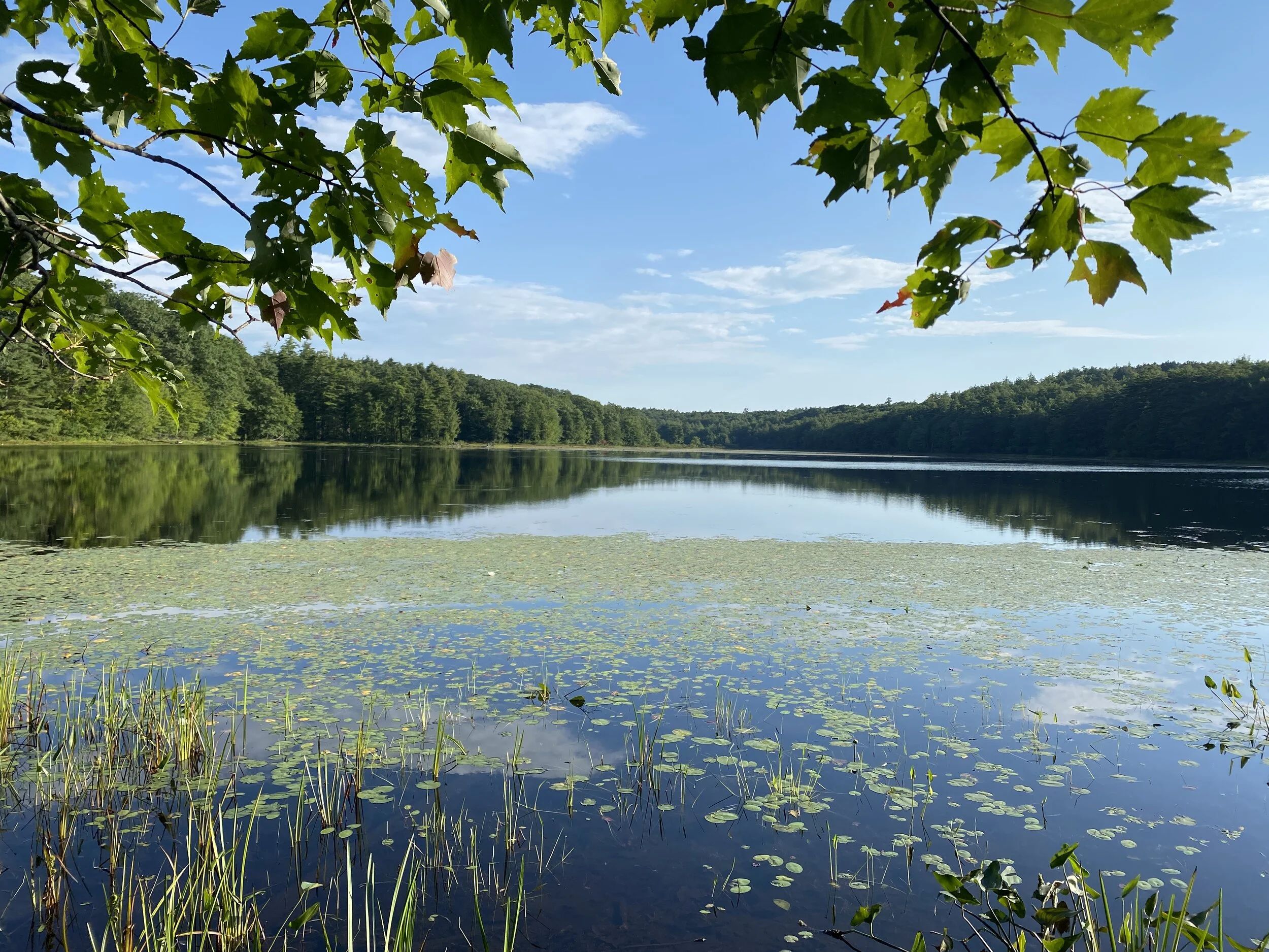
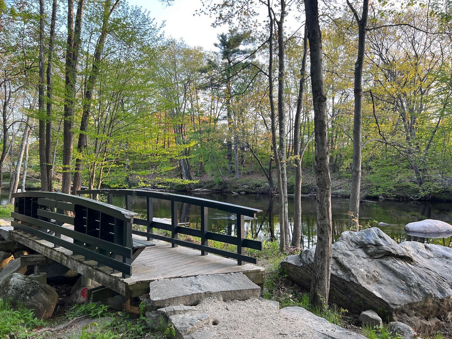
Mile Slip Forest is located at the end of Mile Slip Road in Milford, NH. A great thing about this trail is there is a large parking lot. There are a few different trails that you can take. From the parking lot you can do about a mile loop on the Mitchell Brook Trail which follows Mitchell Brooke or you can do a loop up to Badger Hill, which this write up is about. There are some different variations you can do of this trail. I would recommend either using the All Trails app or printing off a map to bring with you.

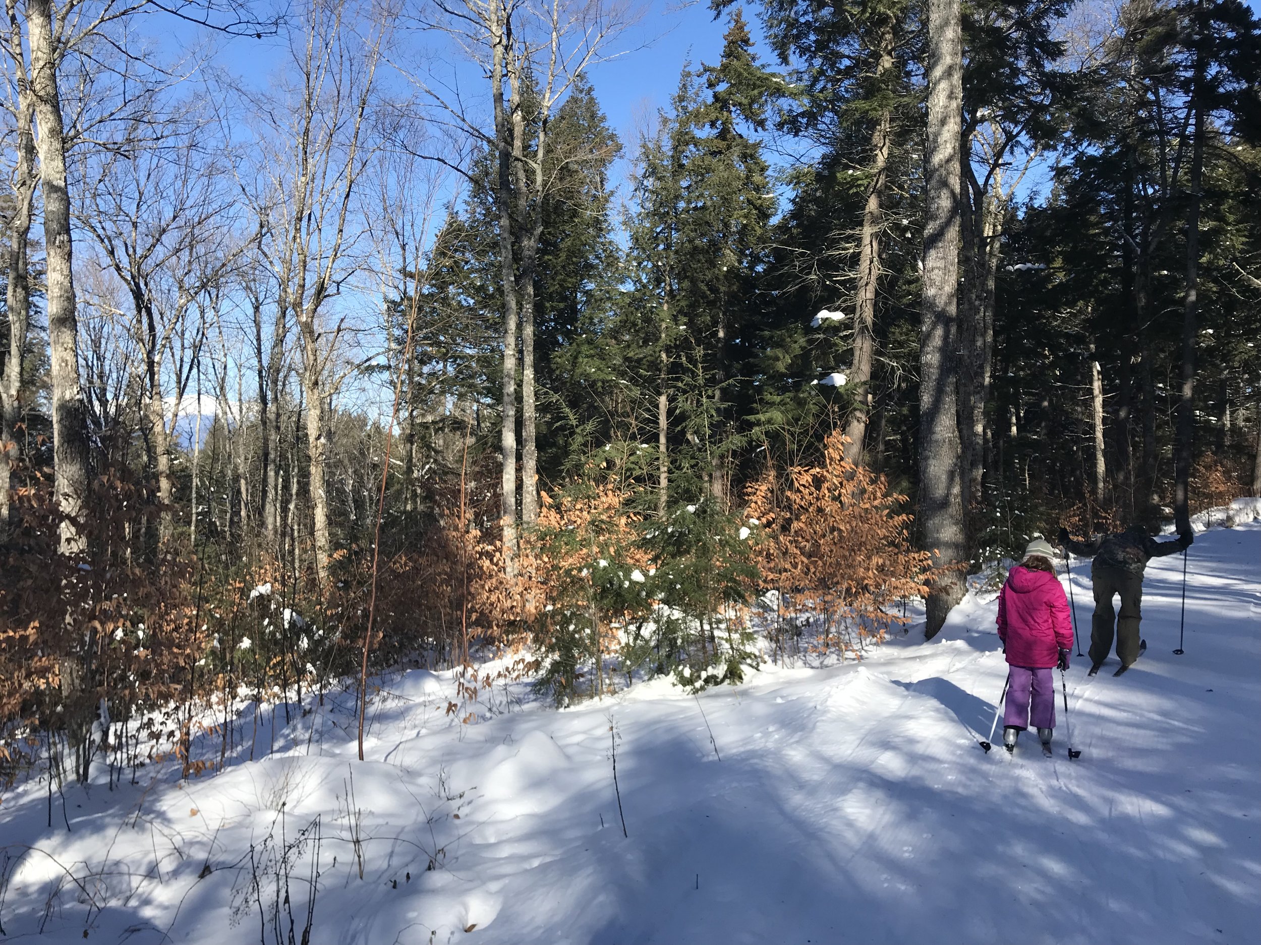
The trail starts out by following a multi-use trail until you come to a trail sign on the left that heads up into the woods. We meandered through the woods with gentle inclines at times. This side of Badger Hill trail is fairly easy to follow with trail markers.

IMAGE.JPG

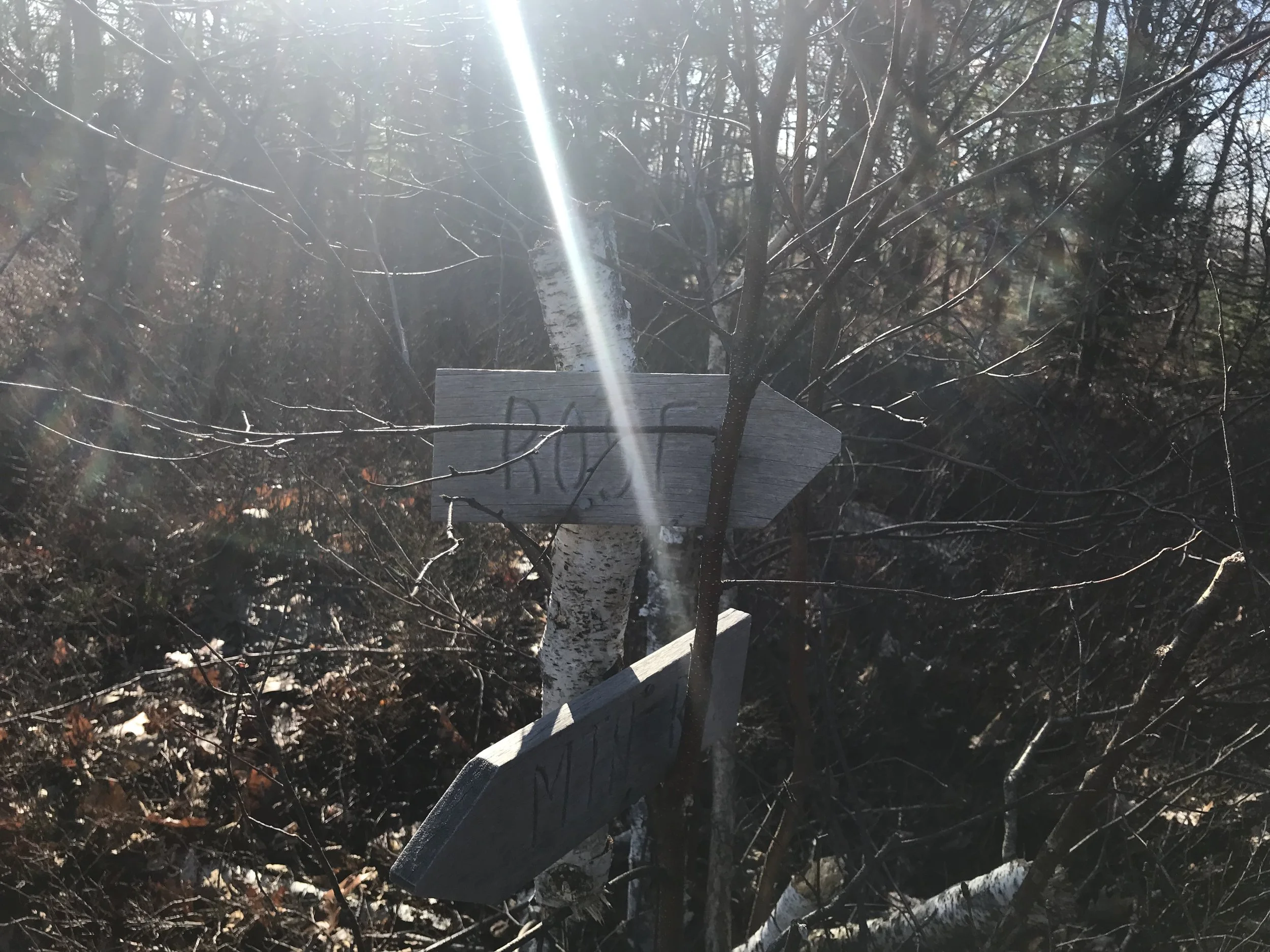
We continued on the trail and when we got to the top of the hill there are more access trails and a large fire pit. Follow the trail markers past the fire pit and down hill. It will feel like you are missing the bench, but you are not. You will come to a trail sign pointing the way to bench.

Unfortunately there is not a great view due to trees being in the way. You are looking towards the Wapack Range.

IMAGE.JPG

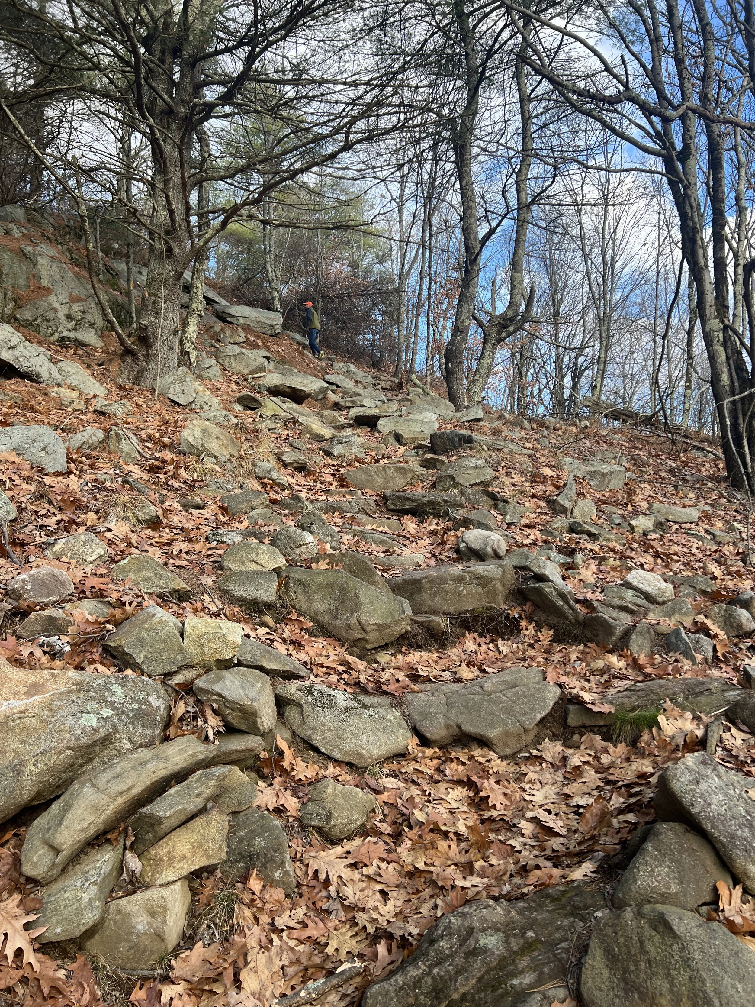
You return to the sign that marked the trail to the bench and finished the loop down the hill. There are some steeper section this way. In the winter Microspikes are needed. In the fall when there are leaves on the ground the steeper sections can be slippery.

IMAGE.JPG

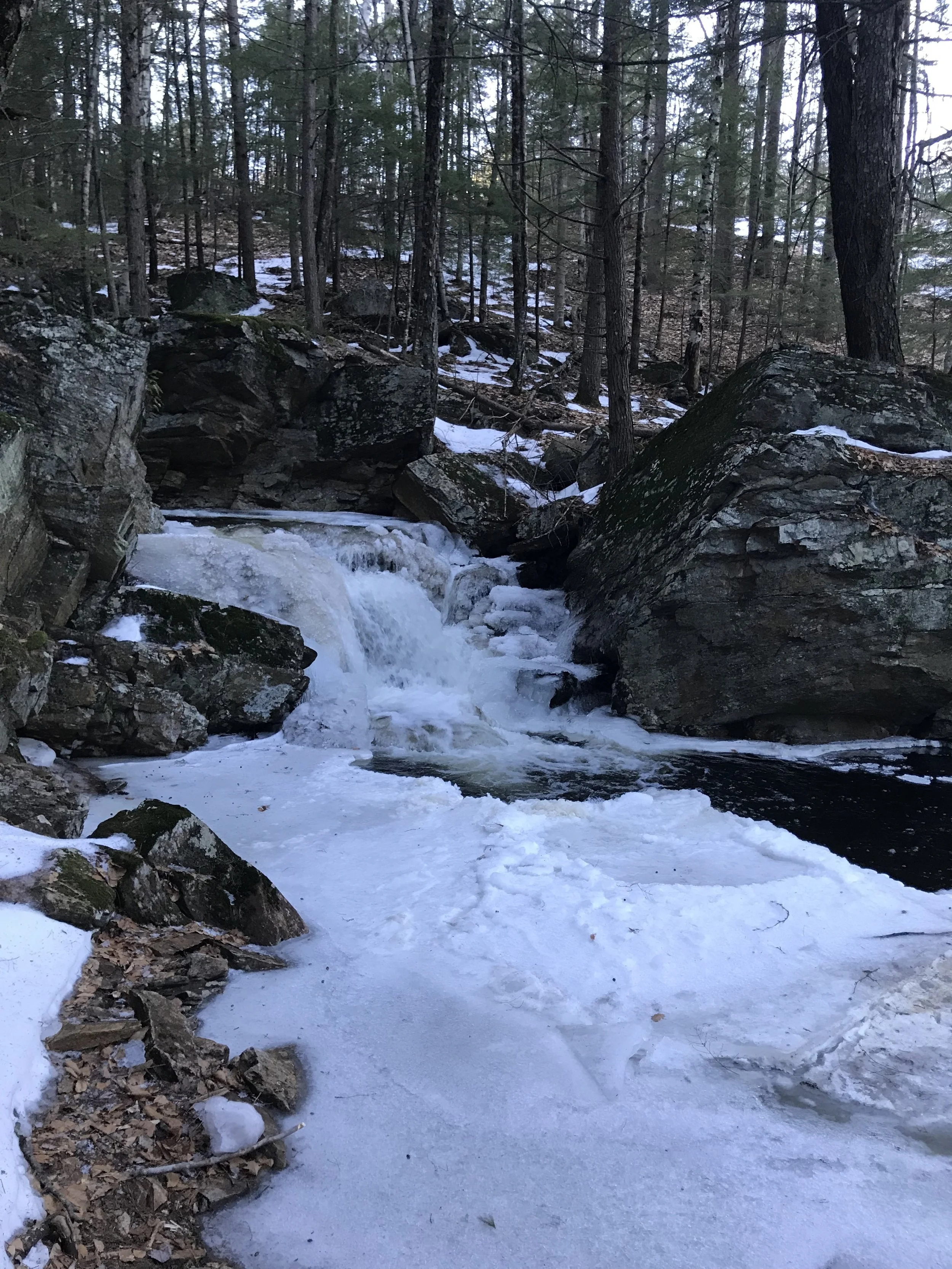
The trail was a little difficult to follow on the way down as it was not as well marked as it was on the way up, but we were able to figure it out. In the winter the bottom part of the trail that meets the access trail can be fun for sliding down on your butt as pictured below.

FullSizeRender.jpg

You finished the loop by taking a left and walking the access trail back to the parking lot or going straight on the Mitchell Brook Trail. If you do both loops it is a little under three miles. If you just to Badger Hill, it is about two miles. Overall this is a good hike to get a little elevation in, but not great views.

This post contains affiliate links for which I may receive a small amount of compensation at no cost to you.

Senter Falls

Distance: .75 Loop

Difficulty: Easy

Waterfalls, I just cannot say how much I love them. I usually love them just in the summer, but the last couple winters I have really found a new love for frozen waterfalls. The different formations they take with the change in weather and the beauty of the water rushing below the ice. I recently watch a video on Facebook with Live Free with Kris where she visited four waterfalls in the Wilton/Lynborough Area. I had visited three of them, Purgatory Falls, Tucker Brooks Falls and Garwin Falls. I had not been too or heard of Senter Falls, of course I had to check it out.

Located on Lyndeborough Road in Lyndeborough NH is the trailhead. The best way to get to the trail head is from Second NH Turnpike near the Francestown town line. Lyndeborough Road is a dirt road. The road is not maintained in the winter. Please plan accordingly. The trailhead is about a half mile in on the right hand side. There is a trailhead sign that says Alan and Edgar Rice Nature Area. There was not much of a parking area. There was only enough room across from the trailhead for one car.

IMAGE.JPG

The trail starts out by going down a small incline and over a nice wooden bridge.

IMAGE.JPG

After you cross the bridge and bare to the left you will see that you have the option to go right or left, both marked by blue trail markers. I recommend going right for the best views of the falls. This is a loop trail. Within just a couple minutes you come to the first set of falls.

IMAGE.JPG

Then you climb up along the waterfall for about a quarter of a mile for some great views.

IMAGE.JPG

With the final cascade being the best off all.

IMAGE.JPG

When you get to the top of the waterfall the trail goes left up a incline, then you follow a ridge and then have a steep descent connecting you back to where you started.

IMAGE.JPG

Of course there was a little time to play on the ice on the side of the trail. 

IMAGE.JPG

The trail is a little less than three quarters of a mile. I would only recommend it in the winter if you have some form of microspikes.

We have been back in the spring time and the falls were just a beautiful.

82210787-2647-4AE1-AFF4-7277375DBF58.jpeg

While you are in the area make sure you check out Frog Rock.

This post contains affiliate links for which I may receive a small amount of compensation at no cost to you.

Out with the Old Pack and in with the New Pack

About 13 years ago, my husband and I moved into our first and current home.  We were excited about living in the Monadnock Region due to the almost unlimited outdoor activities in our backyard.  For my first birthday in our new home my husband bought me a camelbak day pack and the Hiking the Monadnock Region Book.  This is what started my journey of exploring the trails in our area.  For the last 13 years I have been using the same backpack for all my hiking adventures.  This fall I noticed that there were holes forming in the bottom of the pack.  My husband tried to convince me to get a new one, but I was not emotionally ready.  I know it sounds silly, but this pack is a symbol of so many hikes since moving to the Monadnock Region. Such as hiking Mt. Monadnock, exploring other trails in Vermont and New Hampshire. As well as hiking so many trails solo and with my husband. Also, my daughters first hike and hikes with friends.

I was recently chosen as an ambassador for the 365 Mile Challenge.  One of the many perks of being an ambassador is receiving amazing swag to try out and review.  I was lucky enough to get picked for a Deuter Speed Lite 22 Hiking Backpack. I figured now was a good time to start making the transition to a new pack. When it arrived I was in love with the color, we did not get to pick which color, but I feel I lucked out as other ambassadors got red and black, but I am partial to the green.  The other part I noticed and love is there is a yellow flower attached to the pack.  It is such a fun talking point.  As I emptied out the old pack and filled up the new one I was feeling a little sentimental. It was time to move on, it is just a backpack, right?

Out with in old and in with the new.

Out with in old and in with the new.

I worked on organizing my new backpack.  There was plenty of room for all my items.  The only thing I missed was there is only one small pocket instead of several small ones like my older pack It did seem a little disorganized.  I like there is a pocket on the side for my water bottle. There is also a small pocket on the hip belt to put small items like chapstick. The biggest part of the backpack had plenty of room for my first aid kit and all my winter essentials. There is also a front pouch that does not have a zipper that will be great for when I walk to yoga and can put my mat in it. 

IMAGE.JPG

I tested out the backpack on an easy three and half mile hike.  Even though the pack is not broken in yet, it was comfortable.  The hip straps fit nicely, which is good because I have wide hips.  The straps were comfortable and easy to adjust.  I am also large chested and the chest strap did not make me feel like I was pressing my breasts together like other packs have. The pack was easy to get on and off.  When I did need to find something it was not hard to find items in my pack even though I was worried about being able to organize some of my things.   

Some of my fellow ambassadors from the 365 Mile Challenge also had feed back on the pack. 

Julie: “I love all the straps and loops, awesome pockets on the waist. I’m 5’10 and once I was able to get the straps adjusted for my height it fit well. There is Good airflow. I looooove the color! It's sort of a ruby red. And who doesn't love a cute flower on their pack? Overall a good pack and a decent fit for my tall frame.” 

IMG_0298.JPG

Kari: “I have never invested in a pack for myself. I have always had hand-me-down or borrowed packs. They have worked fine for me, but I have never LOVED a backpack. I have a new Deuter Speed Lite 22 SL backpack that is a lady's fit and I cannot believe how great it is! My two favorite features is the chest strap and the shoulder adjustment straps. All of the backpacks I have used have chest straps that are not effective because of their location. I cannot move it high enough for it to be effective and comfortable. This pack adjusts so it is actually across my chest (and not my breasts) and helps carry the weight. I also love the shoulder adjustment straps because it pulls the pack nice and close to my body so I am able to carry the weight close to my body. It makes all the difference. I am still learning about the different features and storage space. I have been using my backpack for sledding excursions and for day to day. I am looking forward to using it on a longer skiing trip and cannot wait for it to be my go to summer hiking pack!” Kari can be found on Instagram @pofahlpaths

Kari and her new pack.

Kari and her new pack.

Overall I am really enjoying the pack as it’s perfect for my height of 5ft 3 inches. If you are a taller women I would recommend trying it on first. I have only used it twice, but I have not found any complaints about it. I would highly recommend this pack to other women. I do always recommend that you go to a store to try a pack on before buying as they fit all body types differently.

FullSizeRender.jpg

This post contains affiliate links for which I may receive a small amount of compensation at no cost to you.

Dinsmore Brook Conservation Area

Distance: Varies

Difficulty: Easy

I recently did this trail with some friends. Let’s just say that the hike did not go as planned. There are two locations for this hike. I chose the trail located on Old County North Road. There is a small kiosk and on the kiosk at the trail head was a sign that said bridge out. There was no other information. We decided to try the trail anyway. About a two tenths of a mile down the trail the bridge was out. The stream was too wide and high to cross. We ended up going back to the cars and headed for the other trailhead on Second NH Turnpike North. From Route 47 turn onto School House Road, then take the first sharp right turn onto the Turnpike, a few hundred yards and look for the woods road on the left hand side for the trailhead. There is a small white sign nailed to a tree.

IMAGE.JPG

The trail follows an old road/ATV/Snowmobile trails. I’m not sure if we were on the trail the whole hike or if we were just following the ATV/Snowmobile trails. There are trail markers making the trail, but halfway through the hike I did not see them anymore. There were views of wetlands and a flowing stream.

IMAGE.JPG

If you are going to hike this I would recommend printing off a map, it’s not the best map, but it gives you an idea of where you are going. The day that we did the trail it was very icy and of course I was the only one that did not have my micro spikes. My husband had bought me a new pair for Christmas and I was excited to try them out, but I figured with the warmer weather and rain that the trail would be muddy not icy. I was wrong.

IMAGE.JPG

The trail is relatively flat, my guess is it can be really muddy. There is not official parking area so you have to park on the side of the road. This would be a good trail for snowshoeing if we ever get any snow or if you are looking for a leisurely walk into the woods.

On a happy note three of us, a friend, my daughter and I finished the 365 Mile Challenge, meaning we did 365 self propelled miles in 2018. Click here to read more about the challenge.

This post contains affiliate links for which I may receive a small amount of compensation at no cost to you.

Pulpit Rock Trail

Distance: 1-3.5 Miles

Difficulty: Easy

I have been hearing a lot about this trail and was recently in the area so I wanted to check it out. I ended up doing it on two different days because the first time we hike the trail, I parked at the wrong end and we did not make it to the main feature of the trail, which is the waterfall.

The first time we hiked it we parked the the trailhead located off Horace Greeley Road in Bedford. From Rt 101 we turned onto Joppa Hill Road. We followed the road until the intersection of Horace Greeley Road and Joppa Hill Road. There is a farm directly in front of you. Turn left and the trail head is on your right I would guess between a quarter of a mile to a half mile from the turn. There is a small sign marking the trailhead, but it is easy to miss. There is room for 1-2 cars to park here or your can drive a little bit down the dirt road. It can be muddy if we have had a lot of rain. There is a little bit bigger parking lot for 2-4 cars depending on the size of the cars. There is a small kiosk marking the start of the trail.

You start out of by walking along a bog where you can see beaver and birds. There are planks to walk over.

IMAGE.JPG

Then you head into the woods for a few minutes before coming to a split into the trail. You can go straight which loops you further up the trail, but is longer or you can take a left into the field. We went left through the field. There are signs stating animal activity in the field so they ask that you walk on the outskirts of the field to the other side and go back into the woods.

IMAGE.JPG

You meander through the woods, up little hills and over streams. We talked about a mile and half in, but due to having movie tickets, we did not have enough time to complete the whole three and half mile trail. I was disappointed that we did not make it to the main feature of the trail.

IMAGE.JPG

Since some of my coworkers live in this area I asked them about the trail. Of course we parked at the wrong end to see the falls. There is nothing wrong with doing the hike from where we started, but if you are on a time crunch I would not recommend it.

Since I hate to leave a trail unfinished I followed my co workers instructions and went back a second time, this time we parking at a much bigger parking lot off of New Boston Road in Bedford. This parking lot was better marked and had room for multiple cars. There is a sign that you need to lock your cars and secure your belongings, which I do not see at many trail heads so I wonder if there has been some break ins here.

We followed the Kennard Trail for almost a mile to Pulpit rock. We started out by walking on some board walks. Then following a fairly flat trail until we reached Pulpit Rock. There are a few side trails, but you want to stay on the Kennard Trail.

IMAGE.JPG

Once at Pulpit Rock there is a kiosk with information about the area.

IMAGE.JPG

You can stand and look down in to the gorge.

IMAGE.JPG

There are trails around the rock and down into the gorge. Due to the ice we were not able to get all the way down, but were able to get some decent views.

IMAGE.JPG

I am excited to come back and explore when there is no ice. Please use caution as the rocks can be very slippery, if you are hiking with kids make sure they stay away from the rocks.

IMAGE.JPG

If you want a shorter hike I would start from the New Boston Road side, if you are looking for a longer hike I would start from the Horace Greeley Road Side.

Pack it Lunch Box

I was recently looking for a lunch box for work and day trips. I had had a Thirty One Lunch bag for many years. Although it last well (over seven years), it was a little too big and bulky for what I needed and it started to rip. I started asking around and looking to see what my options were. My job requires me to travel between two different locations so having a refrigerator is not always an option. I needed a lunch bag that was light weight, would keep my food cold and had cool designs.

IMAGE.jpg

With the recommendations of some friends I found the lunch bag from a company called Pack-It. Lets just say I found a great lunch box. They come in various sizes and designs. The best thing about them is the ice packs are built into the lunch box. When you are not using the bag you store it in your freezer. As you can see above I chose a design that looks like mountains.

IMAGE.JPG

So far I have had enough room for everything. It stays cold for at least five to six hours. I am able to fit my breakfast and lunch for work in this bag. I store the lunch box on a shelf in my office. You can put it in a fridge if you have access to it for it to stay colder longer.

IMAGE.JPG

We have also used this lunch box for day trips and it has worked well. On a couple really hot days we have put drinks and snacks in it while kayaking and everything stayed cool for the afternoon. The pack gets really dirty when we use it for kayaking, but I am happy to report that it easily wiped clean with a sponge and warm water.

When my daughter needs a new lunch box I will be getting her one as well. I have recommended this lunch box to my friends and co workers as this is the best lunch box I have ever had. If you are looking for a lunch box that will stay cool and you do not have to worry about having ice packs this is great lunch bag.

This post contains affiliate links for which I may receive a small amount of compensation at no cost to you.

Keen Kids Hiking Boots

We recently were looking for new hiking boots for our daughter. We had always bought second hand boots due to her feet growing so quickly and not wanted to spend a lot of money. With us doing more and more hiking I wanted to get her something more durable, easier to get off and on and easier for her to tie. Lets face it parents how many times do we hear on the trail, “there is something in my boot” and it is nice to have a pair of boots that are easy to get on and off.

We started looking around. One day we walked into Alec’s Shoe Store in Nashua. if you have not been into this store you have to go. There have any type of shoe you are looking for, including a good selection of hiking good and there customer service is amazing.

In their clearance section they had a pair of Keen kids hiking boots in her size. I love Keen shoes. Every summer my daughters has a pair of their sandals. She uses them a lot and is not easy on them. They always hold up. She out grows them before she wears them out. Therefore I was happy to try out their boots.

IMAGE.JPG

We have tried them out on a few hikes and so far so good. I love that they do not have traditional laces so they never come untied. If my daughter needs to take her boots off on the trail she can easily do so. They are water resistant. I would not go through streams with them, but so far when walking through mud and puddles on the trail her feet have stayed dry. My daughter says they are comfortable and she likes wearing them. She has good support when going up and down rocks and mountains.

IMAGE.jpg

If you have an active hiker in your life, I would highly recommend these boots.

This post contains affiliate links for which I may receive a small amount of compensation at no cost to you.

Cider Mill Pond Trail

Distance 4 mile loops, but distance can vary

Difficulty: Easy

With a little more than a week until Christmas I was itching to get outside and unwind. This afternoon my family and I took a walk around the Cider Mill Pond Trail in Brookline. I’m not sure if this is part of the Beaver Brook trail system, but some of the trails connect to the Beaver Brook Trails. The parking lot is located on Route 130 in Brookline. There is a decent parking lot, a picnic table and a kiosk.

FullSizeRender.jpg

There is a series of trails that look like you could do several miles. We did almost a four mile loop with a couple side trails. The trail is pretty well marked. It looks like in the winter they allow snowmobiles so please use caution if you hike this in the winter. We started out on the Cider Mills Trail, which meanders through the forest with almost no elevation gain. The trails turns into the Sargent Trail. There are a few houses near the trail. There are also some pretty large water holes from all the rain we have had.

IMAGE.JPG

Along with some cool rock formations that my daughter enjoyed.

IMAGE.JPG

Off the Sargent Trail is a trail called Stone House Ledge Trail. I was a little curious about this trail due to the name. We started walking up a small incline. A little under a half a mile you come to an area with many larges rocks, some provide nice views of the forest below and other make a great climbing area for older kids.

IMAGE.JPG

Some look like they have caves. My daughter loved climbing in and around the rocks. If you do this trail make sure you take this side trail and check out all the rocks as they are pretty cool.

FullSizeRender.jpg

We headed back to Sargent Trail and looped back around going by two small ponds. One pond requires you to take small side trail to see it, but its a nice little swamp area where you could get a glance of a bird or a beaver.

IMAGE.JPG

From you here you connect back to to the Cider Mill Trail and then onto the parking lot.

This is a great for beginners, hiking with dogs, hiking with kids or someone who just wants to get out into the woods for a couple hours.

Darn Tough Socks

When I am hiking, snow shoeing, cross country skiing or any type of outdoor activity I want to be wearing good quality gear. There is no exception when it comes to my feet. I bought good quality boots, therefore I want good quality socks. I have tried various brands of hiking socks, but there is only one brand of socks that I trust due to comfort, quality and keeping my feet warm and dry in all various types of weather and activities.

Darn Tough Socks are made in Vermont and they truly stand behind their product. I brought my first pair of Darn Tough Socks about ten years ago. When you buy a pair the cashier should tell you that these socks are good for life.

Fast forward ten years, these socks have hiked, cross country skied and snowed shoed probably thousands of miles. A couple weeks ago I was putting my socks away and noticed a hole in the bottom of them. I was disappointment for sure. I only have one pair, as I have only needed one pair. My husband reminded me that I could take them to the store I bought them and they would refund them. I am always a little skeptical because it is hard to get things for free or find companies to stand behind their product.

I called EMS where I bought the socks and they told me to go on line and fill out the warranty form and Darn Tough will send me a new pair of socks. Still skeptical I went online, filled out the form and within a day or two I get an email back that I was getting a new pair of socks. They provided me with a coupon code and an address to send the old pair of socks back to them. I ordered my new socks and quickly got to the post office to mail my old ones. Three to four business days later I had my new socks in the mail.

IMAGE.JPG

Now I have a brand new pair of socks for hopefully another ten year. My feet are comfortable and happy. I will continue to only buy Darn Tough socks for my outdoor activities.

Katahdin Area Trail System

Distance: Varies

Difficulty Easy to Moderate depending on trail.

We spent Thanksgiving with my side of the family in my home town of Millinocket, Maine. With more snow than normal this time of year we were anxious to get our cross country skis out. The day after Thanksgiving is REI’s #OptOutside Day, since I was finally not working this year I could participate in the “holiday.”

The Katahdin Region provides a host of opportunities to cross country ski which can provide some difficulty to figure out where to ski and which ones would be groomed early in the season. With the help of my hometown friends I learned that the Katahdin Area Trails at New England Outdoors Center on Millinocket Lake were recently groomed so my husband, daughter and I decided to check them out.

Located about ten miles north of Millinocket off the Black Cat Road is New England Outdoors Center which offers an array of outdoor activities throughout the year. The have recently added a trail system that is open to cross country skiers in the snowy months.

There is parking lot across the street from the Lodge with a sign and map to mark the start of the trail system. You can also go inside the Lodge and get a copy to take with you. Rentals are available if needed. I also saw someone giving lessons.

IMAGE.JPG

With it being the beginning of the snow season there were only a few trails open, it was plenty for what we wanted to do. I hoped to do the Katahdin View loop as I heard the views were amazing from that trail, but it looked a little too difficult for our nine year old daughter and the trail was not groomed. Instead we did part of the Twin Pines Loop to the Lake Side Trail Loop.

IMAGE.JPG

The trails are very well groomed. There was no set classic cross country ski tracks, I am not sure if that changes as the season goes on. We did not have any trouble and we able to get a nice glide throughout the trails. The trails that we took provide some glimpses of Mt. Katahdin as well as some beautify forest scenery.

IMAGE.JPG

The two trails that we took were marked as easy, but I would classify them more as moderate as there were some fairly steep hills with turns on them. A couple of them my daughter had to walk down. I was able to do them, with some challenge, but I did not fall.

IMAGE.JPG

The loop we did was a little under four miles. I really enjoyed the ski. The trails were well marked with maps at every intersection. The best part is the trails were free. I would absolutely ski these trails again and recommend others check them out while they are in the area.

After the ski you can either grab some delicious food at the restaurant or walk down to the lake to enjoy the beautiful view. of Mt. Katahdin.

IMAGE.JPG

Widow Gage Town Trail

Distance: 1.6 Mile loop

Difficulty: Easy

Located a mile past Rhododendron State Park in Fitzwilliam is a nice two mile hike through the forrest around stone walls, a large cellar whole and around the edge of a pond.

I love when I can find a hiking trail that has a nice parking lot and Widow Gage Town Trail is one of them. The parking lot is large enough to park several cars which is nice when you are planning group hikes.

There is a small kiosk with maps to take with you. You can grab one, but the trail is well marked. There are two loops. The blue loop and the red loop. Both marked with trail markers of the color of the trail. If you do both loops it is about a total of two miles. Which is what I did the day I hiked it.

Like a lot of trails in New Hampshire there is an abundance of stone walls. Some of them seem very large. I always wonder how long it took the builder as I know most of them are very long. There is a book title, Exploring Stone Walls: A Field Guide to New England’s Stone Walls, that talks about the history of New Englands Stone Walls. I have not read the book myself, but have had people tell me they enjoyed the book.

IMAGE.JPG

When you get close to the pond there is a fairly large cellar hole. This was one of the biggest ones I have seen in the area. It make me curious to know what was here. The kids I was hiking with loved the cellar hole. I did notice a lot of beer bottles and cans so be cautious of broken glass if your kids are in the cellar hole. Also remember this is a part of New Hampshires history so make sure they are using caution not to disturb the rocks if they do go into the hole.

IMAGE.JPG

The last part of the loop before you head back to the parking lot is a beautiful views of a pond. I am not sure if this is always a pond or a swamp. It was hard to tell because of all the rain we have had lately.

IMAGE.JPG

There were a couple different view points of the pond.

IMAGE.JPG

Overall, this is a great hike for beginners as the trail is easy to follow. There is minimal incline, more up and down small hills and some beautiful scenery. The kids that I had on the hike enjoyed exploring the various streams along the trail, again I do not know if they were just there because of the large amounts of rain we have had or if they are always there. Put this on your list of trails to check out.

This post contains affiliate links for which I may receive a small amount of compensation at no cost to you.

Pinnacle and Rose Mountain

Distance: 2.5 Miles to Rose Mountain

Difficulty: Easy side of Moderate

When I plan for a group hike, I try to plan the route the best that I can. Sometimes it is difficult as not all trails have a lot of information about them. I feel like I am always taking a chance when I am leading a group hike. This past weekend was no different as the trail I wanted to do had very minimal information about it, but that is what makes it an adventure, right.

Pinnacle and Rose Mountain are located in Lyndborough, NH. To access the trailhead you take Route 31 towards the center of Lyndborough to Center Road. Follow Center Road for a couple miles and then turn left onto Mountain Road. I found that if you are coming from Wilton you can put 444 Mountain Road Lyndeborough in your GPS and it will bring you to the trailhead. If you are coming west from Greenfield/Peterborough you cannot type the address into your GPS as it can send you in various directions to roads that are not passable. If you are coming for that direction make sure you follow RT 31 until you hit Center Road.

The trailhead is on the left hand side of the road, across the street from the mailbox marked 444. I did notice that the numbers were fading, but my GPS brought me really close to the trailhead and I was able to find it. There is no marking on the trailhead, but it is pretty wide opening with a stone wall nearby. You have to park on the side of the road, so make sure you park as far off to the side as you can. This may make it difficult for winter hiking.

I could only find one map on these trails. It is not the best, but it gives you an idea. Unfortunately the trails were not on All Trails either.

FullSizeRender.jpg

Once you leave the road you follow the trail up a slight incline and then down over a stream. A few hundred feet is a fork in the trail and a picture of the map of the trails, shown above. We chose to bare left. The trail has a good incline to it. It is only about 3/4 of mile to the first mountain top, Pinnacle Mountain.

IMAGE.JPG

From here you are looking towards Manchester and Concord, there are some pretty good views. Behind you is a small sign pointing to Rose Mountain.

IMAGE.JPG

We followed the trail to another lookout point towards Mt. Monadnock. This is where we got turned around. From the lookout we went back the way we came to what I thought was the trail, but I did not see any markers so we ended up turning around again. After wandering around for about ten minutes we finally discovered the trail continued from the look out that we were at.

From here I cannot give clear direction on how to get to Rose Mountain as I am not sure I went the correct way. I kept following the trail and looking at my All Trails Map. Below is the trail I marked. I forgot to turn it on until about a half mile into a our hike.

FullSizeRender.jpg

We were able to stop at Lyndeborough Mountain, which is a small side trail. There was not a view from here, I would not recommend taking this side trail.

There was a cool old car in the woods, we were a couple miles in the woods, so I wonder how it got there.

IMAGE.JPG

We did finally ended up at Rose Mountain which has many cairns and a beautiful view of Mt Monadnock. It is about two and half miles, therefore roughly a five mile roundtrip hike.

IMAGE.JPG

If you are going to hike this make sure you have a good map with you and have a good sense of directions. I did really enjoy the hike as it is very beautiful with good views. I would like to go back and try it again and hopefully not get turned around.

Hedgehog Mountain

Distance: 1 mile with options for longer

Difficulty: Easy side of Moderate

Located in Deering, NH near Hillsborough is a great trail that can be a short hike or if wished, a longer hike. The Hedgehog Mountain Trail is located on Hedgehog Mountain Road off of Old Country Road in Deering. The parking lot was recently redone with more parking and a kiosk with trail information.

From the parking lot walk .10 of a mile up the road to the trailhead.  The trail head is located on the left. Follow the yellow trail blazes through the woods.   

IMAGE.JPG

The trail meanders through the woods on a steady incline.

IMAGE.JPG

Since we have had a lot of rain the trail was like one big stream, making the leaves very slippery. If we have had a lot of rain use caution on the trail with your footing.

IMAGE.JPG

As the trail goes on it gets fairly steep with some spots that flatten out. Close to the top are a lot of loose rocks where you need to continue to use caution with your footing, especially if you have little ones with you.

Right before you summit you will see a sign for the Hedgehog Ridge Trail

IMAGE.JPG

This trail is about four miles to High Five Reservation if you are looking for a longer hike. The map is below and it looks like there are various view points along the way. I have never done this section of the trail.

IMAGE.JPG

From the trail intersection you are just a few hundred feed to the rock outcropping where you have beautiful views of Mt. Monadnock and looking west.

IMAGE.JPG

To this point it is only about a mile, making it very doable for beginner hikers and children. If you want a longer hike you can continue on to High Five Reservation which is about 4.5 miles.

IMAGE.JPG

Remember in the fall when the leaves on the ground trails with a lot of rocks can become very slippery.

Gap Mountain, South Trailhead

Distance: 1.4 Miles

Difficulty: Easy side of Moderate

Gap Mountain is one of my favorite hikes in the Monadnock Region. The hike is not too strenuous and provides a great view of Mt. Monadnock.

There are a couple trailheads for Gap Mountain, North Trailhead and South Trailhead. The South Trailhead is more popular and the route I usually take. The South Trailhead for Gap Mountain is located in Troy, New Hampshire off of Route 12. There are two Gap Mountain Roads, make sure you take the one that has a sign for Upper Gap Mountain Road. As you drive the down road there are signs for the trailhead. Follow the signs to the trailhead, which is on the left. One of the good things about this trailhead is there is plenty of parking, a porta potty and a kiosk with a map. In the winter months there is a gate closing off the parking lot. You may be able to fit one car off to the side, but you cannot park on the road. If you are hiking in the winter months know there may not be parking available.

IMAGE.JPG

When you start out on the Gap Mountain Trail it is fairly flat, meandering through the woods and over a couple streams. I feel like this trail is always muddy.

IMAGE.JPG

The second half of the trail starts to get a little steeper with the last quarter mile a rock scramble.

My daughters favorite part of the hike is the stairs and climbing over the rocks near the top.

IMAGE.JPG

Even though the last quarter mile is steep, the view from the top of Gap Mountain is worth it. I love how you get a direct view of Mt. Monadnock. Even on a cloudy day.

IMAGE.JPG

There is a nice 365 degree view of the north part of the Wapck Trail and looking towards Vermont.

IMAGE.JPG

The hike up Gap Mountain is about 1.4 miles to the top. This is a great hike if you want a little challenge with a great view. If you are visiting or live in the Monadnock area, put this hike on your to hike list.

Betty Arnold Forest/Upper Bicentennial Trail

Distance: 1.5 mile loop, but options for further

Difficulty: Easy

On Friday I celebrated my birthday. Every year I take the day off from work and pamper myself. This year my husband joined me for the day. After I enjoyed a facial and then a wine tasting I wanted to get a little hike in, because it would not be right if I did not get a hike in on my birthday. Since we were already in Amherst at Labelle Winery and we had a time crunch to pick up our daughter, I chose to explore a new trail in Amherst.

From the winery you head west on Route 101 towards Milford. Turn right onto Horace-Greeley Rd and take an immediate left onto Austin Road. About a half mile down the road, which turns to dirt, one the right is a nice parking area with a kiosk providing trail information.

IMAGE.JPG

This is actually quite an elaborate trail system. With what looks like to be several miles of trails. We did a quick mile and half loop up Cricket Hill and back to our car. The trails are very well marked with various signs at the different intersections.

IMAGE.JPG

There was no view on Cricket Hill, but the walk through the forest was very pretty. If you live in the area or are close by and want to get some time in the woods this is a perfect trail to check out. This trail is good for all abilities with minimal elevation gain with what we did.

IMAGE.JPG

I loved the various views throughout the woods. There is something peaceful about the smell of fresh fallen leaves and walking through them.

IMAGE.JPG

It was also really nice for my husband and I to get out on a hike by ourselves as this rarely happens anymore.

IMAGE.JPG

Monson Village Trails

Distance: 3 Miles but options for shorter or longer

Difficulty: Easy

I love exploring trails that have some history to them. Located on Federal Hill Road in Milford is Monson Village a step back in time.

From the Forest Society’s Website,

“Monson Center is considered by leading archeologists to be one of the most significant archeological sites in New England. Many of the original foundations of the homes that were built in this late 1700s village are preserved.

Visiting Monson Center, a historic gem, is literally a breath of fresh air, and a step back in time. This small portion of history is off the beaten path, but once you find it, you will never forget.”

IMAGE.JPG

The parking lot is located on Federal Hill Road on the Milford/Hollis Line. There is only room for less than 10 cars so if you are going with a group please plan accordingly. When you leave the parking lot to walk down an old road to a kiosk with trail information and then you walk into a field with various bird houses. When you reach the house there is a box with trail maps and I highly recommend picking one up as the trails are not well marked. This is where you you have the option to go straight past the house or take a left into the field.

We went straight and were able to loop around the outer trails while exploring various cellar holes and stone walls. There are some plaques that mark where old home were dating back to the 1700’s,

IMAGE.JPG

I heard there is a view point, but I was not able to find it. We did get the opportunity to enjoy a beautiful bog that still had some fall colors. My guess is that there are also various birds that visit here due to the nests in the trees.

IMAGE.JPG

We looped back around to view more cellar holes and popped out at the field. We did about 3 miles through the trails. There are other trails for a longer or shorter hike.

IMAGE.JPG

This hike is as easy hike, great for kids and families. I would saw a little difficult to navigate, I use the All Trails app and the map to figure out the loop I wanted to take. We saw a lot of people walking their dogs through the trails. This is a perfect destination for those looking for some New Hampshire history all while enjoying the great outdoors.

Gramwick Trail at Mountain Brook Reservoir

Distance: 1 Mile

Difficulty: Easy

Located off of Gilmore Pond Road on Peabody Hill Road in Jaffrey is a beautiful trail. The Gramwick Trail managed by the Monadnock Conservancy is a great place to get a short hike in by yourself or with your family. The Conservancy appears to be putting some work into the trail as there is a new parking lot with plenty of parking, a new sign and the start of a new kiosk. The parking lot is located on the left after you cross a small stream on Peabody Hill Road. When you turn off Gilmore Pond Road, Peabody Hill Road is dirt.

The trail is flat and meanders through the woods.

00AED6A7-AB35-440C-9551-194DE4C96EB6.jpeg

It follows along the Monadnock Brook Reservoir allowing for many opportunities for beautiful views and bridges over streams, which are always fun to walk across.. My daughter loved putting leaves in the water and watching them go down the stream.

IMG_0881.JPG

I have an obsession with leaf covered bridges.

IMG_0875.JPG

We also saw active signs of a beaver and my guess is there is a lot of wildlife here.

The trail is fairly easy to follow as it is marked with blue diamonds. Do take note on the way back you cannot see all of the trail makers so make sure you pay attention to where you are walking to ensure you stay on the trail.

IMG_0876.JPG

The trail meanders along the shore line and into the woods ending at a view point with beautiful views of the Reservoir.

F14EA2D5-14B2-4149-8FA0-7522741F5C3E.jpeg

If you have a dog who loves the water, I guarantee they will love this trail, just like my Golden Retriever did.

IMG_0885.JPG

It is almost a mile to the end. The trail does turn right up an old road, but I have never followed it to see where it goes. This is a perfect trail for all seasons from beginner hikers or those with young children or someone just wanting another beautiful view in the Monadnock Region.

IMG_0892.JPG


Spirit Falls


Across the border of New Hampshire into Massachusetts is another great waterfall worth checking out. Located in Royalston Massachusetts is Spirit Falls. This falls is special to me as it was the first hike we took our daughter on at just two weeks old. Of course I can not find any of the pictures, but I can assure you they were cute. Even though this was nine years ago, I can remember it just like yesterday. Putting her in the front carrier, feeling scared and excited to go out on our first hike. Some hikers gave us dirty looks, while others praised us.

Even if you have no special connection to this waterfall it is worth checking out. I had originally found this hike in one of my favorite hiking books, New England Waterfalls. The book helped us find and follow the trail. The trail is a little over a mile long and it is very steep at the end. Many people only go half walk thinking they are at the end, but if you are up to it, it is worth the scramble to the bottom of the falls to get the full effect. Make sure you watch the trail markers and wear appropriate footwear as it can be muddy and slippery.

The waterfall is very long, not what you would expect for this area of Massachusetts. I remember thinking that the waterfall never ended.

18739966_423538684697306_8980392918795428412_n.jpg


In my notes I have that there is a side trail to a lookout, but I cannot recall where it is on the trail. When looking at All Trails, it looks like it may be towards the beginning of the hike.

Due to the steepness of the trail I would not recommend this hike for young children who walk on their own, I can remember that my husband and I took turns going down to the bottom of the falls because we had our infant daughter and did not want to bring her down the steep section. I also do not recall any opportunity for swimming here. If you love waterfalls like I do, you need to put this one on your list.