North Hampton Beach State Park

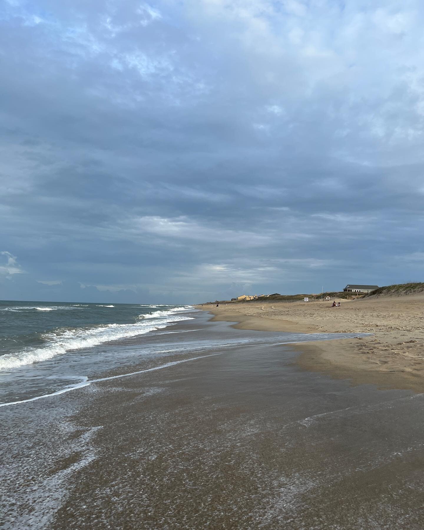
Located in North Hampton, New Hampshire is North Hampton Beach State Park. This is a smaller of the New Hampshire seacoast beaches, but can also be less crowded due to its limited metered parking. Careful to not confuse this beach with North Beach, which is just a few miles south of North Hampton Beach. If you are lucky enough to get a parking space it is a nice beach to check out. There are bathroom and changing facilities with easy access to the beach without a lot of walking. The day we visited there were life guards on site along with police officers walking up and down the side walk.

The beach itself if small, at high tide there is not a lot of room. At low tide part of the beach is rocky, which can make it a little tricky getting in the water if you have sensitive feet. This is also not a lot of beach to walk long distances on.

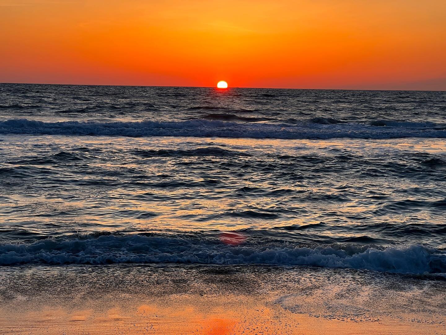
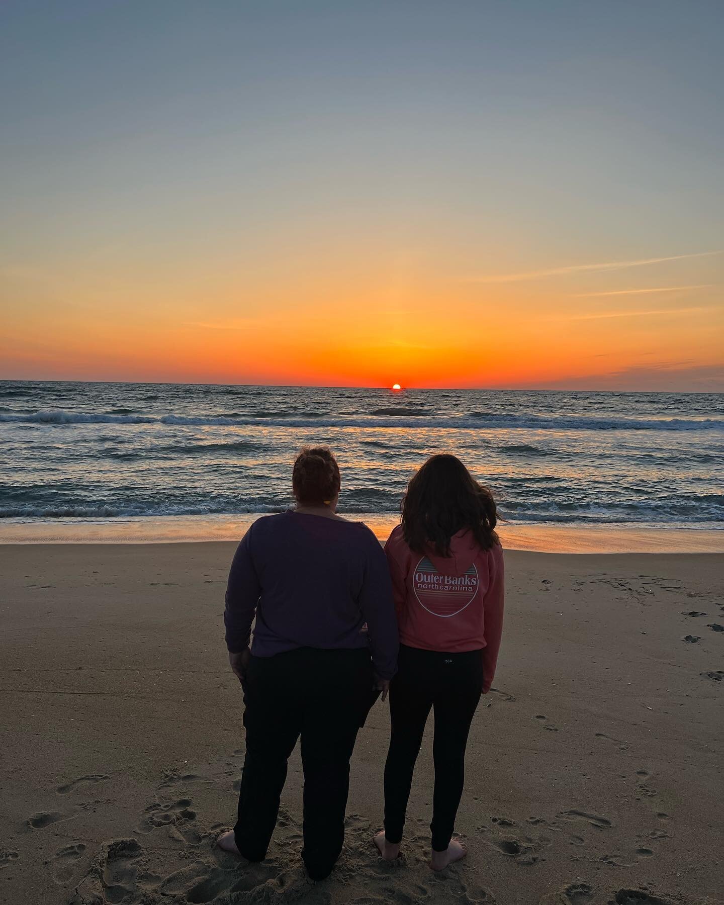
We had stopped at North Hampton State Park Beach after a softball tournament and it was a perfect way to cool down for a couple hours. Across the street is The Beach Plum, which seemed like a popular place for beach goers to get food. Overall, this beach was a great stop for a couple hours to cool off and relax.

Franconia Falls

Distance: 3.2 Miles oneway

Difficulty: Easy

The waterfall and natural waterslide can be dangerous, please use caution.

Located east of Lincoln, New Hampshire off of the Kancamagus Highway is Lincoln Woods. This is the trailhead to several local trails. The primary purpose of our visit was to hike to Franconia Falls. This hike has been on my to do list for a long time with the goal of checking out the natural waterslide.

We parked in the lot for Lincoln Woods and paid the fee to park here. There is a ranger station and bathroom facilities, making it easier to change into our bathing suites for the hike. We started the hike by crossing a bridge that goes over the East Branch of the Pemigewasset River.

Then took a right and followed the trail. This is probably one of the most flat trails in the White Mountains.

Most people were hiking this trail, but we also saw a couple people riding their bikes.

The trail to Franconia Falls was very easy to follow. There were signs along the way to direct you.

It was a 3.2 mile hike from the parking lot to the Franconia Falls. There were signs everywhere cautioning you to be careful as the water can be dangerous. The waterfall is beautiful.

For those a little more daring there is a narrow natural waterslide that drops you 7-8 feet into a small pool. The challenge is that depending on the time of year the pool has some strong currents that can pull you under. Our almost 13 year old daughter did the slide, but we had to help her out of the current. Stronger swimmers did better, but my husband did have to help a couple people out, who could not get away from the current. My daughter said she is not ready to do the slide again anytime soon.

Right before my daughter went down the natural waterslide.

There are a couple spots that you can get in the pools to swim around or slide down smaller rocks.

We spent 3-4 hours laying on the rocks, enjoying the falls and swimming in the pools. I was a little worried that we were going to be tired walking the 3.2 miles back out to our car, but we were not. Since it was an easy flat walk, it went by quickly. Overall, we loved the hike to Franconia Falls and enjoyed the swimming hole. Since it is a bit of a hike there were not a lot of people there, which was nice.

Artist Bluff

Distance: .5 Miles one way, with option for a 1.5 mile loop.

Difficulty: Moderate side of easy

Locate off exit 34C from Route 93 is the trailhead for one of the post popular easy hikes in the White Mountains. Located near Cannon Mountain and Echo Lake State Park is Artist Bluff, a short hike that packs a huge punch.

There are two places you can access the trail. The first one is directly across the street from the parking lot to Echo Lake. The second one is at the parking lot about a quarter of mile up on the right from Echo Lake State Park where you can walk a 1.5 mile loop.

Trail sign across from Echo Lake.

From the parking lot you can take a left and hike the Bald Mountain Loop. If you want to hike straight to Artist Bluff you can take a right, where the trail follows along the woods side of the parking lot until you connect with the trail across from Echo Lake. This part of the trail is flat.

At the joining of the trails take a left and start the steep, but short hike up to Artists Bluff. It is only a half mile from here to the rock outlook.

Once at the top there is an arrows directing you to the left to continue on the Bald Mountain Trail or the right that takes you out to Artist Bluff and a spectacular view of Cannon Mountain and Echo Lake.

This short, but steep hike provides beautiful views of the White Mountains. This is a great hike for beginner hikes that can hike up a rocky trail.

Fairfax Falls

Fairfax Falls is an impressive falls located north of Burlington, Vermont in the town of Fairfax. The falls has served as a hydropower plant for many years and is still running as a power plant. I found this falls thanks to my Vermont Waterfalls Guidebook.

When reading about accessing Fairfax Falls there were a couple different options. On Route 104 southeast of Fairfax is a small parking area. You can follow a trail down to the river for a view of the falls. We found the best view was at the Fairfax Falls Picnic Area and Fishing Access across the river.

After passing the first parking area you take a left onto the bridge that crosses the Lamoille River. Take another left onto River Street. About a quarter of a mile on the left you will see the sign for the picnic area.

There were a couple cars parked along side the road as the road down to the river requires a vehicle with high clearance and four wheel drive. We were able to drive carefully down in our Subaru. There were trucks and other Subaru’s parked at the base of the falls. There is not a lot of parking in this area.

This appeared to be a popular fishing spot as several people were fishing. There is one picnic table if you want to enjoy a meal. We walked along the large rocks to get better views of the falls. Please use caution as the rocks are not always stable and can be slippery.

I was impressed with the sheer size of Fairfax Falls. If you are in the area, it is worth checking out. This does not appear to be a place that is good for swimming, only picnicking, fishing and enjoying the beautiful scenery. .

This page contains affiliate links for which I may receive a small amount of compensation at no cost to you.

The Bridge of Flowers and Light

Located in the village of Enosburg Falls in the town of Enosburgh is The Bridge of Flowers and Light and Enosburg Falls. Enosburg Falls is located in northwest Vermont on the Missisquoi River. In addition to the falls is a cement arch bridge known as the Bridge of Flowers and Light.

There is a small parking lot on Duffy Hill Road next to an old diesel electric power plant that is no longer running. There is also a kiosk marking the Northern Forest Canoe Trail.

Around the kiosk were several wild roses that smelled amazing. As you walk around the kiosk and out onto the bridge you see planted flowers and street lamps.

Off to your right was a beautiful view of Enosburg Falls.

I would not have found this falls if it was not for my Vermont Waterfalls Guide Book. There was something about this bridge and falls that felt calming to me. I am so glad that we were able visit The Bridge of Flowers and Light.

This page contains affiliate links for which I may receive a small amount of compensation at no cost to you.

Bacon Ledges Trail

Distance: 1.2 miles oneway with options for longer

Difficulty: Easy side of moderate

Located in Stoddard, New Hampshire is the trail to Bacon Ledges. From Rt 123 in Stoddard take Shedd Hill Road, than an immediate right onto Old Antrim Road, which is unmarked. This is a narrow dirt road that goes by several houses. About a half mile past the last house you see will be a turnout and the trailhead. There is a brown trail sign on the left hand side of the road marking the trail. I read many posts that the road was challenging at times, but I think the road has been fixed up as we did not see any issues.

The trail meanders through the woods for about a half mile of fairly flat walking. The trail is marked by yellow blazes.

The second half of the trail is a steady incline up to a small rock scramble right before you reach the summit.

The rocky summit provides beautiful views of Highland Lake looking toward the fire tower at Pitcher Mountain and Mt Monadnock in the distance.

After enjoying the view walk behind the ledges to a carin.

A few feet back from the carin is a view looking towards the northeast. It is not as good as the first view, but still pretty.

From here you can continue to Round Mountain and Trout Pond. We did not continue, we turn around and headed back to the truck. Our round trip was almost 3 miles. We did pull several ticks off of us, tick spray did help on the hike back. Make sure you do a good tick check.

Overall I loved this hiked it reminded me of Gap Mountain and Kidder Mountain. For little effort there were some beautiful views. After your hike make sure you stop at Mills Village Country Store for sandwich or ice cream.

Seccombe Trail

Distance: Just under a mile loop.

Difficulty: Easy with gradual incline

Located behind Adams Playground on Union Street in Peterborough, NH is this short loop up to the gravesite of William Seccombe. Seccombe was a sea captain who served as a Lieutenant Commander in the Spanish American War.

To access the trail, park in the dirt parking lot next to the tennis courts. Towards the back of the parking lot is the trailhead.

The trail can be a little tricky to follow as there are several paths that crisscross it. As long as you follow the blue trail markers it is fairly easy to navigate.

The trail goes up a gentle incline until you reach a large boulder and a side trail (red trail markers). From the boulder take a right, onto the side trail, a few hundred feet up is the burial site of the sea captain and his family.

After returning to the boulder follow the remainder of the trail to the backside of the pool at the Adams Playground.

The trail is a little under a mile and a nice historical walk through the woods. During my hike I did see a fox and a deer, which was enjoyable.

Winnekenni Castle Trails

Distance: Varies

Difficulty: Easy

Located in Haverhill Massachusetts is Winnekenni Castle and Park. I am not familiar with many hikes in Massachusetts so I was thankful for my 60 Hikes Within 60 Miles of Boston book. This is a multi use park with trails for walking, hiking, biking, a pond, tennis courts and a playground. There was also tennis courts, but I am not sure if they are for public use as there was some school teams playing. Our goal was to hike up to the castle. We parked along side of the road near the tennis courts and walked the road until we got to the trail. We did notice additional parking near the trailhead.

We followed the dirt path until we saw the sign for the Castle Trail.

The trail meandered around the side of a hill and was pretty easy to follow.

It was only about a half mile up to the castle, which is beautiful. They hold various events and weddings at the castle. There is a road up to the castle, but we enjoyed walking up to it.

We did not explore the other trails, but saw lots of people walking. The trail around the pond looked pretty to explore.

If you are in the Haverhill area this is a beautiful place to visit the castle and get a little hike in.

This page contains affiliate links for which I may receive a small amount of compensation at no cost to you.

Bancroft Castle

Distance: .2 miles

Difficulty: short walk, but straight up

Bancroft Castle located in Groton MA is a popular short hike with some beautiful views. The history of this castle was build by a General in the early 1900’s. Unfortunately he ran out of money before finishing the property and it was sold to a local doctor who used it as a sanatorium. After the sanatorium closed the castle was turned into a hunting club before it burned in 1932.

There are two parking options. One behind Gibbett Hill Restaurant off of Lowell Rd. The second option is on Lowell Road, but there is limited parking and it is closed from dusk to dawn. We were able to get a parking on Lowell Road. It is a short, but steep walk up to the castle.

The castle ruins are beautiful and so fun to walk around.

When I posted a video on Instagram, I had so many people message me that they take photo’s there.

Make sure you walk up the path/hill and check out the beautiful view.

Brennan Falls

Distance: 1 Mile, oneway

Difficulty: Easy

Brennan Falls is a small waterfall located in Francestown, New Hampshire. From Route 47 turn onto Campbell Hill Road. The road turns to dirt. Follow the road for a quarter of a mile. On the left is a class six dirt road next to a driveway. The road is lined with rock walls on both sides. Depending on your vehicle you can park on the side of the road or you can drive the quarter of a mile to the trailhead. We drove in without an issue with our truck. I would not have brought my SUV on this road.

After you walk or drive the quarter of a mile there is a fork in the road, bare left into the parking area. You will see the trailhead with a kiosk.

The trail is an old road. There are limited trail markings, but fairly easy to follow.

Follow the trail until you come to a pond. Walk along the pond a short distance until a fork in the trail. To the right goes towards an old dam and the left continues to the falls.

After baring left you walk a little further until you take a right over a small bridge.

The trail leads through the woods with minimal trail markers until you reach the falls. With the amount of leaves on the ground the trail was hard to follow at times.

Brennan Falls is a small waterfall, but still beautiful. It reminded me of a smaller version of Senter Falls in Lyndeborough, New Hampshire.

Brennan Falls is a fairly easy hike. It is between 3/4 of mile to 1 mile to the falls depending on were you park. There are gentle inclines throughout the trail. The trail does go near private property, please be respectful. Even though it is a small falls we still enjoyed it.


Tucker Brook North

Distance: 1.5 Miles

Difficulty: Easy

Loop Trail

Tucker Brook North Trail is located on Whitten Road in Milford, NH and is an extension of Tucker Brook Forest Trail. If you are coming from Market Basket the trail is on the left hand side of the road. It is marked with a small trail sign. Parking for this trail is on the side of the road, this is a residential area so make sure you are not parking on someone’s property.

There are two trails, one follows Tucker Brook off to the left and another that goes straight into the woods. We took the trail that follows the brook. he trail follows the book for a little over half mile.

The trail then turns into the woods. There is a trail off to the right that goes back to the trailhead. Continue straight on the trail and up a slight hill. The trail takes a right and goes up to a small lookout. In the summer I am not sure if you can see anything due to the tree’s.

The trail continues through the woods and circles back to the main trail before returning to the trailhead. The trail is well marked and easy to follow.

There is not a great lookout, but if you want an easy short walk in the woods this is a great trail. The trail is 1.5 miles long and perfect for all abilities.

Sea Caves at Arthur Park

Distance: .3 miles one way

Difficulty: Easy

Only accessible when the pond is frozen.

Located on North Avenue in Burlington, Vermont is a cool natural formation. The Sea Caves at Arthur Park are a must see in the winter if you are in Burlington. Parking is in the student parking at the high school and you walk across the street to the trailhead. There is a small sign marking the trail.

It is a steep downhill walk to the pond.

Once at the bottom of the hill you walk out onto the pond. It looks like a popular place to ice skate. After walking a few feet you come to the cave. Burlington Parks, Recreation and Waterfront has some history this cave.

The cave is small, but very cool.

It’s a short walk, only a third of a mile to the cave, but worth the stop if you are in the area. This cave is only accessible in the winter when the pond is frozen.

Skatutakee and Thumb Mountain

Distance: 5 Mile Loop

Difficulty: Moderate

The Harris Center has an array of hiking trails from the Channing Trail, Cobb Hill, North Pond Trail and many more. Probably the most well known trails are those up Skatutakee and Thumb Mountain. The trailheads is at the Harris Center on Kings Highway Road. Park in the center’s parking lot and head across the road to the trailhead. As you are walking up the trail make sure you keep your eyes open for beautiful wood carvings along the trail.

It is about a half mile hike to the fork in the trail. Right is Thumb Mountain on the Thumb’s Down Trail. Left is the Harriskat Trail to Skatutakee Mountain. We chose the Harriskat Trail to start our loop. The trail winds through the forest and makes a gradual incline up to the top of Skatutakee Mountain. It is a little over a mile from the split in the trail to the summit of Skatutakee.

It has been a couple years since we have been to the summit. The last time it was becoming overgrown. It was nice to see the trees have been cut back to get a beautiful view of Crotched Mountain and the Wapack Trail.

From Skatutakee’s summit we continued the loop via the Thumbs Up Trail. It is a little under a mile between the Skatutakee summit and the trail to Thumb Mountain. It is fairly flat through this trail. The Thumb Mountain trail is at the intersection of the Thumbs Up and Thumbs Down Trail. It is less than a half mile to the summit, it’s a steady incline up.

From Thumb Mountain summit you get sweeping views of Mt Monadnock.

After returning to the Thumbs Down Trail we headed back towards the Harris Center. On the way back we took a little stop to enjoy Jack’s Pond.

We continued down the trail which connected at the fork of the Harriskat and Thumbs Down Trail. Once back at the Harris Center we did a little over five miles. My husband and I loved this hike. Both summits offered beautiful views, but our favorite was the view from Thumb Mountain’s summit. Due to the difficulty in some spots and the distance of this trail it is for those who have some hiking experience.


Night at Ashworth by the Sea

As many times as I have driven the strip at Hampton or walked the beach I have never stayed overnight. I have always been curious about staying at Ashworth by the Sea, so when we had to be in Hampton for a sports tournament I thought this was a perfect opportunity to stay the night.

With it being December I was hoping to get a good deal. After searching a few different travel websites, the best deal was at booking.com. For $197 for the night we got a room with a partial view of the beach.

We arrived early evening on a Friday night. There is valet parking, but since it was the off season we were able to park directly across the street. The lobby was beautifly decorated for Christmas.

With it being the off season there was no resort or parking fee. At the check in the staff were very friendly. Our room was located on the second floor, on the side of the building. Walking to our room, there were a couple dirty dishes near the wall and the hallway smelled a little musty. Our room was clean and had everything we needed.

Picture taken the following morning, hence why the beds are not made.

We had a balcony with a partial view of Hampton Beach.

For dinner we decided to eat in the hotel so we did not have to drive anywhere. The Breakers is located off the lobby of the hotel. The night we visited it was very quiet, which is probably expected in the off season.

Our waiter was very friendly. The restaurant was neat and clean. Unfortunately our meal was subpar. I had fish and chips and the fish was fresh, but the coleslaw smelled like it had gone bad. My husband had a steak sandwich, it was ok. My daughter had a steak tip Caesar salad and could not eat it as the meat tasted like it had gone bad. Our meal was almost $100. I would not eat there again. When we are in the area again, I would choose to go to Throwback Brewery or Smuttynose Brewery. We have eaten at both these breweries and they are very good.

After dinner we took a moonlit walk on the beach.

After the walk, we took a dip in the pool. The pool area was ok, it was clean. There was an older heater and when it was on it was very warm in the pool area, but when it was off it felt cool. The pool itself was not warm. In the summer months I am sure it is fine, but not ideal in the winter months.

The following morning I got to check something off my bucket list, watch the sunrise at the beach. A storm was coming in that evening so I was worried I would not get to see it, but Mother Nature did not disappointment. A three mile beach walk while watching the sunrise was a perfect way to start the day.

Breakfast was at our favorite bagel place, Ani’s Bagels, in Exeter, NH. They have the freshest bagels I have ever had.

We spent the rest of the day at our daughters sporting event. Overall our stay was ok for one night, but we would not stay there again. The smell in the hallway, subpar restaurant, high price for off season and substandard pool area made me feel like we could find better beach option in the off season.

Buck Meadow Conservation Area

Distance: 1 Mile Loop

Difficulty: Easy

Located on Route 101A in Amherst is Buck Meadow Conservation Area. This use to be a golf course that has been turned into a recreation and conservation area. The parking lot is large and fits several vehicles. This is a multi use trail for hiking, walking, shoeshoeing and cross country skiing.

From the parking lot you bare left towards the edge of the woods and a kiosk with a trail map.

Follow the trail around the edge of the woods. There are trail markers with directions to a couple side trails.

The trails are easy to follow. In total the loop and side trails are only a mile. If you don’t want to drive, want a place to walk the dog, or easy place to snowshoe or cross country ski this is the perfect spot.

There is a another trailhead off Stearns Road in Amherst, but there is only enough parking for one or two cars.

Poet's Seat Tower

Distance: .4 Miles

Difficulty: Easy

Poet’s Seat Tower is not much of a hiking trail, but worth the stop if you are in Greenfield, Massachusetts. Located on Mountain Road is a small parking lot leading up to Poet’s Seat Tower. The “trail” is an old tarred road that leads to a beautiful lookout.

Follow the road up a gentle incline for .4 miles to the Poet’s Tower.

You can climb to almost the top of the tower, where you get sweeping views of the town of Greenfield.

If you walk a few feet past the tower there are a few slate seats where you can sit and enjoy the view. I think this would be a perfect spot watch the sunset.

If you are in the area this is a great place to stop to check out the tower and the view.

Dubes Pond Trail

Distance: Varies

Difficulty: Easy

Dubes Pond Trail is located on Route 27 in Hooksett. I happened across this trail when I needed to kill some time. The only parking is on side of the road. Make sure you do not block the gate or entrance to the pond.

The trail follows a snowmobile trail. At times the path is rocky to walk on. It is very easy to follow.

The trail skirts around Dubes Pond, but there is not much of a view of the pond from this part of the trail. I walked about three quarters of a mile up the trail before turning around. Per All Trails, if you continue down this trail you reach Manchester Waterworks and Bear Brook State Park.

On my way back to the car I noticed there was a trail on the right right that went towards the pond and decided to explore it. This was the best part of the trail as it walked along the edge of Dubes Pond.

This part of the Dubes Pond Trail had several opportunities to enjoy the water views.

I ended up walking almost two miles on this trail. The main trail was not my favorite as it was just walking down a snowmobile trail, but I did enjoy the loop along the pond on the way back. If you are in the area and need to kill some time this is a great option.

Wheeler trail

Distance: .6 Mile Loop

Difficulty: Easy

The Wheeler Trail is located on Route 101 in Peterborough, New Hampshire between Old Street Road and Route 202. If you are coming from the East the trail is a little hard to spot due to placement of the trailhead sign, but it is on the right hand side.

314527DB-7812-4998-9886-0A0AF087AE65.jpeg

I always thought this trail was a cut off trail to Cranberry Meadow Pond Trail, but it’s a little more than that.

From the small parking lot, follow the trail to the first split. There are two bridges, this is the start of a loop, so you can go either way.

We went to the left and followed the trail along the river.

IMG_8748.JPG

The trail then opens up to a large field. If you go left you head towards Cheney Ave. We veered right through the field.

IMG_8751.JPG

The trail then goes back into the woods and crosses a bridge.

IMG_8753.JPG

After crossing the bridge the trail splits again. If you head left it takes you to Old Street Road and the Cranberry Meadow Pond Trail. If you bare right it loops back around to the parking lot.

Even though this trail is only a .6 mile loop we really enjoyed it. Set close to downtown Peterborough, it’s a beautiful little trail, great for all abilities.

Pinnacle Park

Distance: .5 miles one way

Difficulty: Easy

Pinnacle Park located in Hooksett, New Hampshire and is a great urban hiking option. Pinnacle Park is located on Pinnacle Street off of Rt 3A. The parking lot is marked with a sign on the right hand side of the road.

IMG_8731.JPG

In the parking lot is a kiosk with a map of the trails in Pinnacle Park.

IMG_8732.JPG

We followed the trail through the woods. There are no trail markers, but it is pretty easy to follow.

IMG_8714.JPG

There is a trail off to the right that goes to a bench overlook. We did not check out that part of the trail.

The trail was a gentle inclined up to a lookout point, which provides views of Hooksett and the Merrimack River.

IMG_8720.JPG

For little effort, a half mile to the top and being minutes outside of Manchester, Pinnacle Park is a great option for some pretty views.

53D38B51-A2FE-4788-B266-DCF0A9414E1C.jpeg

Hogback Trail Greenfield State Park

Distance 1.5 Mile loop

Difficulty: Easy

Fee for park use

Greenfield State Park is a hidden gem located in the Monadnock Region mostly known for its camping. In the summer it can be a popular day use area for swimming. Recently, I learned there is a nice little hiking trail located in the park.

Hogback Trail is located to the right of the Campground Office. We parked at the first parking lot when you enter the park, which is a small lot on the right. We walked up the road past the office to the trailhead on the left.

IMG_8585.JPG

The trail went down a little hill to Hogback Pond. From here you can go left or right as the trail goes along the pond.

IMG_8586.JPG

We went right and followed the trail along the pond. There are several spots where you get beautiful views of the pond.

IMG_8593.JPG

There are benches along the trail if you want to sit and enjoy the scenery.

IMG_8595.JPG

The trail was not marked, but it was easy to follow around the pond despite some trails that did lead off from the main trail.

The total distance from the parking lot around the pond and back was 1.6 miles. This was an easy hike with some beautiful water views. If you are visiting Greenfield State Park or are in the area make sure you check out Hogback Trail.